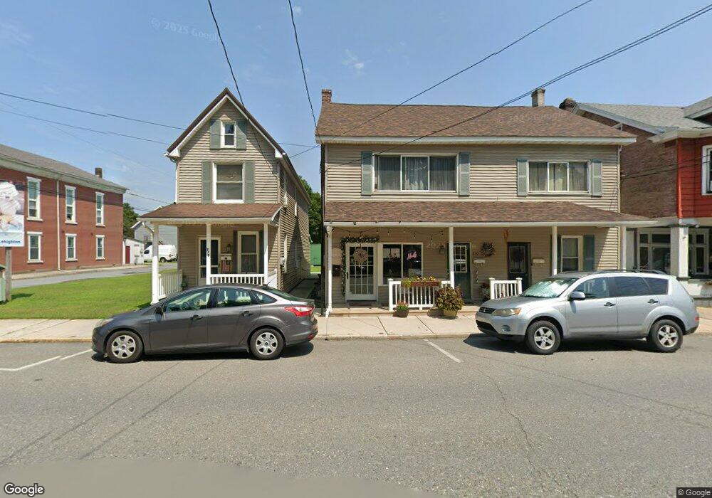
212 Bridge St Weissport, PA 18235
Estimated Value: $217,384 - $353,000
2
Beds
2
Baths
1,692
Sq Ft
$159/Sq Ft
Est. Value
About This Home
This home is located at 212 Bridge St, Weissport, PA 18235 and is currently estimated at $269,846, approximately $159 per square foot. 212 Bridge St is a home located in Carbon County with nearby schools including Lehighton Area High School, Sts. Peter & Paul School, and Valley Ridge Academy.
Ownership History
Date
Name
Owned For
Owner Type
Purchase Details
Closed on
Dec 31, 2019
Sold by
Troutman Glenn C and Troutman Joan M
Bought by
Rail Way Rentals Llc
Current Estimated Value
Home Financials for this Owner
Home Financials are based on the most recent Mortgage that was taken out on this home.
Original Mortgage
$175,000
Interest Rate
3.6%
Mortgage Type
New Conventional
Purchase Details
Closed on
Jan 4, 1983
Bought by
Troutman Glenn C and Troutman Joan M
Create a Home Valuation Report for This Property
The Home Valuation Report is an in-depth analysis detailing your home's value as well as a comparison with similar homes in the area
Home Values in the Area
Average Home Value in this Area
Purchase History
| Date | Buyer | Sale Price | Title Company |
|---|---|---|---|
| Rail Way Rentals Llc | $175,000 | Carbon Search & Setmnt Svcs | |
| Troutman Glenn C | -- | -- |
Source: Public Records
Mortgage History
| Date | Status | Borrower | Loan Amount |
|---|---|---|---|
| Closed | Rail Way Rentals Llc | $175,000 |
Source: Public Records
Tax History Compared to Growth
Tax History
| Year | Tax Paid | Tax Assessment Tax Assessment Total Assessment is a certain percentage of the fair market value that is determined by local assessors to be the total taxable value of land and additions on the property. | Land | Improvement |
|---|---|---|---|---|
| 2025 | $4,051 | $49,000 | $13,300 | $35,700 |
| 2024 | $3,904 | $49,000 | $13,300 | $35,700 |
| 2023 | $3,495 | $49,000 | $13,300 | $35,700 |
| 2022 | $3,867 | $49,000 | $13,300 | $35,700 |
| 2021 | $3,689 | $49,000 | $13,300 | $35,700 |
| 2020 | $3,603 | $49,000 | $13,300 | $35,700 |
| 2019 | $3,431 | $49,000 | $13,300 | $35,700 |
| 2018 | $3,382 | $49,000 | $13,300 | $35,700 |
| 2017 | $3,382 | $49,000 | $13,300 | $35,700 |
| 2016 | -- | $49,000 | $13,300 | $35,700 |
| 2015 | -- | $49,000 | $13,300 | $35,700 |
| 2014 | -- | $49,000 | $13,300 | $35,700 |
Source: Public Records
Map
Nearby Homes
- 142 Bankway St
- 438 White St
- 0 Fairyland Rd Unit PM-136987
- 201 Fairview St
- 12 2nd Ave
- 361 Court St Unit REAR
- 361 Court St
- 236 S 2nd St
- 230 S 2nd St
- 193 S 4th St
- 193 S 4th St Unit 191-193
- 117 N 4th St
- 231 Coal St
- 639 Iron St
- 344 Ochre St
- 230 Carbon St
- 410 S 8th St
- 470 N 8th St
- 17 Mahoning Dr E
- 600 N Harrity Rd
- 208 Bridge St
- 204 Bridge St
- 204 Bridge St Unit A-6
- 200-202 Bridge St
- 200 Bridge St Unit 2
- 201 Bridge St
- 150 White St
- 301 Prospect St Unit 303
- 0 Prospect St
- 308 Bridge St
- 308 Bridge St
- 310 Bridge St
- 312 Bridge St
- 114 Bridge St
- 114 Bridge St
- 315 Prospect St
- 118 White St
- 313 Prospect St
- 314 Bridge St
- 314 Bridge St