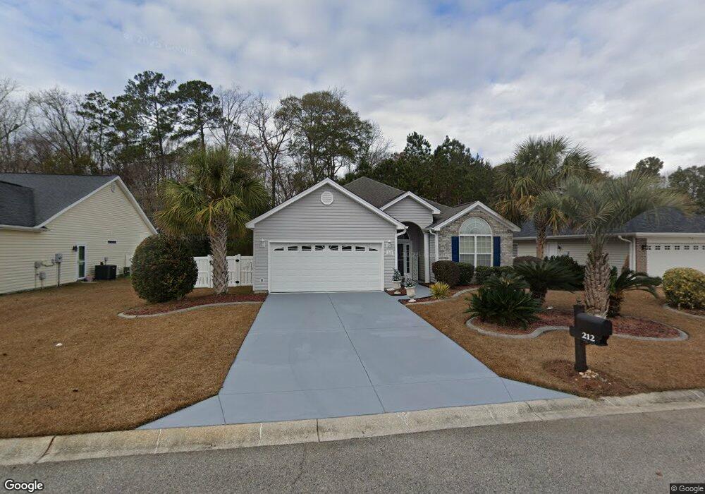
212 Colby Ct Myrtle Beach, SC 29588
Estimated Value: $308,000 - $320,000
3
Beds
2
Baths
1,739
Sq Ft
$179/Sq Ft
Est. Value
About This Home
This home is located at 212 Colby Ct, Myrtle Beach, SC 29588 and is currently estimated at $311,755, approximately $179 per square foot. 212 Colby Ct is a home located in Horry County with nearby schools including Socastee Elementary School, Forestbrook Middle School, and Socastee High School.
Ownership History
Date
Name
Owned For
Owner Type
Purchase Details
Closed on
May 29, 2008
Sold by
Petervary Carol L
Bought by
Boone Beverly Kelly
Current Estimated Value
Home Financials for this Owner
Home Financials are based on the most recent Mortgage that was taken out on this home.
Original Mortgage
$198,407
Outstanding Balance
$124,322
Interest Rate
6.02%
Mortgage Type
Purchase Money Mortgage
Estimated Equity
$187,433
Purchase Details
Closed on
Jun 6, 2006
Sold by
H & H Properties Llc
Bought by
Petervary Carol L
Home Financials for this Owner
Home Financials are based on the most recent Mortgage that was taken out on this home.
Original Mortgage
$190,000
Interest Rate
6.49%
Mortgage Type
Purchase Money Mortgage
Purchase Details
Closed on
Aug 30, 2005
Sold by
Independent Builders Development Inc
Bought by
H & H Properties Llc
Create a Home Valuation Report for This Property
The Home Valuation Report is an in-depth analysis detailing your home's value as well as a comparison with similar homes in the area
Home Values in the Area
Average Home Value in this Area
Purchase History
| Date | Buyer | Sale Price | Title Company |
|---|---|---|---|
| Boone Beverly Kelly | $208,850 | -- | |
| Petervary Carol L | $242,310 | None Available | |
| H & H Properties Llc | $588,000 | -- |
Source: Public Records
Mortgage History
| Date | Status | Borrower | Loan Amount |
|---|---|---|---|
| Open | Boone Beverly Kelly | $198,407 | |
| Previous Owner | Petervary Carol L | $190,000 |
Source: Public Records
Map
Nearby Homes
- TBD W Oak Circle Dr
- 188 Governors Loop
- 244 Colby Ct
- 811 Luttie Rd
- 1412 Reid Ct
- 721 Luttie Rd
- 1108 Ella Ct
- 712 Luttie Rd
- 31 Smith Blvd
- 708 Luttie Rd
- 525 Sims Dr Unit MB
- 209 Foxpath Loop
- 240 Foxpath Loop
- 104 Meredith Ct Unit Lot 104
- 101 Horizon River Dr Unit H8
- 53 Smith Blvd
- 5724 Dogwood Cir
- 800 Geddings Dr
- 313 Foxpath Loop
- 407 Meadowbrook Dr
- 208 Colby Ct
- 216 Colby Ct
- 204 Colby Ct
- 204 Colby Ct Unit Lawsons Landing
- 220 Colby Ct Unit MB
- 217 Colby Ct
- 565 W Oak Circle Dr
- 200 Colby Ct
- 224 Colby Ct Unit MB
- 221 Colby Ct
- 561 W Oak Circle Dr
- 575 W Oak Circle Dr Unit MB
- 225 Colby Ct
- 204 Governors Loop
- 557 W Oak Circle Dr
- 1600 Pheasant Pointe Ct Unit MB
- 568 W Oak Circle Dr
- 1604 Pheasant Pointe Ct Unit Lawsons Landing
- 1604 Pheasant Pointe Ct
- 564 W Oak Circle Dr
Your Personal Tour Guide
Ask me questions while you tour the home.