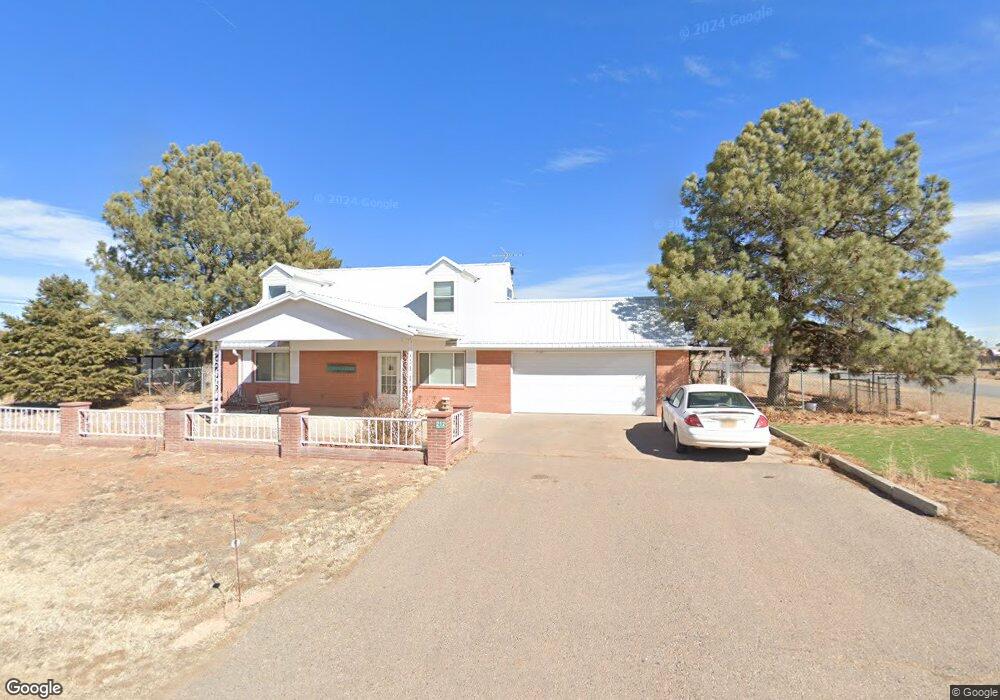
212 Eunice St Moriarty, NM 87035
Estimated Value: $196,000 - $246,000
Studio
--
Bath
--
Sq Ft
14,505
Sq Ft
About This Home
This home is located at 212 Eunice St, Moriarty, NM 87035 and is currently estimated at $221,000. 212 Eunice St is a home with nearby schools including Moriarty Elementary School, Moriarty Middle School, and Moriarty High School.
Ownership History
Date
Name
Owned For
Owner Type
Purchase Details
Closed on
Mar 14, 2025
Sold by
Brunson Michael C and Brunson Tyla
Bought by
Garcia Samuel E
Current Estimated Value
Home Financials for this Owner
Home Financials are based on the most recent Mortgage that was taken out on this home.
Original Mortgage
$10,000
Outstanding Balance
$4,775
Interest Rate
6.95%
Mortgage Type
FHA
Estimated Equity
$216,225
Purchase Details
Closed on
Jul 29, 2022
Sold by
Tyla Ware
Bought by
Brunson Michael C and Brunson Tyla
Home Financials for this Owner
Home Financials are based on the most recent Mortgage that was taken out on this home.
Original Mortgage
$29,000
Interest Rate
4.58%
Create a Home Valuation Report for This Property
The Home Valuation Report is an in-depth analysis detailing your home's value as well as a comparison with similar homes in the area
Purchase History
| Date | Buyer | Sale Price | Title Company |
|---|---|---|---|
| Garcia Samuel E | -- | Fidelity National Title | |
| Garcia Samuel E | -- | Fidelity National Title | |
| Brunson Michael C | -- | Fidelity National Title |
Source: Public Records
Mortgage History
| Date | Status | Borrower | Loan Amount |
|---|---|---|---|
| Open | Garcia Samuel E | $10,000 | |
| Closed | Garcia Samuel E | $10,000 | |
| Open | Garcia Samuel E | $204,008 | |
| Closed | Garcia Samuel E | $204,008 | |
| Previous Owner | Brunson Michael C | $29,000 | |
| Previous Owner | Brunson Michael C | $160,000 |
Source: Public Records
Tax History
| Year | Tax Paid | Tax Assessment Tax Assessment Total Assessment is a certain percentage of the fair market value that is determined by local assessors to be the total taxable value of land and additions on the property. | Land | Improvement |
|---|---|---|---|---|
| 2025 | $736 | $28,500 | $1,894 | $26,606 |
| 2024 | $718 | $27,687 | $1,499 | $26,188 |
| 2023 | $699 | $26,878 | $1,117 | $25,761 |
| 2022 | $1,329 | $51,059 | $10,706 | $40,353 |
| 2021 | $1,285 | $49,281 | $10,333 | $38,948 |
| 2020 | $1,281 | $49,523 | $10,323 | $39,200 |
| 2019 | $935 | $37,669 | $4,025 | $33,644 |
| 2018 | $957 | $37,631 | $4,021 | $33,610 |
| 2017 | $0 | $37,665 | $0 | $0 |
| 2016 | $0 | $0 | $0 | $0 |
| 2015 | -- | $0 | $0 | $0 |
| 2014 | -- | $35,361 | $3,680 | $31,681 |
Source: Public Records
Map
Nearby Homes
- 0 Hazel St
- 502 2 U S Route 66
- 502 12 U S Route 66
- 415 Irene Ave
- 410 E Irene Ave Unit Lot 7
- 410 E Irene Ave Unit Lot 6
- 0 Tbd Martinez Rd
- 207 Abrahames Rd
- 0 US Route 66 E Unit 1090286
- 612 Irene Ave
- 0 U S Rt 66 E (Tr 2-A-2-d) Unit 1077343
- 0 U S Rt 66 E (Tr 2-A-2-c) Unit 1077337
- 0 Princeton Ave
- 0 6th Martinez St Unit 1091214
- 1211 1 St
- 0 U S Rt 66 E (Tr 2-A-2-abcd) Unit 1077699
- 0 U S Rt 66 E (Tr 2-A-2-b) Unit 1044761
- 0 U S Rt 66 E (Tr 2-A-2-a) Unit 1044759
- 315 Camino Eric
- 0 6th St Amelia Ave Unit 1076203
- 0 Eunice St
- 200 Eunice St
- 202 Tingley Ave
- 206 Tingley Ave E
- 211 Tingley Ave E
- 305 Eunice St Unit 1
- 210 Roosevelt Ave
- 215 Tingley Ave E
- 121 Link Ave
- 320 Eunice St
- 209 Link Ave E
- 212 Roosevelt Ave
- 119 Link Ave W
- 109 Tingley Ave
- 203 Roosevelt Ave
- 112 Roosevelt Ave
- 207 Link Ave E
- 109 Tingley Ave
- 114 E Tingley Ave
- 0 Link Ave
Your Personal Tour Guide
Ask me questions while you tour the home.