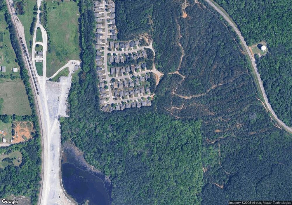
212 Gardenside Dr Alabaster, AL 35007
Estimated Value: $236,709 - $254,000
3
Beds
2
Baths
1,318
Sq Ft
$187/Sq Ft
Est. Value
About This Home
This home is located at 212 Gardenside Dr, Alabaster, AL 35007 and is currently estimated at $245,927, approximately $186 per square foot. 212 Gardenside Dr is a home located in Shelby County with nearby schools including Thompson Intermediate School, Thompson Middle School, and Thompson High School.
Ownership History
Date
Name
Owned For
Owner Type
Purchase Details
Closed on
Jul 21, 2008
Sold by
Lasalle Bank Na
Bought by
Brown Joseph D
Current Estimated Value
Home Financials for this Owner
Home Financials are based on the most recent Mortgage that was taken out on this home.
Original Mortgage
$120,950
Outstanding Balance
$79,011
Interest Rate
6.32%
Mortgage Type
FHA
Estimated Equity
$166,916
Purchase Details
Closed on
May 15, 2008
Sold by
Burke Patrick J
Bought by
Lasalle Bank Na
Purchase Details
Closed on
Sep 27, 2005
Sold by
The Lorrin Group Llc
Bought by
Burke Patrick J
Home Financials for this Owner
Home Financials are based on the most recent Mortgage that was taken out on this home.
Original Mortgage
$107,688
Interest Rate
5.77%
Mortgage Type
Fannie Mae Freddie Mac
Create a Home Valuation Report for This Property
The Home Valuation Report is an in-depth analysis detailing your home's value as well as a comparison with similar homes in the area
Home Values in the Area
Average Home Value in this Area
Purchase History
| Date | Buyer | Sale Price | Title Company |
|---|---|---|---|
| Brown Joseph D | $123,200 | None Available | |
| Lasalle Bank Na | $112,216 | None Available | |
| Burke Patrick J | $134,610 | -- |
Source: Public Records
Mortgage History
| Date | Status | Borrower | Loan Amount |
|---|---|---|---|
| Open | Brown Joseph D | $120,950 | |
| Previous Owner | Burke Patrick J | $107,688 | |
| Closed | Burke Patrick J | $26,922 |
Source: Public Records
Tax History Compared to Growth
Tax History
| Year | Tax Paid | Tax Assessment Tax Assessment Total Assessment is a certain percentage of the fair market value that is determined by local assessors to be the total taxable value of land and additions on the property. | Land | Improvement |
|---|---|---|---|---|
| 2024 | $2,204 | $40,820 | $0 | $0 |
| 2023 | $2,061 | $38,160 | $0 | $0 |
| 2022 | $1,940 | $35,920 | $0 | $0 |
| 2021 | $1,734 | $32,120 | $0 | $0 |
| 2020 | $778 | $15,160 | $0 | $0 |
| 2019 | $763 | $14,880 | $0 | $0 |
| 2017 | $691 | $13,560 | $0 | $0 |
| 2015 | $664 | $13,060 | $0 | $0 |
| 2014 | $648 | $12,760 | $0 | $0 |
Source: Public Records
Map
Nearby Homes
- 191 Gardenside Dr
- 104 Sunflower Place
- 1077 Grande View Pass
- 1064 Grande View Pass Unit RESIDENTIAL LOT / 91
- 213 Grande View Cir
- 1208 Grande View Ln
- 1210 Grande View Ln
- 54 Melissa Dr Unit 2
- 1217 Grande View Ln
- 111 Grande View Cir
- 129 Windwood Cir
- 1724 Butler Rd
- 61 Maylene Dr
- 397 Wynlake Dr
- 207 Grande View Pkwy
- 304 Forest Pkwy
- 424 Acer Trail
- 10141 Highway 17 Unit 20
- 1161 Butler Rd
- 121 Old Spanish Trail
- 208 Gardenside Dr
- 204 Gardenside Dr
- 211 Gardenside Dr
- 207 Gardenside Dr
- 203 Gardenside Dr
- 200 Gardenside Dr
- 199 Gardenside Dr
- 196 Gardenside Dr
- 126 Marigold Dr
- 195 Gardenside Dr
- 114 Marigold Dr
- 122 Marigold Dr
- 118 Marigold Dr
- 190 Gardenside Dr
- 110 Marigold Dr
- 186 Gardenside Dr
- 104 Marigold Dr
- 171 Gardenside Dr
- 121 Marigold Dr
- 125 Marigold Dr
