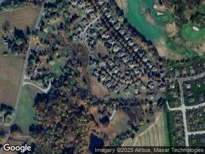
212 Joyce Cir Avondale, PA 19311
Estimated Value: $446,073 - $517,000
2
Beds
2
Baths
2,474
Sq Ft
$193/Sq Ft
Est. Value
About This Home
This home is located at 212 Joyce Cir, Avondale, PA 19311 and is currently estimated at $477,768, approximately $193 per square foot. 212 Joyce Cir is a home located in Chester County with nearby schools including Penn London Elementary School, Avon Grove Intermediate School, and Fred S Engle Middle School.
Ownership History
Date
Name
Owned For
Owner Type
Purchase Details
Closed on
Aug 27, 2013
Sold by
Mills Stephen J and Mills Cynthia L
Bought by
Weaver Terri L
Current Estimated Value
Home Financials for this Owner
Home Financials are based on the most recent Mortgage that was taken out on this home.
Original Mortgage
$170,000
Interest Rate
4.42%
Mortgage Type
New Conventional
Purchase Details
Closed on
Aug 30, 2001
Sold by
Pulte Home Corp Of The Delaware Valley
Bought by
Baker Phoebe B
Home Financials for this Owner
Home Financials are based on the most recent Mortgage that was taken out on this home.
Original Mortgage
$100,000
Interest Rate
7.05%
Create a Home Valuation Report for This Property
The Home Valuation Report is an in-depth analysis detailing your home's value as well as a comparison with similar homes in the area
Home Values in the Area
Average Home Value in this Area
Purchase History
| Date | Buyer | Sale Price | Title Company |
|---|---|---|---|
| Weaver Terri L | $280,000 | None Available |
Source: Public Records
Mortgage History
| Date | Status | Borrower | Loan Amount |
|---|---|---|---|
| Open | Weaver Term L | $150,250 | |
| Closed | Weaver Terri L | $170,000 | |
| Previous Owner | Mills Stephen J | $164,345 | |
| Previous Owner | Mills Stephen J | $87,000 | |
| Previous Owner | Baker Phoebe B | $100,000 |
Source: Public Records
Tax History Compared to Growth
Tax History
| Year | Tax Paid | Tax Assessment Tax Assessment Total Assessment is a certain percentage of the fair market value that is determined by local assessors to be the total taxable value of land and additions on the property. | Land | Improvement |
|---|---|---|---|---|
| 2024 | $5,933 | $145,600 | $44,640 | $100,960 |
| 2023 | $5,810 | $145,600 | $44,640 | $100,960 |
| 2022 | $5,725 | $145,600 | $44,640 | $100,960 |
| 2021 | $5,607 | $145,600 | $44,640 | $100,960 |
| 2020 | $5,421 | $145,600 | $44,640 | $100,960 |
| 2019 | $5,287 | $145,600 | $44,640 | $100,960 |
| 2018 | $5,153 | $145,600 | $44,640 | $100,960 |
| 2017 | $5,046 | $145,600 | $44,640 | $100,960 |
| 2016 | $5,519 | $145,600 | $44,640 | $100,960 |
| 2015 | $5,519 | $145,600 | $44,640 | $100,960 |
| 2014 | $5,519 | $145,600 | $44,640 | $100,960 |
Source: Public Records
Map
Nearby Homes
- 301 Whitestone Rd
- 103 Dylan Cir
- 607 Martin Dr
- 125 Maloney Terrace
- 228 Schoolhouse Rd
- 17 Nottingham Dr
- 4 Sullivan Chase Dr
- 38 Angelica Dr
- 6 Letchworth Ln
- 1935 Garden Station Rd
- 225 State Rd
- 12 Rushford Place
- 723 Elphin Rd
- 30 Inniscrone Dr
- 183 Ellicott Rd
- 179 Ellicott Rd
- 167 Ellicott Rd
- 175 Ellicott Rd
- 314 Dawnwood Dr
- 131 Marthas Way
