Estimated Value: $136,000 - $185,000
3
Beds
2
Baths
1,375
Sq Ft
$117/Sq Ft
Est. Value
About This Home
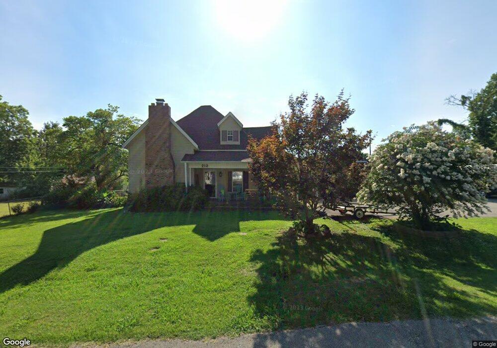
This home is located at 212 Linden St, Dyer, TN 38330 and is currently estimated at $160,571, approximately $116 per square foot. 212 Linden St is a home located in Gibson County with nearby schools including Dyer Elementary School and Gibson County High School.
Ownership History
Date
Name
Owned For
Owner Type
Purchase Details
Closed on
May 22, 2004
Sold by
Eakes Dorothie M Estate
Bought by
Sanders Charlie and Sanders Glenda
Current Estimated Value
Home Financials for this Owner
Home Financials are based on the most recent Mortgage that was taken out on this home.
Original Mortgage
$26,004
Outstanding Balance
$12,517
Interest Rate
5.88%
Estimated Equity
$148,054
Purchase Details
Closed on
Jan 24, 1994
Bought by
Eakes Dorothie M
Purchase Details
Closed on
Jun 15, 1993
Bought by
Copeland Jeff and Copeland Deeleah
Purchase Details
Closed on
Mar 3, 1992
Bought by
Lowrance Wade and Lowrance Rhonda
Purchase Details
Closed on
Nov 5, 1966
Bought by
Mcknight Wm and Mcknight Lillian
Create a Home Valuation Report for This Property
The Home Valuation Report is an in-depth analysis detailing your home's value as well as a comparison with similar homes in the area
Home Values in the Area
Average Home Value in this Area
Purchase History
| Date | Buyer | Sale Price | Title Company |
|---|---|---|---|
| Sanders Charlie | $23,000 | -- | |
| Eakes Dorothie M | $25,500 | -- | |
| Copeland Jeff | $18,100 | -- | |
| Lowrance Wade | $6,000 | -- | |
| Mcknight Wm | -- | -- |
Source: Public Records
Mortgage History
| Date | Status | Borrower | Loan Amount |
|---|---|---|---|
| Open | Mcknight Wm | $26,004 |
Source: Public Records
Tax History Compared to Growth
Tax History
| Year | Tax Paid | Tax Assessment Tax Assessment Total Assessment is a certain percentage of the fair market value that is determined by local assessors to be the total taxable value of land and additions on the property. | Land | Improvement |
|---|---|---|---|---|
| 2024 | $1,105 | $31,875 | $2,750 | $29,125 |
| 2023 | $621 | $19,950 | $1,275 | $18,675 |
| 2022 | $607 | $19,950 | $1,275 | $18,675 |
| 2021 | $607 | $19,950 | $1,275 | $18,675 |
| 2020 | $992 | $19,950 | $1,275 | $18,675 |
| 2019 | $977 | $19,650 | $1,275 | $18,375 |
| 2018 | $690 | $13,675 | $1,275 | $12,400 |
| 2017 | $663 | $13,675 | $1,275 | $12,400 |
| 2016 | $663 | $13,675 | $1,275 | $12,400 |
| 2015 | $604 | $13,675 | $1,275 | $12,400 |
| 2014 | $604 | $13,675 | $1,275 | $12,400 |
Source: Public Records
Map
Nearby Homes
- 246 Thomas St
- 137 W South St
- 208 & 210 Lee St
- 288 W Broad St
- 142 S Poplar St
- 299 E Walnut St
- 117 Washington St
- 0 Royal St
- 354 E Maple St
- 139 Peach St
- 205 Division St
- 173 Orr Rd
- 0 Reed Rd
- 163 Monroe St
- 548 E College St
- 153 New Hope St
- 106 Scattered Acres Dr
- 23 Gravettes Crossing Rd W
- 84 Trenton Hwy
- 0 Ernest Paschall Rd Unit RRA45339