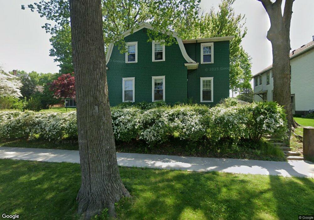
212 Mary Place Muscatine, IA 52761
Estimated Value: $253,000 - $283,873
4
Beds
3
Baths
2,475
Sq Ft
$108/Sq Ft
Est. Value
About This Home
This home is located at 212 Mary Place, Muscatine, IA 52761 and is currently estimated at $267,718, approximately $108 per square foot. 212 Mary Place is a home located in Muscatine County with nearby schools including Muskie Early Learning Center, Madison Elementary School, and Central Middle School.
Ownership History
Date
Name
Owned For
Owner Type
Purchase Details
Closed on
Nov 4, 2019
Sold by
Hoffman Ruthann and Baumgardner Ruthann
Bought by
Peate Joseph S and Peate Laura E
Current Estimated Value
Home Financials for this Owner
Home Financials are based on the most recent Mortgage that was taken out on this home.
Original Mortgage
$168,800
Outstanding Balance
$148,501
Interest Rate
3.6%
Mortgage Type
New Conventional
Estimated Equity
$119,217
Create a Home Valuation Report for This Property
The Home Valuation Report is an in-depth analysis detailing your home's value as well as a comparison with similar homes in the area
Home Values in the Area
Average Home Value in this Area
Purchase History
| Date | Buyer | Sale Price | Title Company |
|---|---|---|---|
| Peate Joseph S | $176,000 | None Available |
Source: Public Records
Mortgage History
| Date | Status | Borrower | Loan Amount |
|---|---|---|---|
| Open | Peate Joseph S | $168,800 |
Source: Public Records
Tax History Compared to Growth
Tax History
| Year | Tax Paid | Tax Assessment Tax Assessment Total Assessment is a certain percentage of the fair market value that is determined by local assessors to be the total taxable value of land and additions on the property. | Land | Improvement |
|---|---|---|---|---|
| 2025 | $4,580 | $275,210 | $52,240 | $222,970 |
| 2024 | $4,580 | $262,820 | $52,240 | $210,580 |
| 2023 | $4,382 | $262,191 | $52,269 | $209,922 |
| 2022 | $4,104 | $217,770 | $49,310 | $168,460 |
| 2021 | $4,104 | $210,040 | $49,310 | $160,730 |
| 2020 | $3,968 | $197,680 | $49,310 | $148,370 |
| 2019 | $3,886 | $184,480 | $0 | $0 |
| 2018 | $3,824 | $184,210 | $0 | $0 |
| 2017 | $3,788 | $176,200 | $0 | $0 |
| 2016 | $3,788 | $176,200 | $0 | $0 |
| 2015 | $3,788 | $170,820 | $0 | $0 |
| 2014 | $3,690 | $170,820 | $0 | $0 |
Source: Public Records
Map
Nearby Homes
- 1554 Washington St
- 140 Sheridan St
- 318 Monroe St
- 1414 Lincoln Blvd
- 1416 Lincoln Blvd
- 504 Adams St
- 416 Jackson St
- 0 Fillmore St Parcel
- 1509 Lincoln Blvd
- 514 Jackson St
- 610 Jackson St
- 1708 Cobblestone Dr
- 630 Jackson St
- 1707 Lincoln Blvd
- 2016 Lincoln Blvd
- 1903 Park Ave
- 1903 Park Ave
- 1010 Lombard St
- 1005 Cypress St
- 503 Mcarthur St
- 208 Mary Place
- 1207 Orchard Ave
- 1203 Orchard Ave
- 211 Mary Place
- 215 Mary Place
- 204 Mary Place
- 1113 Orchard Ave
- 219 Mary Place
- 202 Mary Place
- 1025 Orchard Ave
- 221 Mary Place
- 1111 Orchard Ave
- 1124 Oakland Dr
- 1023 Orchard Ave
- 1017 Orchard Ave
- 1015 Orchard Ave
- 302 Parkington Dr
- 1204 Orchard Ave
- 1305 Orchard Ave
- 1208 Orchard Ave