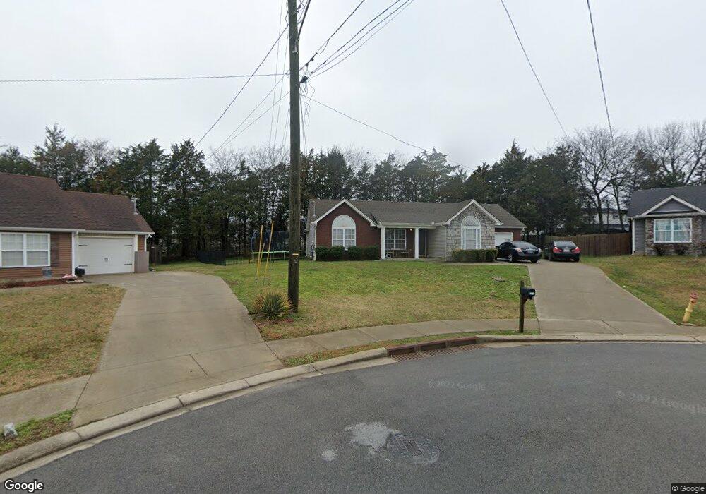
212 Peyton Leann Point La Vergne, TN 37086
Estimated Value: $325,000 - $358,000
--
Bed
--
Bath
1,416
Sq Ft
$246/Sq Ft
Est. Value
About This Home
This home is located at 212 Peyton Leann Point, La Vergne, TN 37086 and is currently estimated at $348,080, approximately $245 per square foot. 212 Peyton Leann Point is a home located in Rutherford County with nearby schools including David Youree Elementary School, Rock Springs Middle School, and Lavergne High School.
Ownership History
Date
Name
Owned For
Owner Type
Purchase Details
Closed on
May 30, 2013
Sold by
Secretary Of Housing And U
Bought by
Kwan Hyuk
Current Estimated Value
Home Financials for this Owner
Home Financials are based on the most recent Mortgage that was taken out on this home.
Original Mortgage
$94,983
Outstanding Balance
$67,203
Interest Rate
3.37%
Mortgage Type
FHA
Estimated Equity
$280,877
Purchase Details
Closed on
Nov 27, 2012
Sold by
Thda
Bought by
Hud Secretary Of
Purchase Details
Closed on
Oct 19, 2012
Sold by
Pognant Terri B
Bought by
Thda
Purchase Details
Closed on
Aug 10, 2009
Sold by
Dennis Butler Builders Llc
Bought by
Pognant Terri B
Home Financials for this Owner
Home Financials are based on the most recent Mortgage that was taken out on this home.
Original Mortgage
$151,200
Interest Rate
5.19%
Create a Home Valuation Report for This Property
The Home Valuation Report is an in-depth analysis detailing your home's value as well as a comparison with similar homes in the area
Home Values in the Area
Average Home Value in this Area
Purchase History
| Date | Buyer | Sale Price | Title Company |
|---|---|---|---|
| Kwan Hyuk | $95,000 | -- | |
| Hud Secretary Of | $158,204 | -- | |
| Thda | $158,204 | -- | |
| Pognant Terri B | $153,990 | -- |
Source: Public Records
Mortgage History
| Date | Status | Borrower | Loan Amount |
|---|---|---|---|
| Open | Kwan Hyuk | $94,983 | |
| Previous Owner | Pognant Terri B | $151,200 |
Source: Public Records
Tax History Compared to Growth
Tax History
| Year | Tax Paid | Tax Assessment Tax Assessment Total Assessment is a certain percentage of the fair market value that is determined by local assessors to be the total taxable value of land and additions on the property. | Land | Improvement |
|---|---|---|---|---|
| 2025 | $1,652 | $68,500 | $13,750 | $54,750 |
| 2024 | $1,652 | $68,500 | $13,750 | $54,750 |
| 2023 | $1,285 | $68,500 | $13,750 | $54,750 |
| 2022 | $1,107 | $68,500 | $13,750 | $54,750 |
| 2021 | $1,094 | $49,300 | $8,325 | $40,975 |
| 2020 | $1,094 | $49,300 | $8,325 | $40,975 |
| 2019 | $1,094 | $49,300 | $8,325 | $40,975 |
Source: Public Records
Map
Nearby Homes
- 286 Jefferson Pike
- 1407 Portsmouth Ct
- 1507 Ridgemont Dr
- 1400 Bright Sky Ct
- 401 Jefferson Pike
- 0 Old Nashville Hwy Unit RTC2671318
- 118 Markum Dr
- 149 Alsup Ln
- 2031 Summit Ln
- 172 Parrish St
- 140 Parrish St
- 2129 Academy Way
- 412 Shadylake Dr
- 121 Highland St
- 2124 Academy Way
- 124 Gale Ln
- 126 Gale Ln
- 1804 Mars St
- 813 Chaney Woods Dr
- 1820 Mars St
- 208 Peyton Leann Point
- 209 Peyton Leann Place
- 209 Peyton Leann Point
- 2019 Abingdon Dr
- 2017 Abingdon Dr
- 2021 Abingdon Dr
- 204 Peyton Leann Point
- 205 Peyton Leann Point
- 2015 Abingdon Dr
- 309 Kimberly Ann Ct
- 2023 Abingdon Dr
- 104 Twilight Cove
- 200 Peyton Leann Point
- 201 Peyton Leann Point
- 313 Kimberly Ann Ct
- 305 Kimberly Ann Ct
- 2013 Abingdon Dr
- 109 Twilight Cove
- 1845 Moonlight Dr
- 2018 Abingdon Dr