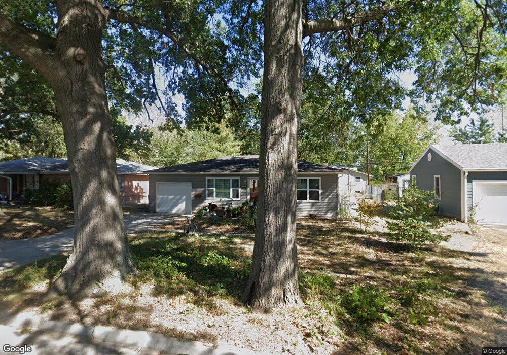
212 Ruby Ln Columbia, MO 65203
Estimated Value: $189,000 - $199,403
2
Beds
1
Bath
885
Sq Ft
$219/Sq Ft
Est. Value
About This Home
This home is located at 212 Ruby Ln, Columbia, MO 65203 and is currently estimated at $194,101, approximately $219 per square foot. 212 Ruby Ln is a home located in Boone County with nearby schools including West Boulevard Elementary School, West Middle School, and David H. Hickman High School.
Ownership History
Date
Name
Owned For
Owner Type
Purchase Details
Closed on
Jun 24, 2011
Sold by
Bex Joseph and Bex Linda
Bought by
Burke Amanda
Current Estimated Value
Home Financials for this Owner
Home Financials are based on the most recent Mortgage that was taken out on this home.
Original Mortgage
$80,370
Outstanding Balance
$55,066
Interest Rate
4.5%
Mortgage Type
FHA
Estimated Equity
$139,035
Purchase Details
Closed on
Mar 22, 2010
Sold by
Bex Joseph L and Bex Linda
Bought by
Bex Joseph and Bex Linda
Purchase Details
Closed on
Mar 24, 2009
Sold by
Secretary Of Housing & Urban Development
Bought by
Bex Joseph L and Bex Linda L
Purchase Details
Closed on
Sep 22, 2008
Sold by
Sanders Kellie
Bought by
Countrywide Home Loans Inc
Create a Home Valuation Report for This Property
The Home Valuation Report is an in-depth analysis detailing your home's value as well as a comparison with similar homes in the area
Purchase History
| Date | Buyer | Sale Price | Title Company |
|---|---|---|---|
| Burke Amanda | -- | None Available | |
| Bex Joseph | -- | None Available | |
| Bex Joseph L | -- | None Available | |
| Countrywide Home Loans Inc | $85,872 | None Available |
Source: Public Records
Mortgage History
| Date | Status | Borrower | Loan Amount |
|---|---|---|---|
| Open | Burke Amanda | $80,370 |
Source: Public Records
Tax History
| Year | Tax Paid | Tax Assessment Tax Assessment Total Assessment is a certain percentage of the fair market value that is determined by local assessors to be the total taxable value of land and additions on the property. | Land | Improvement |
|---|---|---|---|---|
| 2025 | $1,323 | $20,197 | $3,382 | $16,815 |
| 2024 | $1,189 | $17,632 | $3,382 | $14,250 |
| 2023 | $1,180 | $17,632 | $3,382 | $14,250 |
| 2022 | $1,091 | $16,321 | $3,382 | $12,939 |
| 2021 | $1,093 | $16,321 | $3,382 | $12,939 |
| 2020 | $1,038 | $14,569 | $3,382 | $11,187 |
| 2019 | $1,038 | $14,569 | $3,382 | $11,187 |
| 2018 | $968 | $0 | $0 | $0 |
| 2017 | $956 | $13,490 | $3,382 | $10,108 |
| 2016 | $982 | $13,490 | $3,382 | $10,108 |
| 2015 | $906 | $13,490 | $3,382 | $10,108 |
| 2014 | -- | $13,490 | $3,382 | $10,108 |
Source: Public Records
Map
Nearby Homes
- 400 Auburn Ln
- 1308 W Worley St
- 1301 W Ash St
- 602 Clinkscales Rd
- 1210 Squirewood Way
- 807 Clinkscales Rd
- 1303 London Dr
- 105 Westridge Dr
- 302 Westridge Dr
- 807 Hope Place
- 708 Donnelly Ave
- 501 Westridge Dr
- 1108 W Stewart Rd
- 1220 Ridge Rd
- 304 Fredora Ave
- 506 W Worley St
- 315 Loch Ln
- 404 S Greenwood Ave
- 405 Alexander Ave
- 1402 W Rollins Rd
Your Personal Tour Guide
Ask me questions while you tour the home.