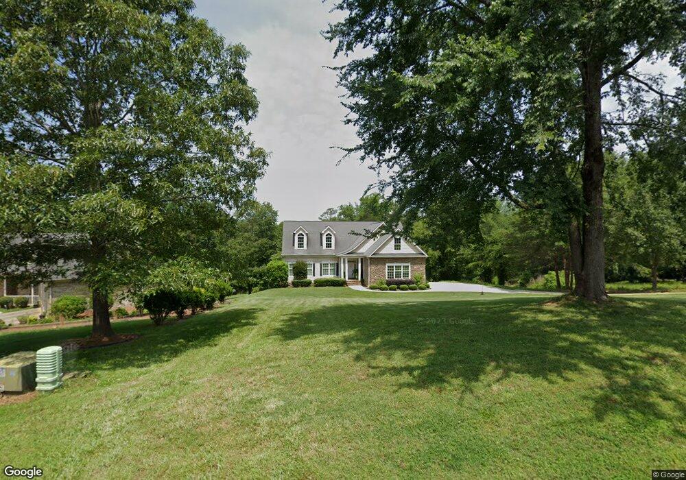
212 Sandy Point Dr Anderson, SC 29625
Estimated Value: $473,000 - $876,000
--
Bed
--
Bath
2,020
Sq Ft
$340/Sq Ft
Est. Value
About This Home
This home is located at 212 Sandy Point Dr, Anderson, SC 29625 and is currently estimated at $687,249, approximately $340 per square foot. 212 Sandy Point Dr is a home with nearby schools including Pendleton High School.
Ownership History
Date
Name
Owned For
Owner Type
Purchase Details
Closed on
Mar 29, 2021
Sold by
Stovall Larry L and Stovall Judy S
Bought by
Stovall Larry L and Stovall Judy S
Current Estimated Value
Home Financials for this Owner
Home Financials are based on the most recent Mortgage that was taken out on this home.
Original Mortgage
$269,000
Outstanding Balance
$242,483
Interest Rate
2.9%
Mortgage Type
New Conventional
Estimated Equity
$444,766
Purchase Details
Closed on
Apr 12, 2004
Sold by
Sanders David E
Bought by
Stovall Larry L
Purchase Details
Closed on
Apr 12, 2003
Sold by
Stouffer Susan L
Bought by
Bazone James A
Create a Home Valuation Report for This Property
The Home Valuation Report is an in-depth analysis detailing your home's value as well as a comparison with similar homes in the area
Home Values in the Area
Average Home Value in this Area
Purchase History
| Date | Buyer | Sale Price | Title Company |
|---|---|---|---|
| Stovall Larry L | -- | None Available | |
| Stovall Larry L | $66,000 | -- | |
| Bazone James A | $178,100 | -- |
Source: Public Records
Mortgage History
| Date | Status | Borrower | Loan Amount |
|---|---|---|---|
| Open | Stovall Larry L | $269,000 |
Source: Public Records
Tax History Compared to Growth
Tax History
| Year | Tax Paid | Tax Assessment Tax Assessment Total Assessment is a certain percentage of the fair market value that is determined by local assessors to be the total taxable value of land and additions on the property. | Land | Improvement |
|---|---|---|---|---|
| 2024 | $105 | $18,120 | $3,140 | $14,980 |
| 2023 | $105 | $18,120 | $3,140 | $14,980 |
| 2022 | $75 | $18,120 | $3,140 | $14,980 |
| 2021 | $75 | $15,280 | $2,880 | $12,400 |
| 2020 | $72 | $15,280 | $2,880 | $12,400 |
| 2019 | $72 | $15,280 | $2,880 | $12,400 |
| 2018 | $1,732 | $15,280 | $2,880 | $12,400 |
| 2017 | -- | $15,280 | $2,880 | $12,400 |
| 2016 | $1,687 | $15,200 | $2,850 | $12,350 |
| 2015 | $1,701 | $15,200 | $2,850 | $12,350 |
| 2014 | $1,763 | $15,200 | $2,850 | $12,350 |
Source: Public Records
Map
Nearby Homes
- 116 Dean Rd
- 1011 Arrowhead Point Rd
- 360 Cann Rd
- 5028 Patterson Rd
- 140 Robinhood Rd
- 108 Grindstone Way
- 136 Robinhood Rd
- 1011 Shadow Ln
- 527 Nautical Way
- 5924 S Carolina 187
- 04 & 05 Camp Creek Rd
- Lots 4 & 5 Camp Creek Rd Unit Lots 4 & 5
- 00 Camp Creek Rd
- 02 Pinetree Rd
- 01 Pinetree Rd
- Pinetree Rd
- Pinetree Rd
- 4638 Pine Needle Cir
- 4615 Pine Needle Cir
- 00 Nunnally Rd
- 214 Sandy Point Dr
- 216 Sandy Point Dr
- 208 Sandy Point Dr
- 206 Sandy Point Dr
- 217 Sandy Point Dr
- 213 Sandy Point Dr
- 218 Sandy Point Dr
- 211 Sandy Point Dr
- 215 Sandy Point Dr
- 209 Sandy Point Dr Unit 5
- 209 Sandy Point Dr
- 219 Sandy Point Dr
- 204 Sandy Point Dr
- 222 Sandy Point Dr
- 207 Sandy Point Dr
- 207 Sandy Point Dr Unit 4
- 205 Sandy Point Dr
- 221 Sandy Point Dr
- Lot 28 Sandy Point Dr
- lot 23 Sandy Point Dr