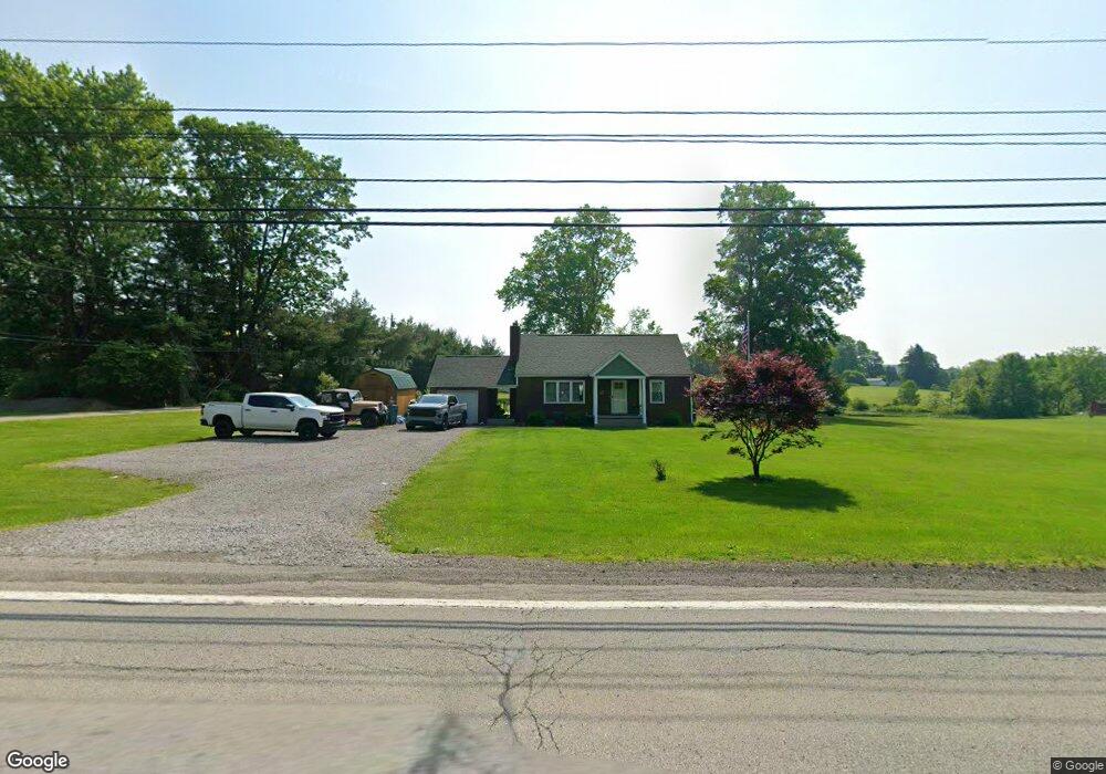
212 State Route 356 Apollo, PA 15613
Washington Township NeighborhoodEstimated Value: $77,298 - $246,000
3
Beds
1
Bath
--
Sq Ft
5.2
Acres
About This Home
This home is located at 212 State Route 356, Apollo, PA 15613 and is currently estimated at $177,075. 212 State Route 356 is a home located in Westmoreland County with nearby schools including Kiski Area High School.
Ownership History
Date
Name
Owned For
Owner Type
Purchase Details
Closed on
Feb 17, 2009
Sold by
Knasko Susan C and Leggett Kathleen A
Bought by
Hilty Shelly L and Hilty Derek L
Current Estimated Value
Home Financials for this Owner
Home Financials are based on the most recent Mortgage that was taken out on this home.
Original Mortgage
$108,000
Outstanding Balance
$68,561
Interest Rate
5.18%
Mortgage Type
FHA
Estimated Equity
$108,514
Purchase Details
Closed on
Sep 20, 2001
Sold by
Knasko Susanna S
Bought by
Knasko Susanna S and Knasko Susan C
Create a Home Valuation Report for This Property
The Home Valuation Report is an in-depth analysis detailing your home's value as well as a comparison with similar homes in the area
Home Values in the Area
Average Home Value in this Area
Purchase History
| Date | Buyer | Sale Price | Title Company |
|---|---|---|---|
| Hilty Shelly L | $110,000 | None Available | |
| Knasko Susanna S | -- | -- |
Source: Public Records
Mortgage History
| Date | Status | Borrower | Loan Amount |
|---|---|---|---|
| Open | Hilty Shelly L | $108,000 |
Source: Public Records
Tax History Compared to Growth
Tax History
| Year | Tax Paid | Tax Assessment Tax Assessment Total Assessment is a certain percentage of the fair market value that is determined by local assessors to be the total taxable value of land and additions on the property. | Land | Improvement |
|---|---|---|---|---|
| 2025 | $2,636 | $17,670 | $2,730 | $14,940 |
| 2024 | $2,499 | $17,670 | $2,730 | $14,940 |
| 2023 | $2,281 | $17,670 | $2,730 | $14,940 |
| 2022 | $2,210 | $17,670 | $2,730 | $14,940 |
| 2021 | $2,211 | $17,670 | $2,730 | $14,940 |
| 2020 | $2,205 | $17,670 | $2,730 | $14,940 |
| 2019 | $2,178 | $17,670 | $2,730 | $14,940 |
| 2018 | $2,143 | $17,670 | $2,730 | $14,940 |
| 2017 | $2,090 | $17,670 | $2,730 | $14,940 |
| 2016 | $2,057 | $17,670 | $2,730 | $14,940 |
| 2015 | $2,057 | $17,670 | $2,730 | $14,940 |
| 2014 | $2,047 | $17,670 | $2,730 | $14,940 |
Source: Public Records
Map
Nearby Homes
- 119 Pine Run Church Rd
- 843 Pine Run Rd
- 184 Pine Run Church Rd
- 150 Watson Rd
- 4792 State Route 66
- 217 Karen Dr
- 115 Acadia Ln
- 716 Pennsylvania 356
- 223 Old Mill Rd
- 0 Watson Rd
- 211 Old Mill Rd
- 380 Northgate Dr Unit D
- 501 State Route 356
- 262 Vista Dr
- 910 Robin Dr
- 519 Dogwood Ct
- 311 & 313 N 2nd St
- 1316 Hancock Ave
- 237 Beaver Run Rd
- 620 Cedar Ridge Dr
- 115 Fir Dr
- 119 Fir Dr
- 591 State Route 356
- 509 Mahen Ln
- 513 Mahen Ln
- 111 Fir Dr
- 200 State Route 356
- 198 State Route 356
- 123 Fir Dr
- 103 Fir Dr
- 1005 Shaner Acres Dr
- 197 State Route 356
- 226 State Route 356
- 193 State Route 356
- 232 State Route 356
- 223 State Route 356
- 1009 Shaner Acres Dr
- 227 State Route 356
- 1006 Shaner Acres Dr
- 521 Morabito Ln