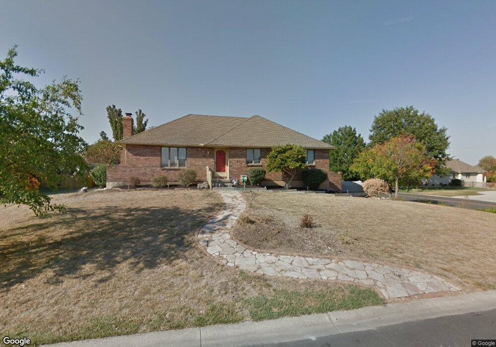
212 SW Seaside Sparrow St Lees Summit, MO 64082
Estimated Value: $385,000 - $501,000
3
Beds
3
Baths
1,616
Sq Ft
$262/Sq Ft
Est. Value
About This Home
This home is located at 212 SW Seaside Sparrow St, Lees Summit, MO 64082 and is currently estimated at $423,201, approximately $261 per square foot. 212 SW Seaside Sparrow St is a home located in Cass County with nearby schools including Timber Creek Elementary School, Raymore-Peculiar East Middle School, and Raymore-Peculiar Senior High School.
Ownership History
Date
Name
Owned For
Owner Type
Purchase Details
Closed on
Jul 25, 2005
Sold by
Riggs Robert F and Riggs Jennet W
Bought by
Thomas Monica D and Thomas Daniel A
Current Estimated Value
Home Financials for this Owner
Home Financials are based on the most recent Mortgage that was taken out on this home.
Original Mortgage
$171,593
Outstanding Balance
$88,715
Interest Rate
5.61%
Mortgage Type
New Conventional
Estimated Equity
$334,486
Create a Home Valuation Report for This Property
The Home Valuation Report is an in-depth analysis detailing your home's value as well as a comparison with similar homes in the area
Home Values in the Area
Average Home Value in this Area
Purchase History
| Date | Buyer | Sale Price | Title Company |
|---|---|---|---|
| Thomas Monica D | -- | -- |
Source: Public Records
Mortgage History
| Date | Status | Borrower | Loan Amount |
|---|---|---|---|
| Open | Thomas Monica D | $171,593 |
Source: Public Records
Tax History Compared to Growth
Tax History
| Year | Tax Paid | Tax Assessment Tax Assessment Total Assessment is a certain percentage of the fair market value that is determined by local assessors to be the total taxable value of land and additions on the property. | Land | Improvement |
|---|---|---|---|---|
| 2025 | $2,852 | $46,740 | $6,740 | $40,000 |
| 2024 | $2,852 | $41,010 | $6,130 | $34,880 |
| 2023 | $2,841 | $41,010 | $6,130 | $34,880 |
| 2022 | $2,572 | $36,140 | $6,130 | $30,010 |
| 2021 | $2,572 | $36,140 | $6,130 | $30,010 |
| 2020 | $2,533 | $34,780 | $6,130 | $28,650 |
| 2019 | $2,478 | $34,780 | $6,130 | $28,650 |
| 2018 | $2,317 | $31,080 | $5,250 | $25,830 |
| 2017 | $2,129 | $31,080 | $5,250 | $25,830 |
| 2016 | $2,129 | $29,680 | $5,250 | $24,430 |
| 2015 | $2,128 | $29,680 | $5,250 | $24,430 |
| 2014 | $1,982 | $27,510 | $2,630 | $24,880 |
| 2013 | -- | $27,510 | $2,630 | $24,880 |
Source: Public Records
Map
Nearby Homes
- 111 Teton Ridge
- 115 Teton Ridge
- 119 Teton Ridge
- 5027 SW Kingfisher Dr
- 5118 SW Pelican Point
- 4500 SW Aft Dr
- 4600 SW Admiral Byrd Dr
- 131 Seneca Ln
- 917 SW Soldier Ct
- 4213 SW Sapelo Dr
- 4641 SW Soldier Dr
- 4647 SW Olympia Place
- 105 Tuscarora Ln
- 226 N Winnebago Dr
- 4605 SW Olympia Cir
- 4053 SW Clipper Ln
- 1128 SW Whitby Dr
- 4132 SW Minnesota Dr
- 1132 SW Whitby Dr
- 1136 SW Whitby Dr
- 216 SW Seaside Sparrow St
- 211 SW Marsh Wren St
- 220 SW Seaside Sparrow St
- 211 SW Seaside Sparrow St
- 215 SW Marsh Wren St
- 215 SW Seaside Sparrow St
- 5007 SW Raintree Pkwy
- 4933 SW Raintree Pkwy
- 219 SW Marsh Wren St
- 219 SW Seaside Sparrow St
- 224 SW Seaside Sparrow St
- 5015 SW Raintree Pkwy
- 4929 SW Raintree Pkwy
- 223 SW Seaside Sparrow St
- 223 SW Marsh Wren St
- 228 SW Seaside Sparrow St
- 210 SW Marsh Wren St
- 5021 SW Raintree Pkwy
- 218 SW Albatross Ct
- 222 SW Albatross Ct