Estimated Value: $1,036,000 - $1,368,000
5
Beds
--
Bath
1,960
Sq Ft
$603/Sq Ft
Est. Value
About This Home
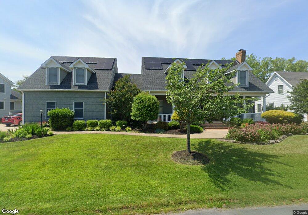
This home is located at 212 University Dr, Lewes, DE 19958 and is currently estimated at $1,181,180, approximately $602 per square foot. 212 University Dr is a home located in Sussex County with nearby schools including Lewes Elementary School, Mariner Middle School, and Cape Henlopen High School.
Ownership History
Date
Name
Owned For
Owner Type
Purchase Details
Closed on
Oct 22, 2021
Sold by
Malinowski Linda
Bought by
My 3 Sons Llc
Current Estimated Value
Purchase Details
Closed on
Sep 26, 2018
Sold by
Robert L Thomas
Bought by
Good Dean A and Good Rebecca H
Home Financials for this Owner
Home Financials are based on the most recent Mortgage that was taken out on this home.
Original Mortgage
$559,920
Interest Rate
4.65%
Purchase Details
Closed on
Apr 28, 2017
Sold by
Thomas Phyllis C and Thomas Robert L
Bought by
Malinowski Linda
Purchase Details
Closed on
Mar 13, 1994
Bought by
Thomas Robert L and Thomas Phyllis C
Create a Home Valuation Report for This Property
The Home Valuation Report is an in-depth analysis detailing your home's value as well as a comparison with similar homes in the area
Home Values in the Area
Average Home Value in this Area
Purchase History
| Date | Buyer | Sale Price | Title Company |
|---|---|---|---|
| My 3 Sons Llc | -- | None Available | |
| Good Dean A | $699,900 | -- | |
| Malinowski Linda | $725,000 | None Available | |
| Thomas Robert L | -- | -- |
Source: Public Records
Mortgage History
| Date | Status | Borrower | Loan Amount |
|---|---|---|---|
| Previous Owner | Thomas Robert L | $559,920 | |
| Previous Owner | Thomas Robert L | -- |
Source: Public Records
Tax History Compared to Growth
Tax History
| Year | Tax Paid | Tax Assessment Tax Assessment Total Assessment is a certain percentage of the fair market value that is determined by local assessors to be the total taxable value of land and additions on the property. | Land | Improvement |
|---|---|---|---|---|
| 2025 | $1,668 | $25,150 | $2,850 | $22,300 |
| 2024 | $1,213 | $25,150 | $2,850 | $22,300 |
| 2023 | $1,211 | $25,150 | $2,850 | $22,300 |
| 2022 | $1,169 | $25,150 | $2,850 | $22,300 |
| 2021 | $1,184 | $25,150 | $2,850 | $22,300 |
| 2020 | $1,181 | $25,150 | $2,850 | $22,300 |
| 2019 | $1,182 | $25,150 | $2,850 | $22,300 |
| 2018 | $1,104 | $25,150 | $0 | $0 |
| 2017 | $1,058 | $25,150 | $0 | $0 |
| 2016 | $1,005 | $25,150 | $0 | $0 |
| 2015 | $960 | $25,150 | $0 | $0 |
| 2014 | $953 | $25,150 | $0 | $0 |
Source: Public Records
Map
Nearby Homes
- 131 New Rd
- 113 New Rd
- 422 Burton Ave
- 322 Captains Cir
- 325 Captains Cir
- 305 Seagull Dr
- 157 Tyler's Cir Unit 15
- 310 Burton Ave Unit A
- The Bethany Plan at Fishers Cove - Fisher's Cove
- Cassidy Plan at Fishers Cove - Fisher's Cove
- 165 Tyler's Cir
- 179 Tyler's Cir Unit 6
- 149 Jacks Way Unit 18
- 159 Tylers Cir Unit 14
- 109 Samantha Dr
- Lot 4 Mulberry St
- Lot 3 Mulberry St
- 240 2nd St
- 5 Clayton Ave
- 228 2nd St
- 212 University Dr
- 234 University Dr
- 214 University Dr
- 210 University Dr
- 129 New Rd
- 213 University Dr
- 216 University Dr Unit 54
- 211 University Dr
- 208 University Dr
- 127 New Rd
- 217 University Dr
- 214 Marina Dr
- 218 University Dr
- 212 Marina Dr
- 16690 New Rd
- 220 Marina Dr
- 210 Marina Dr
- 207 University Dr
- 206 University Dr Unit o
- 206 University Dr