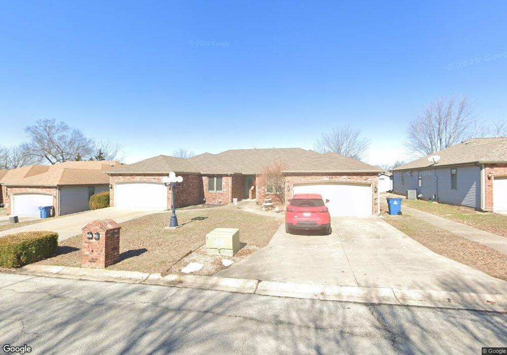
212 W Briarbrook Ln Carl Junction, MO 64834
Briarbrook NeighborhoodEstimated Value: $235,000
Studio
--
Bath
1,666
Sq Ft
$141/Sq Ft
Est. Value
About This Home
This home is located at 212 W Briarbrook Ln, Carl Junction, MO 64834 and is currently estimated at $235,000, approximately $141 per square foot. 212 W Briarbrook Ln is a home located in Jasper County with nearby schools including Carl Junction Primary School (K-1), Carl Junction Intermediate School, and Carl Junction Primary School (2-3).
Ownership History
Date
Name
Owned For
Owner Type
Purchase Details
Closed on
Oct 6, 2017
Sold by
Powers Daniel C
Bought by
Powers Daniel C and Powers Chelsea
Current Estimated Value
Home Financials for this Owner
Home Financials are based on the most recent Mortgage that was taken out on this home.
Original Mortgage
$69,200
Outstanding Balance
$57,600
Interest Rate
3.78%
Mortgage Type
New Conventional
Estimated Equity
$177,400
Purchase Details
Closed on
Jul 7, 2008
Sold by
Ogrady David L and Ogrady Carolyn M
Bought by
Powers Daniel C
Home Financials for this Owner
Home Financials are based on the most recent Mortgage that was taken out on this home.
Original Mortgage
$84,400
Interest Rate
6.11%
Mortgage Type
Purchase Money Mortgage
Create a Home Valuation Report for This Property
The Home Valuation Report is an in-depth analysis detailing your home's value as well as a comparison with similar homes in the area
Home Values in the Area
Average Home Value in this Area
Purchase History
| Date | Buyer | Sale Price | Title Company |
|---|---|---|---|
| Powers Daniel C | -- | Waco Totle Company | |
| Powers Daniel C | -- | Abbey |
Source: Public Records
Mortgage History
| Date | Status | Borrower | Loan Amount |
|---|---|---|---|
| Open | Powers Daniel C | $69,200 | |
| Previous Owner | Powers Daniel C | $84,400 |
Source: Public Records
Tax History
| Year | Tax Paid | Tax Assessment Tax Assessment Total Assessment is a certain percentage of the fair market value that is determined by local assessors to be the total taxable value of land and additions on the property. | Land | Improvement |
|---|---|---|---|---|
| 2025 | $1,400 | $24,200 | $1,630 | $22,570 |
| 2024 | $1,405 | $22,080 | $1,630 | $20,450 |
| 2023 | $1,405 | $22,080 | $1,630 | $20,450 |
| 2022 | $1,421 | $22,340 | $1,630 | $20,710 |
| 2021 | $1,231 | $22,340 | $1,630 | $20,710 |
| 2020 | $1,144 | $20,490 | $1,630 | $18,860 |
| 2019 | $1,088 | $20,490 | $1,630 | $18,860 |
| 2018 | $974 | $18,470 | $0 | $0 |
| 2017 | $977 | $18,470 | $0 | $0 |
| 2016 | $1,085 | $20,690 | $0 | $0 |
Source: Public Records
Map
Nearby Homes
- 710 Briarbrook Dr
- 126 N Windwood
- 328 Briarbrook Dr
- 107 Foursome Ln
- 706 W Briarbrook Ln
- 807 Copper Oaks Dr
- 128 Par Ln
- 106 Victoria Ln
- 909 Silver Oaks Dr
- 708 Danica Jo Ln
- 901 Black Thorn Dr
- 201 Tee Ln
- 306 Lakeview Ln
- 907 Silver Oaks Dr
- 908 Silver Oaks Dr
- 913 W Briarbrook Ln
- 126 Briarbrook Dr
- 910 Silver Oaks
- 1021 Copper Oaks Dr
- 232 Hickory Place
- 212 W Briarbrook Ln Unit 1
- 210 W Briarbrook Ln
- 214 W Briarbrook Ln
- 208 W Briarbrook Ln
- 208 W Briarbrook Ln Unit 1
- 218 W Briarbrook Ln
- 206 W Briarbrook Ln
- 220 W Briarbrook Ln
- 204 W Briarbrook Ln
- 205 W Briarbrook Ln Unit 207
- 222 W Briarbrook Ln
- 202 W Briarbrook Ln
- 201 W Briarbrook Ln
- 224 W Briarbrook Ln
- 209 W Briarbrook Ln Unit 211
- 226 W Briarbrook Ln
- 119 W Briarbrook Ln
- 117 W Briarbrook Ln
- 117 W Briarbrook Ln Unit 2
- 117 W Briarbrook Ln
Your Personal Tour Guide
Ask me questions while you tour the home.