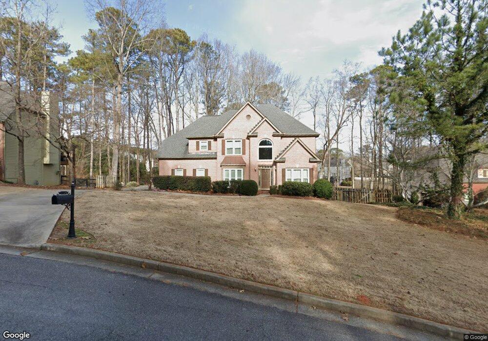
2120 Brookton Way Unit II Cumming, GA 30041
Big Creek NeighborhoodEstimated Value: $625,000 - $751,000
4
Beds
3
Baths
2,507
Sq Ft
$270/Sq Ft
Est. Value
About This Home
This home is located at 2120 Brookton Way Unit II, Cumming, GA 30041 and is currently estimated at $678,109, approximately $270 per square foot. 2120 Brookton Way Unit II is a home located in Forsyth County with nearby schools including Sharon Elementary School, South Forsyth Middle School, and South Forsyth High School.
Ownership History
Date
Name
Owned For
Owner Type
Purchase Details
Closed on
Jun 22, 2001
Sold by
West John L
Bought by
Shopp John E and Shopp Barbara N
Current Estimated Value
Home Financials for this Owner
Home Financials are based on the most recent Mortgage that was taken out on this home.
Original Mortgage
$100,000
Interest Rate
7.23%
Mortgage Type
New Conventional
Purchase Details
Closed on
Feb 6, 1998
Sold by
E D W & Assoc
Bought by
West John L
Home Financials for this Owner
Home Financials are based on the most recent Mortgage that was taken out on this home.
Original Mortgage
$196,200
Interest Rate
6.62%
Mortgage Type
New Conventional
Create a Home Valuation Report for This Property
The Home Valuation Report is an in-depth analysis detailing your home's value as well as a comparison with similar homes in the area
Home Values in the Area
Average Home Value in this Area
Purchase History
| Date | Buyer | Sale Price | Title Company |
|---|---|---|---|
| Shopp John E | $249,000 | -- | |
| West John L | $218,000 | -- |
Source: Public Records
Mortgage History
| Date | Status | Borrower | Loan Amount |
|---|---|---|---|
| Closed | Shopp John E | $100,000 | |
| Previous Owner | West John L | $196,200 |
Source: Public Records
Tax History Compared to Growth
Tax History
| Year | Tax Paid | Tax Assessment Tax Assessment Total Assessment is a certain percentage of the fair market value that is determined by local assessors to be the total taxable value of land and additions on the property. | Land | Improvement |
|---|---|---|---|---|
| 2025 | $942 | $242,792 | $68,000 | $174,792 |
| 2024 | $942 | $246,836 | $60,000 | $186,836 |
| 2023 | $843 | $225,996 | $60,000 | $165,996 |
| 2022 | $912 | $154,548 | $40,000 | $114,548 |
| 2021 | $902 | $154,548 | $40,000 | $114,548 |
| 2020 | $896 | $148,284 | $40,000 | $108,284 |
| 2019 | $901 | $147,464 | $40,000 | $107,464 |
| 2018 | $891 | $129,400 | $28,000 | $101,400 |
| 2017 | $3,243 | $116,832 | $28,000 | $88,832 |
| 2016 | $3,021 | $108,832 | $20,000 | $88,832 |
| 2015 | $3,026 | $108,832 | $20,000 | $88,832 |
| 2014 | $2,418 | $91,328 | $20,000 | $71,328 |
Source: Public Records
Map
Nearby Homes
- 2472 Ballantrae Cir Unit 26
- 2516 Ballantrae Cir Unit 39
- 2615 Hillandale Cir
- 2550 Ballantrae Cir Unit 53
- 1925 Commonwealth Ct
- 2530 Ballantrae Cir Unit 45
- 2260 Thames Ct
- Hedgewood with Basement Plan at Willow Glen - Highlands Collection
- Rosalynn Plan at Willow Glen - Reserve Collection
- Rhinewood with Basement Plan at Willow Glen - Reserve Collection
- Montadale with Basement Plan at Willow Glen - Highlands Collection
- Peterson with Basement Plan at Willow Glen - Reserve Collection
- Parkmont Plan at Willow Glen - Reserve Collection
- Parkmont with Basement Plan at Willow Glen - Reserve Collection
- Montadale Plan at Willow Glen - Highlands Collection
- Hillstone Plan at Willow Glen - Highlands Collection
- Peterson Plan at Willow Glen - Reserve Collection
- Antoinette with Basement Plan at Willow Glen - Highlands Collection
- Rosalynn with Basement Plan at Willow Glen - Reserve Collection
- Hillstone with Basement Plan at Willow Glen - Highlands Collection
- 2130 Brookton Way
- 2030 Brookton Way
- 2015 Bentwood Ct
- 2175 Bricker Ct
- 2175 Bricker Ct Unit N/A
- 2215 Bricker Ct
- 2115 Brookton Way
- 2005 Bentwood Ct
- 2135 Westford Cove
- 2125 Westford Cove
- 2145 Westford Cove
- 2115 Arbor Chase
- 2105 Westford Cove
- 2170 Bricker Ct
- 2235 Bricker Ct
- 2120 Arbor Chase
- 2210 Bricker Ct
- 2180 Bricker Ct
- 2220 Bricker Ct
- 2155 Westford Cove