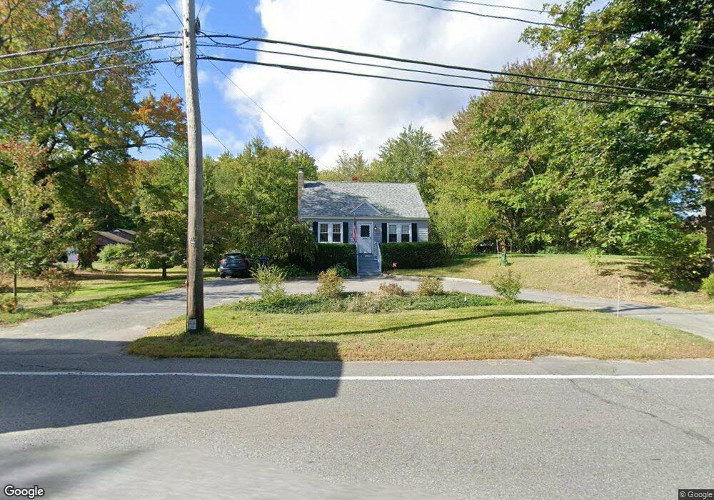
2120 Main St Lancaster, MA 01523
Estimated Value: $439,631 - $542,000
3
Beds
2
Baths
1,512
Sq Ft
$311/Sq Ft
Est. Value
About This Home
This home is located at 2120 Main St, Lancaster, MA 01523 and is currently estimated at $470,158, approximately $310 per square foot. 2120 Main St is a home located in Worcester County with nearby schools including Mary Rowlandson Elementary School, Luther Burbank Middle School, and Nashoba Regional High School.
Create a Home Valuation Report for This Property
The Home Valuation Report is an in-depth analysis detailing your home's value as well as a comparison with similar homes in the area
Home Values in the Area
Average Home Value in this Area
Tax History
| Year | Tax Paid | Tax Assessment Tax Assessment Total Assessment is a certain percentage of the fair market value that is determined by local assessors to be the total taxable value of land and additions on the property. | Land | Improvement |
|---|---|---|---|---|
| 2025 | $5,084 | $314,600 | $103,000 | $211,600 |
| 2024 | $5,051 | $289,300 | $93,800 | $195,500 |
| 2023 | $0 | $277,300 | $85,300 | $192,000 |
| 2022 | $4,293 | $220,700 | $79,400 | $141,300 |
| 2021 | $4,198 | $210,100 | $79,400 | $130,700 |
| 2020 | $4,107 | $206,900 | $79,500 | $127,400 |
| 2019 | $3,922 | $198,600 | $79,500 | $119,100 |
| 2018 | $3,794 | $189,900 | $79,500 | $110,400 |
| 2016 | $3,513 | $179,700 | $78,600 | $101,100 |
| 2015 | $3,354 | $178,800 | $78,600 | $100,200 |
| 2014 | $3,270 | $172,900 | $78,600 | $94,300 |
Source: Public Records
Map
Nearby Homes
- 2290 Main St
- 303 Ponakin Rd
- 2038-1 Laurel Hill Ln
- 2038 Laurel Hill Ln Unit LOT 18
- 1497 Lunenburg Rd
- 35 Mcgovern Blvd
- 0 Main St
- 18 Highfield Dr
- 193 Bayberry Hill Ln
- 121 &125 Flanagan Hill Rd
- 144 Seven Bridge Rd
- 2 Turtle Ln Unit 2
- 437 Johnny Appleseed Ln
- 851 Lancaster St
- 7 Lawson Ave
- 675 Willard St
- 23 Lantern Ln
- 73 Prescott St
- 99 Cortland Cir
- 372 Litchfield St
Your Personal Tour Guide
Ask me questions while you tour the home.