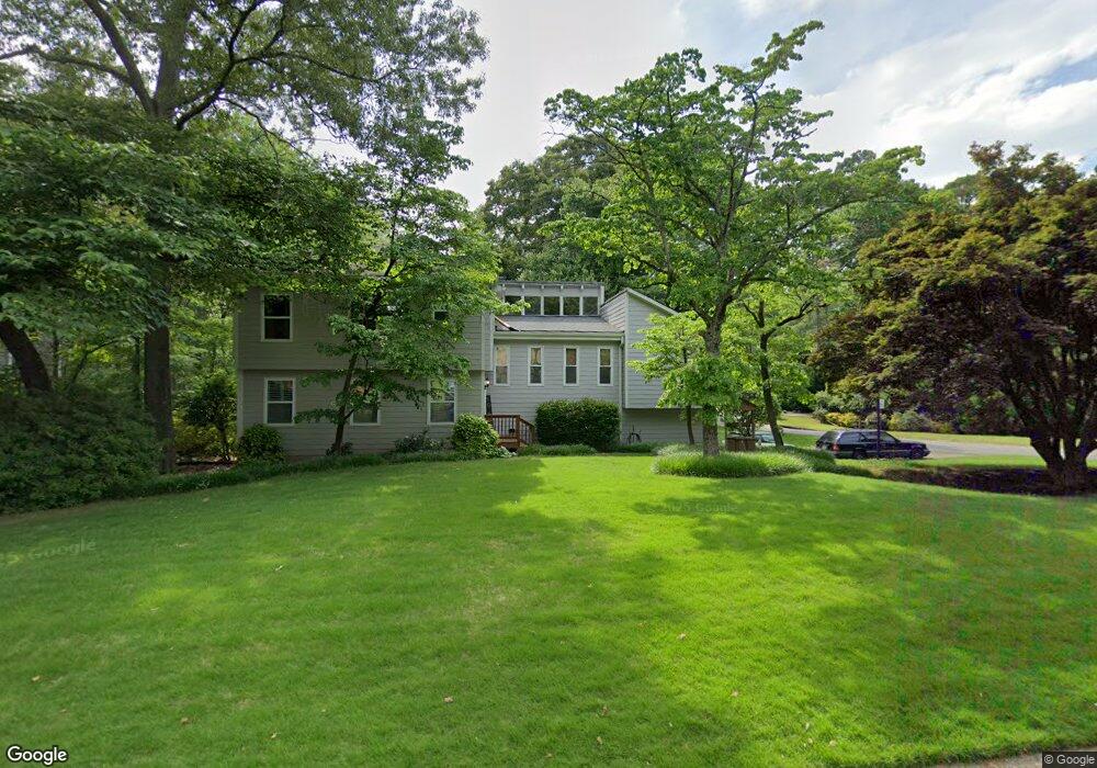
2120 Preswick Dr NE Marietta, GA 30066
Sandy Plains NeighborhoodEstimated Value: $411,000 - $488,000
4
Beds
3
Baths
1,818
Sq Ft
$249/Sq Ft
Est. Value
About This Home
This home is located at 2120 Preswick Dr NE, Marietta, GA 30066 and is currently estimated at $453,525, approximately $249 per square foot. 2120 Preswick Dr NE is a home located in Cobb County with nearby schools including Keheley Elementary School, McCleskey Middle School, and The Garden School.
Ownership History
Date
Name
Owned For
Owner Type
Purchase Details
Closed on
Apr 10, 2009
Sold by
Lovello Dean V and Lovello Kimberly A
Bought by
Kalli Stephen G and Kalli Andre
Current Estimated Value
Home Financials for this Owner
Home Financials are based on the most recent Mortgage that was taken out on this home.
Original Mortgage
$217,000
Interest Rate
4.77%
Mortgage Type
Trade
Purchase Details
Closed on
Jun 30, 2008
Sold by
Sobotka Robert F and Sobotka Sandra
Bought by
Lovello Dean and Lovello Kimberly A
Home Financials for this Owner
Home Financials are based on the most recent Mortgage that was taken out on this home.
Original Mortgage
$160,000
Interest Rate
5.96%
Mortgage Type
New Conventional
Create a Home Valuation Report for This Property
The Home Valuation Report is an in-depth analysis detailing your home's value as well as a comparison with similar homes in the area
Home Values in the Area
Average Home Value in this Area
Purchase History
| Date | Buyer | Sale Price | Title Company |
|---|---|---|---|
| Kalli Stephen G | $217,000 | -- | |
| Lovello Dean | $227,000 | -- |
Source: Public Records
Mortgage History
| Date | Status | Borrower | Loan Amount |
|---|---|---|---|
| Previous Owner | Kalli Stephen G | $217,000 | |
| Previous Owner | Lovello Dean | $160,000 |
Source: Public Records
Tax History Compared to Growth
Tax History
| Year | Tax Paid | Tax Assessment Tax Assessment Total Assessment is a certain percentage of the fair market value that is determined by local assessors to be the total taxable value of land and additions on the property. | Land | Improvement |
|---|---|---|---|---|
| 2025 | $1,010 | $178,472 | $36,000 | $142,472 |
| 2024 | $946 | $155,880 | $34,400 | $121,480 |
| 2023 | $740 | $155,880 | $34,400 | $121,480 |
| 2022 | $881 | $134,036 | $28,000 | $106,036 |
| 2021 | $826 | $115,860 | $28,000 | $87,860 |
| 2020 | $791 | $104,216 | $26,000 | $78,216 |
| 2019 | $2,437 | $98,064 | $26,000 | $72,064 |
| 2018 | $2,409 | $96,740 | $26,000 | $70,740 |
| 2017 | $1,864 | $75,944 | $26,000 | $49,944 |
| 2016 | $1,866 | $75,944 | $26,000 | $49,944 |
| 2015 | $1,525 | $60,616 | $20,000 | $40,616 |
| 2014 | $1,538 | $60,616 | $0 | $0 |
Source: Public Records
Map
Nearby Homes
- 2256 Turtle Club Dr NE Unit 1
- 4799 North Trail
- 5100 Ravenwood Dr
- 4797 North Trail
- 2423 Turtle Crossing NE
- 4813 Highpoint Dr NE
- 4709 Trickum Rd NE
- 205 Leland Way
- 5009 Kingsley Manor Ct
- 4592 N Landing Dr
- 1877 Falcon Wood Dr NE
- 134 Sierra Cir
- 223 Wild Ginger Bend
- 235 Wild Ginger Bend
- 416 Maypop Ln
- 255 Wild Ginger Bend
- 2130 Preswick Dr NE
- 4872 Highpoint Dr NE
- 2121 Preswick Dr NE
- 4895 Highpoint Dr NE
- 2140 Preswick Dr NE
- 2131 Preswick Dr NE Unit 1
- 4885 Highpoint Dr NE
- 4875 Highpoint Dr NE
- 4905 Highpoint Dr NE
- 4818 Woodspring Dr NE
- 4820 Woodspring Dr NE
- 4915 Highpoint Dr NE
- 4912 Highpoint Dr NE
- 2150 Preswick Dr NE
- 2141 Preswick Dr NE
- 4865 Highpoint Dr NE Unit 3
- 4922 Highpoint Dr NE
- 0 Preswick Dr Unit 3240249
- 0 Preswick Dr Unit 8475154
- 0 Preswick Dr