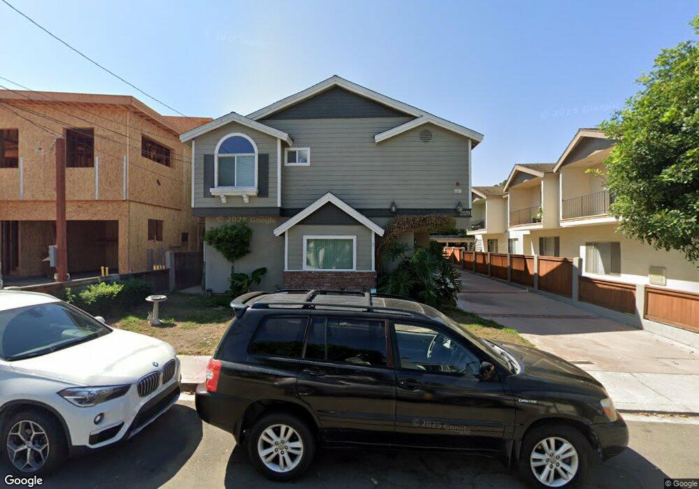
2120 Rockefeller Ln Unit C Redondo Beach, CA 90278
North Redondo Beach NeighborhoodEstimated Value: $1,201,462 - $1,377,000
3
Beds
3
Baths
1,901
Sq Ft
$692/Sq Ft
Est. Value
About This Home
This home is located at 2120 Rockefeller Ln Unit C, Redondo Beach, CA 90278 and is currently estimated at $1,316,116, approximately $692 per square foot. 2120 Rockefeller Ln Unit C is a home located in Los Angeles County with nearby schools including Birney Elementary School, Adams Middle School, and Redondo Union High School.
Ownership History
Date
Name
Owned For
Owner Type
Purchase Details
Closed on
Oct 5, 2001
Sold by
Mackie Alan J
Bought by
Mackie Robert E and Mackie Dina R
Current Estimated Value
Purchase Details
Closed on
Mar 4, 1998
Sold by
Roach Robert T and Roach Merry H
Bought by
Mackie Robert E and Mackie Dina R
Home Financials for this Owner
Home Financials are based on the most recent Mortgage that was taken out on this home.
Original Mortgage
$218,000
Outstanding Balance
$39,810
Interest Rate
7%
Estimated Equity
$1,276,306
Create a Home Valuation Report for This Property
The Home Valuation Report is an in-depth analysis detailing your home's value as well as a comparison with similar homes in the area
Home Values in the Area
Average Home Value in this Area
Purchase History
| Date | Buyer | Sale Price | Title Company |
|---|---|---|---|
| Mackie Robert E | -- | -- | |
| Mackie Robert E | $278,000 | Southland Title Corporation |
Source: Public Records
Mortgage History
| Date | Status | Borrower | Loan Amount |
|---|---|---|---|
| Open | Mackie Robert E | $218,000 |
Source: Public Records
Tax History Compared to Growth
Tax History
| Year | Tax Paid | Tax Assessment Tax Assessment Total Assessment is a certain percentage of the fair market value that is determined by local assessors to be the total taxable value of land and additions on the property. | Land | Improvement |
|---|---|---|---|---|
| 2025 | $5,633 | $443,874 | $164,453 | $279,421 |
| 2024 | $5,633 | $435,172 | $161,229 | $273,943 |
| 2023 | $5,537 | $426,640 | $158,068 | $268,572 |
| 2022 | $5,421 | $418,275 | $154,969 | $263,306 |
| 2021 | $5,261 | $410,075 | $151,931 | $258,144 |
| 2019 | $5,118 | $397,915 | $147,426 | $250,489 |
| 2018 | $4,951 | $390,114 | $144,536 | $245,578 |
| 2016 | $4,776 | $374,967 | $138,924 | $236,043 |
| 2015 | $4,694 | $369,336 | $136,838 | $232,498 |
| 2014 | $4,628 | $362,102 | $134,158 | $227,944 |
Source: Public Records
Map
Nearby Homes
- 1708 Blossom Ln
- 2100 Carnegie Ln
- 2720 27201/2 Carnegie Ln
- 2021 Carnegie Ln Unit 7
- 2002 Carnegie Ln Unit A
- 2210 Harriman Ln Unit A
- 2317 Carnegie Ln Unit B
- 2020 Clark Ln Unit B
- 2001 Artesia Blvd Unit 207
- 1913 Harriman Ln Unit 1
- 2227 Mathews Ave
- 2301 Marshallfield Ln Unit A
- 1900 Vanderbilt Ln
- 2005 Mathews Ave Unit C
- 2321 Clark Ln Unit B
- 2321 Clark Ln Unit A
- 1832 Rockefeller Ln Unit 9
- 2002 Marshallfield Ln
- 2221 Pullman Ln Unit B
- 2405 Mathews Ave Unit C
- 2120 Rockefeller Ln Unit B
- 2120 Rockefeller Ln Unit A
- 2118 Rockefeller Ln
- 1607 Rindge Ln
- 2116 Rockefeller Ln Unit C
- 2116 Rockefeller Ln Unit A
- 1606 Rindge Ln
- 2200 Rockefeller Ln
- 2114 Rockefeller Ln
- 2121 Grant Ave
- 2119 Grant Ave Unit C
- 2119 Grant Ave
- 1601 Rindge Ln Unit 1
- 1605 Rindge Ln
- 1603 Rindge Ln
- 1601 Rindge Ln
- 2121 Rockefeller Ln
- 2123 Rockefeller Ln
- 2117 Grant Ave