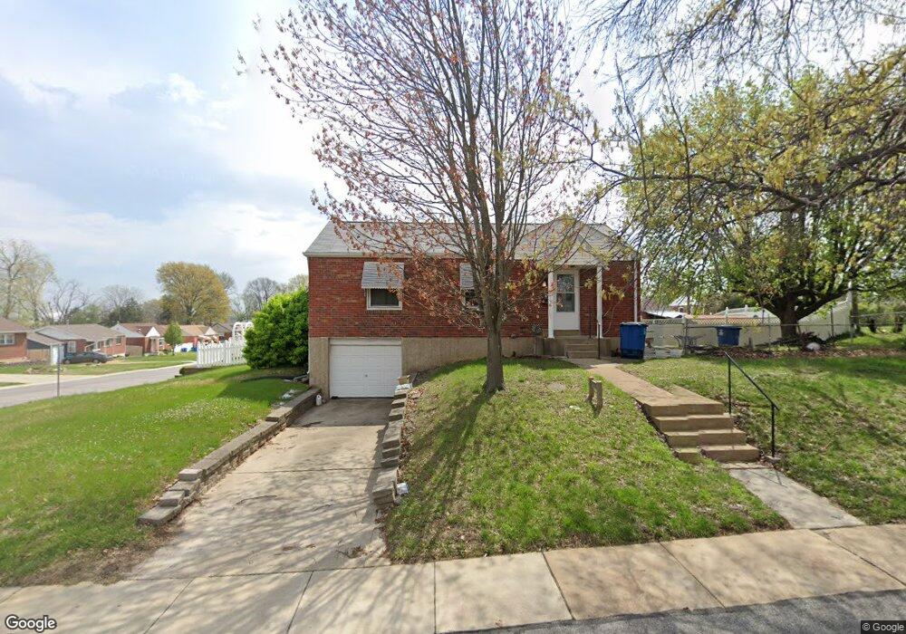
2120 Telegraph Rd Saint Louis, MO 63125
Lemay NeighborhoodEstimated Value: $153,000 - $180,000
2
Beds
1
Bath
814
Sq Ft
$202/Sq Ft
Est. Value
About This Home
This home is located at 2120 Telegraph Rd, Saint Louis, MO 63125 and is currently estimated at $164,564, approximately $202 per square foot. 2120 Telegraph Rd is a home located in St. Louis County with nearby schools including Forder Elementary School, Margaret Buerkle Middle School, and Mehlville High School.
Ownership History
Date
Name
Owned For
Owner Type
Purchase Details
Closed on
Jul 18, 1997
Sold by
Jane Lardner Betty
Bought by
Lardner Susan Diane
Current Estimated Value
Home Financials for this Owner
Home Financials are based on the most recent Mortgage that was taken out on this home.
Original Mortgage
$25,600
Interest Rate
7.6%
Create a Home Valuation Report for This Property
The Home Valuation Report is an in-depth analysis detailing your home's value as well as a comparison with similar homes in the area
Home Values in the Area
Average Home Value in this Area
Purchase History
| Date | Buyer | Sale Price | Title Company |
|---|---|---|---|
| Lardner Susan Diane | -- | Land Title Company |
Source: Public Records
Mortgage History
| Date | Status | Borrower | Loan Amount |
|---|---|---|---|
| Closed | Lardner Susan Diane | $25,600 |
Source: Public Records
Tax History Compared to Growth
Tax History
| Year | Tax Paid | Tax Assessment Tax Assessment Total Assessment is a certain percentage of the fair market value that is determined by local assessors to be the total taxable value of land and additions on the property. | Land | Improvement |
|---|---|---|---|---|
| 2025 | $1,946 | $30,230 | $12,310 | $17,920 |
| 2024 | $1,946 | $26,540 | $6,860 | $19,680 |
| 2023 | $1,833 | $26,540 | $6,860 | $19,680 |
| 2022 | $1,538 | $22,210 | $7,520 | $14,690 |
| 2021 | $1,535 | $22,210 | $7,520 | $14,690 |
| 2020 | $1,460 | $19,980 | $7,520 | $12,460 |
| 2019 | $1,457 | $19,980 | $7,520 | $12,460 |
| 2018 | $1,264 | $15,390 | $6,100 | $9,290 |
| 2017 | $1,261 | $15,390 | $6,100 | $9,290 |
| 2016 | $1,184 | $13,850 | $4,560 | $9,290 |
| 2015 | $1,117 | $13,850 | $4,560 | $9,290 |
| 2014 | $1,100 | $13,590 | $3,880 | $9,710 |
Source: Public Records
Map
Nearby Homes
- 408 W Ripa Ave
- 2105 Telford Dr
- 645 Vista Conn Dr
- 2228 Hagenstone Terrace
- 9950 Meadow Ave
- 333 Pentonville Dr
- 2218 Telford Dr
- 800 Dumont Place Unit B
- 1745 Herault Place Unit E
- 1725 Herault Place Unit G
- 9954 Luna Ave
- 1656 Herault Place
- 1677 Herault Place Unit B
- 1673 Herault Place Unit B
- 9953 Sadie Ave
- 1678 Blue Ridge Dr Unit A
- 1660 Blue Ridge Dr Unit G
- 824 Dumont Place Unit C
- 1661 Blue Ridge Dr Unit D
- 846 Dumont Place