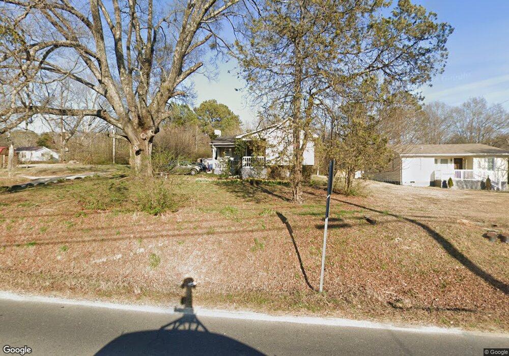
2120 Waring Rd NW Dalton, GA 30721
Estimated Value: $217,753 - $306,000
--
Bed
1
Bath
1,884
Sq Ft
$142/Sq Ft
Est. Value
About This Home
This home is located at 2120 Waring Rd NW, Dalton, GA 30721 and is currently estimated at $267,188, approximately $141 per square foot. 2120 Waring Rd NW is a home located in Whitfield County with nearby schools including Pleasant Grove Elementary School, New Hope Middle School, and Northwest Whitfield County High School.
Ownership History
Date
Name
Owned For
Owner Type
Purchase Details
Closed on
Sep 17, 2025
Sold by
Bermurr Inc
Bought by
Cochran Sharry and Plott Christopher J
Current Estimated Value
Purchase Details
Closed on
Dec 4, 2020
Sold by
Bermurr Inc
Bought by
Integrity Construction Of Dalton Llc
Purchase Details
Closed on
Jun 16, 2005
Sold by
Bermurr Inc
Bought by
Miranda Blaider
Home Financials for this Owner
Home Financials are based on the most recent Mortgage that was taken out on this home.
Original Mortgage
$77,600
Interest Rate
5.57%
Mortgage Type
New Conventional
Purchase Details
Closed on
Oct 1, 1998
Bought by
Bermurr Inc
Create a Home Valuation Report for This Property
The Home Valuation Report is an in-depth analysis detailing your home's value as well as a comparison with similar homes in the area
Home Values in the Area
Average Home Value in this Area
Purchase History
| Date | Buyer | Sale Price | Title Company |
|---|---|---|---|
| Cochran Sharry | -- | None Listed On Document | |
| Integrity Construction Of Dalton Llc | $84,000 | None Listed On Document | |
| Miranda Blaider | -- | -- | |
| Bermurr Inc | $52,100 | -- |
Source: Public Records
Mortgage History
| Date | Status | Borrower | Loan Amount |
|---|---|---|---|
| Previous Owner | Miranda Blaider | $77,600 |
Source: Public Records
Tax History Compared to Growth
Tax History
| Year | Tax Paid | Tax Assessment Tax Assessment Total Assessment is a certain percentage of the fair market value that is determined by local assessors to be the total taxable value of land and additions on the property. | Land | Improvement |
|---|---|---|---|---|
| 2024 | $1,651 | $74,604 | $6,868 | $67,736 |
| 2023 | $1,651 | $55,116 | $5,138 | $49,978 |
| 2022 | $879 | $29,788 | $4,512 | $25,276 |
| 2021 | $879 | $29,788 | $4,512 | $25,276 |
| 2020 | $909 | $29,788 | $4,512 | $25,276 |
| 2019 | $924 | $29,788 | $4,512 | $25,276 |
| 2018 | $910 | $28,874 | $3,598 | $25,276 |
| 2017 | $910 | $28,874 | $3,598 | $25,276 |
| 2016 | $806 | $26,586 | $3,598 | $22,988 |
| 2014 | $732 | $27,208 | $4,220 | $22,988 |
| 2013 | -- | $27,208 | $4,219 | $22,988 |
Source: Public Records
Map
Nearby Homes
- 2215 Kerr Rd NW
- 213 Grassdale Rd
- 2256 Waring Rd NW
- 1247 Reed Rd
- 110 Pinewood Way
- 0 West R W Ridge Dr
- 1015 S Ridge Dr
- 503 Moore Dr
- 000 Reed Rd
- 1425 Wiggs Dr
- 192 Carly Dr
- 522 Westbrook Rd
- 1626 Lagenia Ct
- 1080 Estate Dr
- 439 Westbrook Rd
- 1903 Summit View Dr
- 1903 Middle Summit Dr
- 466 Scarlet Dr
- 117 Pleasant Hill Dr
- 287 Williams Rd NW
- 2118 Waring Rd NW
- 2133 Waring Rd
- 2132 Waring Rd NW
- 524 Andy Ln NE
- 2136 Waring Rd NW
- 527 Andy Ln NE
- 530 Andy Ln NE
- 531 Andy Ln NE
- 545 Andy Ln
- 545 Andy Ln NE
- 0 Kerr Rd NW
- 0 Kerr Rd NW Unit 78791
- 0 Kerr Rd NW Unit 1127021
- 535 Andy Ln NE
- 2144 Waring Rd NW
- 544 Andy Ln NE
- 2149 Waring Rd NW
- 2070 Waring Rd NW
- 2148 Waring Rd NW
- 2099 Freeport Rd NW