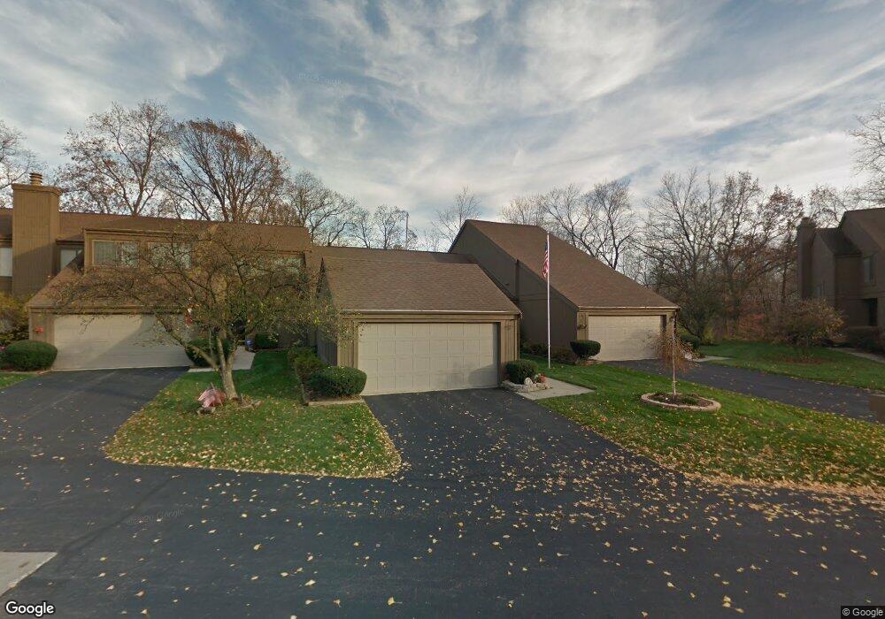
2121 Brookhurst Ave Unit 41C Columbus, OH 43229
Northgate NeighborhoodEstimated Value: $198,000 - $277,000
2
Beds
3
Baths
1,429
Sq Ft
$164/Sq Ft
Est. Value
About This Home
This home is located at 2121 Brookhurst Ave Unit 41C, Columbus, OH 43229 and is currently estimated at $234,371, approximately $164 per square foot. 2121 Brookhurst Ave Unit 41C is a home located in Franklin County with nearby schools including Northgate Intermediate, Alpine Elementary School, and Woodward Park Middle School.
Ownership History
Date
Name
Owned For
Owner Type
Purchase Details
Closed on
Jun 21, 2023
Sold by
Kendall Sharon A
Bought by
Cage Bernice D
Current Estimated Value
Purchase Details
Closed on
Aug 6, 2010
Sold by
Stuhr Richard W
Bought by
Kendall Lawrence A and Kendall Sharon A
Purchase Details
Closed on
Oct 2, 1981
Bought by
Stuhr Irwin R
Purchase Details
Closed on
Jan 1, 1979
Create a Home Valuation Report for This Property
The Home Valuation Report is an in-depth analysis detailing your home's value as well as a comparison with similar homes in the area
Home Values in the Area
Average Home Value in this Area
Purchase History
| Date | Buyer | Sale Price | Title Company |
|---|---|---|---|
| Cage Bernice D | $230,000 | First Ohio Title Insurance Age | |
| Kendall Lawrence A | $118,000 | Real Living | |
| Stuhr Irwin R | $82,500 | -- | |
| -- | $70,600 | -- |
Source: Public Records
Tax History Compared to Growth
Tax History
| Year | Tax Paid | Tax Assessment Tax Assessment Total Assessment is a certain percentage of the fair market value that is determined by local assessors to be the total taxable value of land and additions on the property. | Land | Improvement |
|---|---|---|---|---|
| 2024 | $3,195 | $71,190 | $16,100 | $55,090 |
| 2023 | $2,748 | $71,190 | $16,100 | $55,090 |
| 2022 | $1,966 | $46,660 | $7,110 | $39,550 |
| 2021 | $1,970 | $46,660 | $7,110 | $39,550 |
| 2020 | $1,972 | $46,660 | $7,110 | $39,550 |
| 2019 | $1,567 | $34,580 | $5,250 | $29,330 |
| 2018 | $1,726 | $34,580 | $5,250 | $29,330 |
| 2017 | $1,566 | $34,580 | $5,250 | $29,330 |
| 2016 | $2,080 | $40,150 | $6,020 | $34,130 |
| 2015 | $1,888 | $40,150 | $6,020 | $34,130 |
| 2014 | $1,893 | $40,150 | $6,020 | $34,130 |
| 2013 | $996 | $42,245 | $6,335 | $35,910 |
Source: Public Records
Map
Nearby Homes
- 6658 Walbridge St
- 2120 Willowick Dr Unit B
- 6448 Sharon Woods Blvd Unit B
- 1947 Rockdale Dr Unit 33
- 6496 Hearthstone Ave
- 6355 Johnanne St
- 2197 Bayfield Dr
- 6245 Sharon Woods Blvd
- 6407 Skywae Dr
- 2292 Laurelwood Dr Unit 2292L
- 1635 Tendril Ct
- 6048 Pinemoor St
- 6342 Bellmeadow Dr
- 6458 Faircrest Rd
- 2721 Woodland Trail Dr Unit 2721
- 2727 Patrick Ave
- 2250 Webster Canyon Ct
- 6407 Faircrest Rd
- 2677-2679 Blossom Ave
- 465 W Schrock Rd
- 2121 Brookhurst Ave Unit C
- 2123 Brookhurst Ave
- 2119 Brookhurst Ave Unit 41D
- 2119 Brookhurst Ave Unit D
- 2125 Brookhurst Ave
- 2115 Brookhurst Ave
- 2113 Brookhurst Ave
- 2129 Brookhurst Ave
- 2129 Brookhurst Ave Unit D
- 2110 Brookhurst Ave
- 2111 Brookhurst Ave
- 2112 Brookhurst Ave Unit 43B
- 2131 Brookhurst Ave Unit 42C
- 2131 Brookhurst Ave Unit C
- 2109 Brookhurst Ave
- 2109 Brookhurst Ave Unit D
- 2133 Brookhurst Ave
- 2114 Brookhurst Ave
- 2114 Brookhurst Ave Unit C
- 2116 Brookhurst Ave