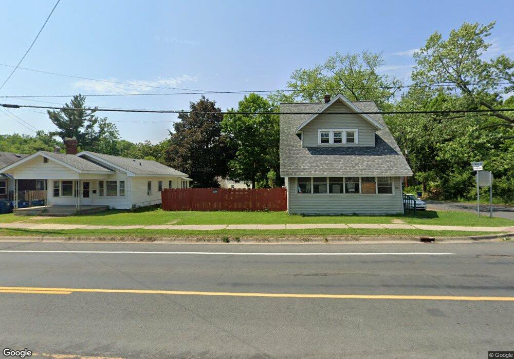
2121 E Main St Kalamazoo, MI 49048
Estimated Value: $205,000
2
Beds
1
Bath
720
Sq Ft
$285/Sq Ft
Est. Value
About This Home
This home is located at 2121 E Main St, Kalamazoo, MI 49048 and is currently priced at $205,000, approximately $284 per square foot. 2121 E Main St is a home located in Kalamazoo County with nearby schools including Northeastern Elementary School, Linden Grove Middle School, and Kalamazoo Central High School.
Ownership History
Date
Name
Owned For
Owner Type
Purchase Details
Closed on
Feb 25, 2014
Sold by
Kalamazoo County Land Bank Authority
Bought by
English James and English Angela
Current Estimated Value
Purchase Details
Closed on
Nov 19, 2012
Sold by
Balkema Mary
Bought by
Kalamazoo County Land Bank Authority
Purchase Details
Closed on
Jan 31, 2007
Sold by
Coleman David G and Coleman Ruth R
Bought by
Hixon Rodney P
Home Financials for this Owner
Home Financials are based on the most recent Mortgage that was taken out on this home.
Original Mortgage
$50,400
Interest Rate
6.23%
Mortgage Type
Purchase Money Mortgage
Purchase Details
Closed on
Aug 6, 2003
Sold by
Fifth Third Bank
Bought by
Coleman David G
Purchase Details
Closed on
Jul 2, 2003
Sold by
Coleman F Jean
Bought by
Fifth Third Bank
Create a Home Valuation Report for This Property
The Home Valuation Report is an in-depth analysis detailing your home's value as well as a comparison with similar homes in the area
Home Values in the Area
Average Home Value in this Area
Purchase History
| Date | Buyer | Sale Price | Title Company |
|---|---|---|---|
| English James | $500 | None Available | |
| Kalamazoo County Land Bank Authority | -- | None Available | |
| Hixon Rodney P | $56,000 | Chicago Title | |
| Coleman David G | -- | -- | |
| Fifth Third Bank | -- | -- | |
| Fifth Third Bank | -- | -- |
Source: Public Records
Mortgage History
| Date | Status | Borrower | Loan Amount |
|---|---|---|---|
| Previous Owner | Hixon Rodney P | $50,400 |
Source: Public Records
Tax History Compared to Growth
Tax History
| Year | Tax Paid | Tax Assessment Tax Assessment Total Assessment is a certain percentage of the fair market value that is determined by local assessors to be the total taxable value of land and additions on the property. | Land | Improvement |
|---|---|---|---|---|
| 2021 | $89 | $0 | $0 | $0 |
| 2020 | $89 | $2,100 | $0 | $0 |
| 2019 | $86 | $1,900 | $0 | $0 |
| 2018 | $84 | $1,900 | $0 | $0 |
| 2017 | $0 | $1,900 | $0 | $0 |
| 2016 | -- | $1,600 | $0 | $0 |
| 2015 | -- | $1,600 | $0 | $0 |
| 2014 | -- | $0 | $0 | $0 |
Source: Public Records
Map
Nearby Homes
- 914 Chicago Ave
- 905 Cooper Ave
- 1008 Cooper Ave
- 707 Fenimore Ave
- 1230 Wayside Rd
- 1722 Humphrey St
- 821 Trimble Ave
- 611 Fenimore Ave
- 553 Fenimore Ave
- 618 Southworth Terrace
- 616 Southworth Terrace
- 608 Southworth Terrace
- 612 Southworth Terrace
- 606 Southworth Terrace
- 1415 Nassau St
- 1520 Fairbanks Ct
- 925 Dayton Ave
- 2105 Gull Rd
- 1718 Henson Ave
- 407 Phelps Ave
- 2119 E Main St
- 2125 E Main St
- 2115 E Main St
- 2107 E Main St
- 1015 Chicago Ave
- 2109 E Main St Unit 210709
- 2203 E Main St
- 2126 E Main St
- 2120 E Main St
- 2114 E Main St
- 1024 Fenimore Ave
- 2117 Briar Place
- 933 Chicago Ave
- 2102 E Main St
- 2202 E Main St
- 1104 Chicago Ave
- 2113 Briar Place
- 2213 E Main St
- 2109 Briar Place
- 2213 B__1x Main St