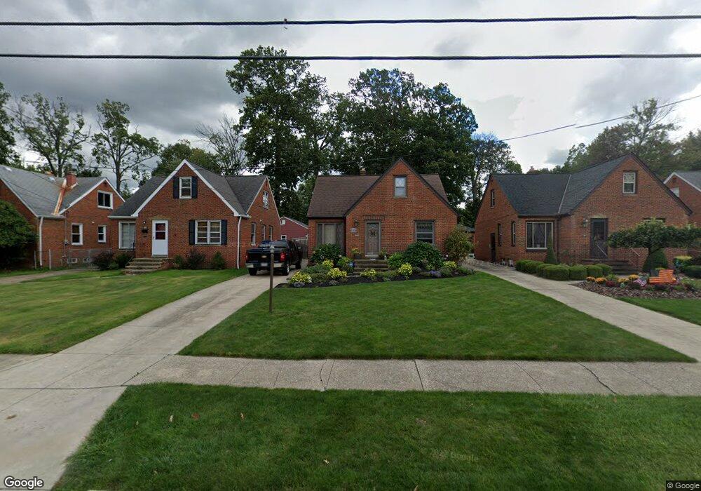
2121 Keystone Rd Cleveland, OH 44134
Estimated Value: $218,000 - $255,000
4
Beds
1
Bath
1,387
Sq Ft
$168/Sq Ft
Est. Value
About This Home
This home is located at 2121 Keystone Rd, Cleveland, OH 44134 and is currently estimated at $233,159, approximately $168 per square foot. 2121 Keystone Rd is a home located in Cuyahoga County with nearby schools including Shiloh Middle School, John Muir Elementary School, and Parma High School.
Ownership History
Date
Name
Owned For
Owner Type
Purchase Details
Closed on
Sep 17, 2002
Sold by
Francescangeli Aldo and Francescangeli Marilyn
Bought by
Modin Daniel H and Modin Lisa M
Current Estimated Value
Home Financials for this Owner
Home Financials are based on the most recent Mortgage that was taken out on this home.
Original Mortgage
$129,200
Outstanding Balance
$54,601
Interest Rate
6.4%
Mortgage Type
Purchase Money Mortgage
Estimated Equity
$178,558
Purchase Details
Closed on
Jan 1, 1975
Bought by
Francescangeli Aldo and Francescangeli M
Create a Home Valuation Report for This Property
The Home Valuation Report is an in-depth analysis detailing your home's value as well as a comparison with similar homes in the area
Home Values in the Area
Average Home Value in this Area
Purchase History
| Date | Buyer | Sale Price | Title Company |
|---|---|---|---|
| Modin Daniel H | $136,000 | Real Living Title Agency Ltd | |
| Francescangeli Aldo | -- | -- |
Source: Public Records
Mortgage History
| Date | Status | Borrower | Loan Amount |
|---|---|---|---|
| Open | Modin Daniel H | $129,200 |
Source: Public Records
Tax History Compared to Growth
Tax History
| Year | Tax Paid | Tax Assessment Tax Assessment Total Assessment is a certain percentage of the fair market value that is determined by local assessors to be the total taxable value of land and additions on the property. | Land | Improvement |
|---|---|---|---|---|
| 2024 | $3,854 | $63,840 | $13,055 | $50,785 |
| 2023 | $3,397 | $48,230 | $9,380 | $38,850 |
| 2022 | $3,366 | $48,230 | $9,380 | $38,850 |
| 2021 | $3,464 | $48,230 | $9,380 | $38,850 |
| 2020 | $3,211 | $39,550 | $7,700 | $31,850 |
| 2019 | $3,080 | $113,000 | $22,000 | $91,000 |
| 2018 | $3,099 | $39,550 | $7,700 | $31,850 |
| 2017 | $2,956 | $35,180 | $6,370 | $28,810 |
| 2016 | $2,939 | $35,180 | $6,370 | $28,810 |
| 2015 | $2,983 | $35,180 | $6,370 | $28,810 |
| 2014 | $2,983 | $37,840 | $6,860 | $30,980 |
Source: Public Records
Map
Nearby Homes
- 2010 Grantwood Dr
- 1872 Valewood Dr
- 5961 Broadview Rd
- 2821 Parklane Dr
- 5850 S Park Blvd
- 1414 Dartmoor Ave
- 1319 Dartmoor Ave
- 1417 Roanoke Dr
- 2901 Wales Ave
- 2922 Commonwealth Dr
- 100 E Decker Dr
- 1100 Winchester Dr
- 3226 Woodlawn Dr
- 2907 Liggett Dr
- 2811 Dellwood Dr
- 3205 George Ave
- 3314 Commonwealth Dr
- 3325 Commonwealth Dr
- 3408 Parklane Dr
- 3218 Somia Dr
- 2201 Keystone Rd
- 2117 Keystone Rd
- 2115 Keystone Rd
- 2209 Keystone Rd
- 2111 Keystone Rd
- 2211 Keystone Rd
- 2215 Keystone Rd
- 2105 Keystone Rd
- 2150 Keystone Rd
- 2116 Keystone Rd
- 2219 Keystone Rd
- 2122 Lorimer Dr
- 2130 Lorimer Dr
- 2118 Lorimer Dr
- 2202 Lorimer Dr
- 2025 Keystone Rd
- 2208 Keystone Rd
- 2114 Lorimer Dr
- 2206 Lorimer Dr
- 2223 Keystone Rd