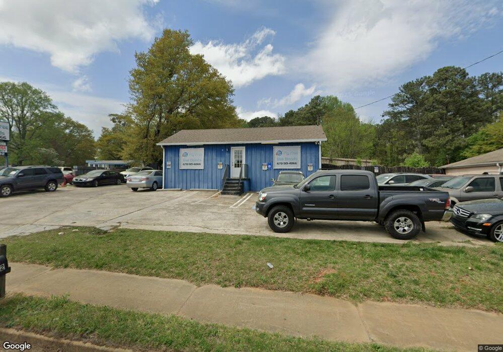
2122 Austell Rd SW Marietta, GA 30008
Southwestern Marietta NeighborhoodEstimated Value: $623,965
--
Bed
--
Bath
5,786
Sq Ft
$108/Sq Ft
Est. Value
About This Home
This home is located at 2122 Austell Rd SW, Marietta, GA 30008 and is currently estimated at $623,965, approximately $107 per square foot. 2122 Austell Rd SW is a home located in Cobb County with nearby schools including Milford Elementary School, Smitha Middle School, and Osborne High School.
Ownership History
Date
Name
Owned For
Owner Type
Purchase Details
Closed on
Feb 1, 2016
Sold by
Plott Robert Alan
Bought by
Olugbenga Kareem
Current Estimated Value
Home Financials for this Owner
Home Financials are based on the most recent Mortgage that was taken out on this home.
Original Mortgage
$200,000
Outstanding Balance
$85,277
Interest Rate
4.04%
Mortgage Type
Commercial
Estimated Equity
$538,688
Purchase Details
Closed on
Aug 25, 1997
Sold by
Parker Bart
Bought by
Plott Robert A
Create a Home Valuation Report for This Property
The Home Valuation Report is an in-depth analysis detailing your home's value as well as a comparison with similar homes in the area
Home Values in the Area
Average Home Value in this Area
Purchase History
| Date | Buyer | Sale Price | Title Company |
|---|---|---|---|
| Olugbenga Kareem | $250,000 | -- | |
| Plott Robert A | $150,000 | -- |
Source: Public Records
Mortgage History
| Date | Status | Borrower | Loan Amount |
|---|---|---|---|
| Open | Olugbenga Kareem | $200,000 |
Source: Public Records
Tax History Compared to Growth
Tax History
| Year | Tax Paid | Tax Assessment Tax Assessment Total Assessment is a certain percentage of the fair market value that is determined by local assessors to be the total taxable value of land and additions on the property. | Land | Improvement |
|---|---|---|---|---|
| 2025 | $4,114 | $136,548 | $60,228 | $76,320 |
| 2024 | $4,099 | $135,948 | $60,228 | $75,720 |
| 2023 | $3,600 | $119,412 | $52,372 | $67,040 |
| 2022 | $3,513 | $115,740 | $50,700 | $65,040 |
| 2021 | $3,346 | $110,260 | $50,700 | $59,560 |
| 2020 | $2,909 | $95,848 | $44,088 | $51,760 |
| 2019 | $2,820 | $92,928 | $44,088 | $48,840 |
| 2018 | $2,820 | $92,928 | $44,088 | $48,840 |
| 2017 | $2,672 | $92,928 | $44,088 | $48,840 |
| 2016 | $1,781 | $61,944 | $34,840 | $27,104 |
| 2015 | $1,825 | $61,944 | $34,840 | $27,104 |
Source: Public Records
Map
Nearby Homes
- 725 S Fork Dr SW
- 2036 Favor Rd SW
- 737 Scott Ln SW
- 1706 Cunningham Rd SW
- 2354 Holly Hill Ct SW
- 152 Summer Lake Dr SW
- 166 Zelma St SW
- 641 Favorwood Dr SW
- 1615 Arden Dr SW
- 1651 Massachusetts Ave SW Unit 1
- 1809 Austell Rd SW
- 891 Scott Ln SW
- 1665 Cunningham Rd SW
- 691 Crosswinds Cir
- 2245 Panstone Dr SW
- 2604 Favor Rd SW
- 583 Crosswinds Cir
- 744 Evelyn Ln
- 2122 Austell Rd SW Unit 2122
- 2110 Austell Rd SW Unit 2110
- 2110 Austell Rd SW
- 2128 Austell Rd SW
- 608 Chamberlain Cir SW
- 2108 Austell Rd SW
- 610 Chamberlain Cir SW
- 601 Chamberlain Cir SW
- 622 Chamberlain Cir SW
- 2096 Austell Rd SW Unit 3
- 613 Chamberlain Cir SW
- 2143 Austell Rd SW
- 625 Chamberlain Cir SW
- 632 Chamberlain Cir SW
- 2158 Austell Rd SW
- 0 Chamberlain Cir SW Unit 7260940
- 0 Chamberlain Cir SW Unit 7169788
- 0 Chamberlain Cir SW Unit 3226884
- 0 Chamberlain Cir SW Unit 8736393
- 0 Chamberlain Cir SW Unit 8272233