
Seller's Agent in 2025
Timothy Odey
KW 1Advantage
(563) 570-2749
5 in this area
127 Total Sales

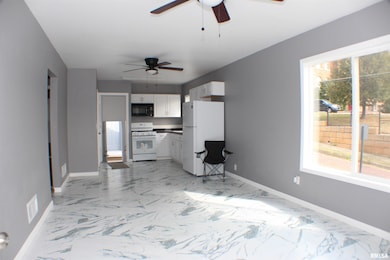
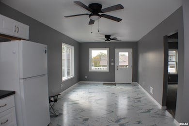
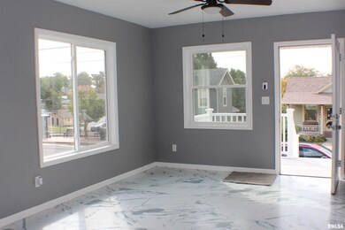
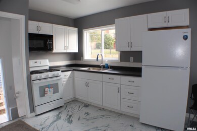
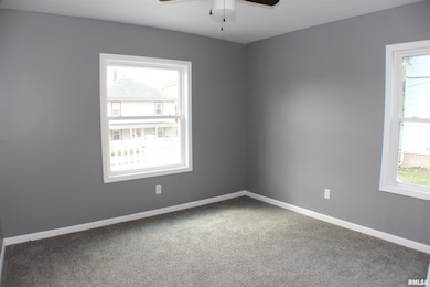
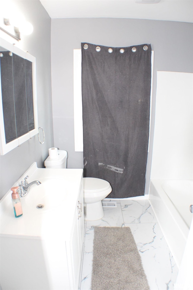
Almost everything is New New New. Windows, roof, flooring, siding, Kitchen, Paint, and much much more. This home would be great for someone who wants to downsize or just starting out. Located just at the Top of the Village of East Davenport, You will be close to dining, entertainment, shopping and easy access to almost anywhere in the QCA. The garage is super sized and has room for cars and possible a workshop if you wish. This home is ready to just move right in and enjoy. Dont delay, come see it today.
Last Agent to Sell the Property
KW 1Advantage Brokerage Phone: 563-570-2749 License #S33406000/475.136128 Listed on: 09/19/2025
| Date | Type | Sale Price | Title Company |
|---|---|---|---|
| Quit Claim Deed | $1,000 | None Listed On Document | |
| Legal Action Court Order | $110,000 | Chicago Title |
| Date | Status | Loan Amount | Loan Type |
|---|---|---|---|
| Previous Owner | $92,000 | New Conventional |
| Date | Event | Price | List to Sale | Price per Sq Ft |
|---|---|---|---|---|
| 11/17/2025 11/17/25 | Sold | $179,900 | 0.0% | $234 / Sq Ft |
| 10/06/2025 10/06/25 | Pending | -- | -- | -- |
| 09/19/2025 09/19/25 | For Sale | $179,900 | -- | $234 / Sq Ft |
| Year | Tax Paid | Tax Assessment Tax Assessment Total Assessment is a certain percentage of the fair market value that is determined by local assessors to be the total taxable value of land and additions on the property. | Land | Improvement |
|---|---|---|---|---|
| 2025 | $1,008 | $66,480 | $12,460 | $54,020 |
| 2024 | $1,561 | $56,350 | $12,460 | $43,890 |
| 2023 | $2,353 | $56,350 | $12,460 | $43,890 |
| 2022 | $2,792 | $69,240 | $7,480 | $61,760 |
| 2021 | $1,486 | $69,240 | $7,480 | $61,760 |
| 2020 | $1,542 | $69,240 | $7,480 | $61,760 |
| 2019 | $1,256 | $63,620 | $7,480 | $56,140 |
| 2018 | $1,070 | $63,620 | $7,480 | $56,140 |
| 2017 | $1,116 | $60,810 | $7,480 | $53,330 |
| 2016 | $1,068 | $60,810 | $0 | $0 |
| 2015 | $1,068 | $55,160 | $0 | $0 |
| 2014 | $958 | $55,160 | $0 | $0 |
| 2013 | $936 | $0 | $0 | $0 |
| 2012 | -- | $51,160 | $6,510 | $44,650 |
Seller's Agent in 2025
Timothy Odey
KW 1Advantage
(563) 570-2749
5 in this area
127 Total Sales
Buyer's Agent in 2025
Deb Haussmann
KW 1Advantage
(563) 343-4747
3 in this area
152 Total Sales
Source: RMLS Alliance
MLS Number: QC4267553
APN: E0030-10
Disclaimer: Certain information contained herein is derived from information provided by parties other than Homes.com. All information provided is deemed reliable, but is not guaranteed to be accurate and should be independently verified.
![]() IDX information is provided exclusively for personal, non-commercial use, and may not be used for any purpose other than to identify prospective properties consumers may be interested in purchasing. Information is deemed reliable but not guaranteed.
IDX information is provided exclusively for personal, non-commercial use, and may not be used for any purpose other than to identify prospective properties consumers may be interested in purchasing. Information is deemed reliable but not guaranteed.