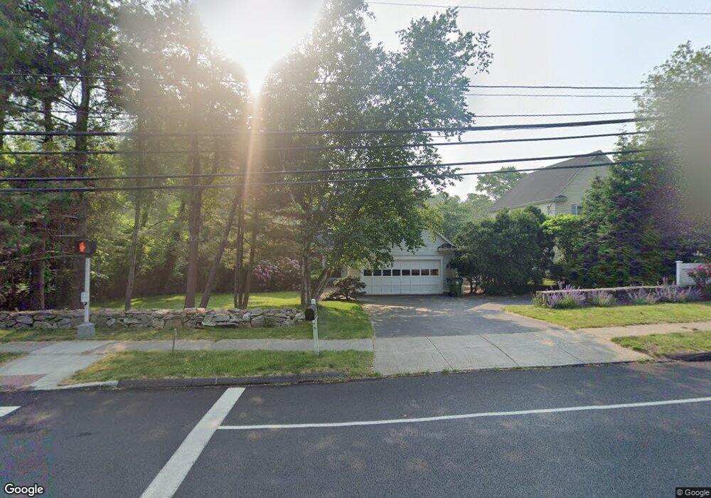
2122 N Benson Rd Fairfield, CT 06824
University NeighborhoodEstimated Value: $1,087,000 - $1,282,000
4
Beds
3
Baths
2,164
Sq Ft
$549/Sq Ft
Est. Value
About This Home
This home is located at 2122 N Benson Rd, Fairfield, CT 06824 and is currently estimated at $1,188,072, approximately $549 per square foot. 2122 N Benson Rd is a home located in Fairfield County with nearby schools including Osborn Hill Elementary School, Fairfield Woods Middle School, and Fairfield Ludlowe High School.
Ownership History
Date
Name
Owned For
Owner Type
Purchase Details
Closed on
Sep 4, 1998
Sold by
Volpacchio Gino and Volpacchio Patricia M
Bought by
Cicvara Lillian and Cicvara Predrag
Current Estimated Value
Purchase Details
Closed on
Oct 23, 1987
Sold by
Munson Builders Inc
Bought by
Volpacchio Gino
Create a Home Valuation Report for This Property
The Home Valuation Report is an in-depth analysis detailing your home's value as well as a comparison with similar homes in the area
Home Values in the Area
Average Home Value in this Area
Purchase History
| Date | Buyer | Sale Price | Title Company |
|---|---|---|---|
| Cicvara Lillian | $419,000 | -- | |
| Cicvara Lillian | $419,000 | -- | |
| Volpacchio Gino | $399,900 | -- |
Source: Public Records
Mortgage History
| Date | Status | Borrower | Loan Amount |
|---|---|---|---|
| Open | Volpacchio Gino | $390,000 | |
| Closed | Volpacchio Gino | $416,500 |
Source: Public Records
Tax History Compared to Growth
Tax History
| Year | Tax Paid | Tax Assessment Tax Assessment Total Assessment is a certain percentage of the fair market value that is determined by local assessors to be the total taxable value of land and additions on the property. | Land | Improvement |
|---|---|---|---|---|
| 2025 | $13,039 | $459,270 | $276,430 | $182,840 |
| 2024 | $12,814 | $459,270 | $276,430 | $182,840 |
| 2023 | $12,635 | $459,270 | $276,430 | $182,840 |
| 2022 | $12,511 | $459,270 | $276,430 | $182,840 |
| 2021 | $12,391 | $459,270 | $276,430 | $182,840 |
| 2020 | $10,804 | $403,270 | $206,990 | $196,280 |
| 2019 | $10,804 | $403,270 | $206,990 | $196,280 |
| 2018 | $10,630 | $403,270 | $206,990 | $196,280 |
| 2017 | $10,412 | $403,270 | $206,990 | $196,280 |
| 2016 | $10,263 | $403,270 | $206,990 | $196,280 |
| 2015 | $10,386 | $418,950 | $217,840 | $201,110 |
| 2014 | $10,222 | $418,950 | $217,840 | $201,110 |
Source: Public Records
Map
Nearby Homes
- 2107 N Benson Rd
- 1137 Stillson Rd
- 1165 Stillson Rd
- 1207 Stillson Rd
- 115 Mayfair Rd
- 359 Reid St
- 79 Mayfair Rd
- 706 Judd St
- 210 Pansy Rd
- 338 Orchard Hill Ln
- 45 Robin Cir
- 28 Stillson Place
- 25 Millspaugh Dr
- 41 Pepperbush Ln
- 33 Middlebrook Place
- 66 Adams Rd
- 68 Figlar Ave
- 180 Oakwood Dr
- 25 Country Rd
- 109 Jeniford Rd
- 2100 N Benson Rd
- 939 Stillson Rd
- 2082 N Benson Rd
- 979 Stillson Rd
- 2062 N Benson Rd
- 919 Stillson Rd
- 2160 N Benson Rd
- 934 Stillson Rd
- 20 Thornhill Rd
- 903 Stillson Rd
- 2032 N Benson Rd
- 2182 N Benson Rd
- 1031 Stillson Rd
- 75 Allen Rd
- 891 Stillson Rd
- 22 Penny Ln
- 892 Stillson Rd
- 39 Allen Rd
- 25 Thornhill Rd
- 2190 N Benson Rd