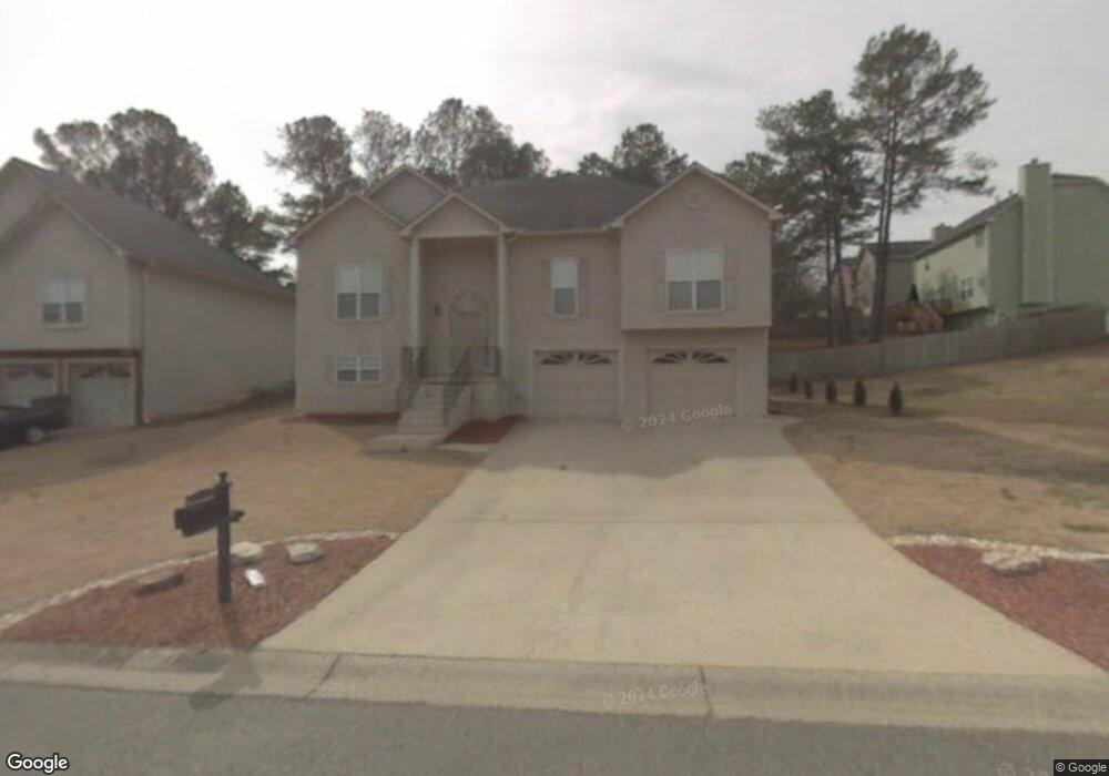
2122 Samantha Way SW Unit II Marietta, GA 30008
Southwestern Marietta NeighborhoodEstimated Value: $339,710 - $390,000
4
Beds
3
Baths
1,792
Sq Ft
$201/Sq Ft
Est. Value
About This Home
This home is located at 2122 Samantha Way SW Unit II, Marietta, GA 30008 and is currently estimated at $359,428, approximately $200 per square foot. 2122 Samantha Way SW Unit II is a home located in Cobb County with nearby schools including Dowell Elementary School, Smitha Middle School, and Osborne High School.
Ownership History
Date
Name
Owned For
Owner Type
Purchase Details
Closed on
Aug 14, 2024
Sold by
Sims Herbert A
Bought by
Sims Allison R and Sims Herbert Allen
Current Estimated Value
Purchase Details
Closed on
Oct 23, 2002
Sold by
Sims Allison R
Bought by
Sims Allison R and Sims Herbert A
Home Financials for this Owner
Home Financials are based on the most recent Mortgage that was taken out on this home.
Original Mortgage
$175,550
Interest Rate
6.07%
Mortgage Type
FHA
Purchase Details
Closed on
Jul 22, 1997
Sold by
W Mark Ellis Co
Bought by
Linton Joseph
Home Financials for this Owner
Home Financials are based on the most recent Mortgage that was taken out on this home.
Original Mortgage
$145,850
Interest Rate
7.61%
Mortgage Type
VA
Create a Home Valuation Report for This Property
The Home Valuation Report is an in-depth analysis detailing your home's value as well as a comparison with similar homes in the area
Home Values in the Area
Average Home Value in this Area
Purchase History
| Date | Buyer | Sale Price | Title Company |
|---|---|---|---|
| Sims Allison R | -- | None Listed On Document | |
| Sims Allison R | -- | -- | |
| Sims Allison R | $177,000 | -- | |
| Linton Joseph | $141,700 | -- |
Source: Public Records
Mortgage History
| Date | Status | Borrower | Loan Amount |
|---|---|---|---|
| Previous Owner | Sims Allison R | $175,550 | |
| Previous Owner | Linton Joseph | $145,850 |
Source: Public Records
Tax History Compared to Growth
Tax History
| Year | Tax Paid | Tax Assessment Tax Assessment Total Assessment is a certain percentage of the fair market value that is determined by local assessors to be the total taxable value of land and additions on the property. | Land | Improvement |
|---|---|---|---|---|
| 2025 | $3,341 | $138,552 | $32,000 | $106,552 |
| 2024 | $3,344 | $138,552 | $32,000 | $106,552 |
| 2023 | $2,395 | $119,820 | $16,000 | $103,820 |
| 2022 | $2,363 | $92,584 | $9,600 | $82,984 |
| 2021 | $2,363 | $92,584 | $9,600 | $82,984 |
| 2020 | $2,202 | $85,196 | $9,600 | $75,596 |
| 2019 | $2,202 | $85,196 | $9,600 | $75,596 |
| 2018 | $1,987 | $75,384 | $9,600 | $65,784 |
| 2017 | $1,889 | $75,384 | $9,600 | $65,784 |
| 2016 | $1,752 | $69,832 | $9,600 | $60,232 |
| 2015 | $1,528 | $60,712 | $12,300 | $48,412 |
| 2014 | $1,541 | $60,712 | $0 | $0 |
Source: Public Records
Map
Nearby Homes
- 1697 Dyeson Rd SW
- 1467 Glynn Oaks Cir SW
- 2268 Grove Valley Way Unit 9
- 2389 Jack Creek Rd SW
- 2001 MacLand Square Dr Unit 11
- 2002 MacLand Square Dr Unit 1
- 1952 Freestone Way
- 1946 MacLand Rd SW
- 2379 Moseley Place SW
- 2050 Heritage Green Dr
- Monteluce Plan at Freestone Station
- Hillside Plan at Freestone Station
- Oakshire Plan at Freestone Station
- Hendricks Plan at Freestone Station
- Hedgerow Plan at Freestone Station
- Antioch Plan at Freestone Station
- 2121 Cumberland Creek Trail SW
- 1951 Bergerac Ct SW
- 2124 Samantha Way SW Unit 2
- 1641 Samantha Place SW
- 0 Samantha Way South W
- 1643 Samantha Place SW
- 2155 Brandon Lee Dr SW
- 2125 Samantha Way SW
- 2126 Samantha Way SW Unit 11
- 2123 Samantha Way SW
- 1645 Samantha Place SW Unit 1
- 0 Samantha Place Unit 7638303
- 0 Samantha Place Unit 7538695
- 0 Samantha Place Unit 7436573
- 0 Samantha Place
- 1637 Samantha Place SW
- 2128 Samantha Way SW Unit GA1321
- 2128 Samantha Way SW Unit 2
- 2128 Samantha Way SW Unit GA13214
- 2127 Samantha Way SW Unit 2
- 2159 Brandon Lee Dr SW Unit 1
- 1635 Samantha Place SW Unit 2