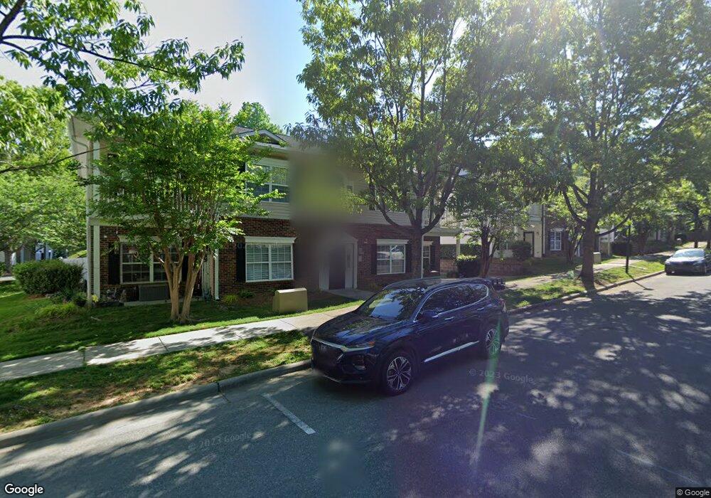
21221 Hickory St Unit 3A Cornelius, NC 28031
Estimated Value: $255,000 - $309,000
2
Beds
2
Baths
1,180
Sq Ft
$232/Sq Ft
Est. Value
About This Home
This home is located at 21221 Hickory St Unit 3A, Cornelius, NC 28031 and is currently estimated at $274,264, approximately $232 per square foot. 21221 Hickory St Unit 3A is a home located in Mecklenburg County with nearby schools including Cornelius Elementary School, Bailey Middle School, and William Amos Hough High School.
Ownership History
Date
Name
Owned For
Owner Type
Purchase Details
Closed on
Aug 16, 2007
Sold by
Carter Sherry A
Bought by
Keller Misty
Current Estimated Value
Home Financials for this Owner
Home Financials are based on the most recent Mortgage that was taken out on this home.
Original Mortgage
$121,591
Outstanding Balance
$76,591
Interest Rate
6.56%
Mortgage Type
FHA
Estimated Equity
$197,673
Purchase Details
Closed on
Jul 18, 2002
Sold by
Mill Creek Cornelius Llc
Bought by
Carter Sherry A
Home Financials for this Owner
Home Financials are based on the most recent Mortgage that was taken out on this home.
Original Mortgage
$100,255
Interest Rate
6.67%
Mortgage Type
FHA
Create a Home Valuation Report for This Property
The Home Valuation Report is an in-depth analysis detailing your home's value as well as a comparison with similar homes in the area
Home Values in the Area
Average Home Value in this Area
Purchase History
| Date | Buyer | Sale Price | Title Company |
|---|---|---|---|
| Keller Misty | $123,500 | Statewide Title Inc | |
| Carter Sherry A | $103,000 | -- |
Source: Public Records
Mortgage History
| Date | Status | Borrower | Loan Amount |
|---|---|---|---|
| Open | Keller Misty | $121,591 | |
| Previous Owner | Carter Sherry A | $100,255 |
Source: Public Records
Tax History Compared to Growth
Tax History
| Year | Tax Paid | Tax Assessment Tax Assessment Total Assessment is a certain percentage of the fair market value that is determined by local assessors to be the total taxable value of land and additions on the property. | Land | Improvement |
|---|---|---|---|---|
| 2025 | $1,360 | $199,763 | -- | $199,763 |
| 2024 | $1,360 | $199,763 | -- | $199,763 |
| 2023 | $1,335 | $199,763 | $0 | $199,763 |
| 2022 | $1,043 | $118,200 | $0 | $118,200 |
| 2021 | $1,031 | $118,200 | $0 | $118,200 |
| 2020 | $1,031 | $118,200 | $0 | $118,200 |
| 2019 | $1,025 | $118,200 | $0 | $118,200 |
| 2018 | $1,133 | $102,500 | $22,400 | $80,100 |
| 2017 | $1,121 | $102,500 | $22,400 | $80,100 |
| 2016 | $1,118 | $102,500 | $22,400 | $80,100 |
| 2015 | $1,099 | $102,500 | $22,400 | $80,100 |
| 2014 | $1,097 | $102,500 | $22,400 | $80,100 |
Source: Public Records
Map
Nearby Homes
- 21252 Hickory St
- 21724 Aftonshire Dr
- 19808 Feriba Place Unit C
- 19623 Oak St
- 19631 Oak St
- 19512 Meridian St
- Lot 9 Meridian St Unit 9
- The Bordeaux Plan at School Street at Catawba
- The Merlot Plan at School Street at Catawba
- 19732 School St
- 19724 School St
- 21108 Townwood Dr
- 10606 Danesway Ln
- 19603 Whilehaven Ct
- 10415 Danesway Ln
- 10701 Washam Potts Rd
- 21223 Pine St
- 20232 Zion Ave
- 19924 Floral Ln
- 964 Gardners Way
- 21217 Hickory St
- 21219 Hickory St
- 21223 Hickory St Unit B
- 21223 Hickory St Unit 3B
- 21644 Aftonshire Dr Unit B
- 21646 Aftonshire Dr Unit 2A
- 21642 Aftonshire Dr Unit 2C
- 21640 Aftonshire Dr Unit 2D
- 21710 Aftonshire Dr Unit B
- 21710 Aftonshire Dr Unit 1B
- 21233 Hickory St Unit 4A
- 21229 Hickory St Unit 4C
- 21152 Feriba Place
- 21706 Aftonshire Dr
- 21712 Aftonshire Dr Unit 1A
- 21712 Aftonshire Dr Unit A
- 21235 Hickory St
- 21231 Hickory St
- 21231 Hickory St Unit D
- 21708 Aftonshire Dr Unit 1C