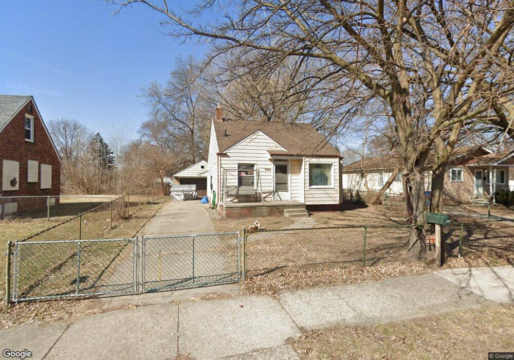
21223 Behrendt Ave Warren, MI 48091
Southwest Warren NeighborhoodEstimated Value: $120,000 - $156,000
3
Beds
2
Baths
911
Sq Ft
$148/Sq Ft
Est. Value
About This Home
This home is located at 21223 Behrendt Ave, Warren, MI 48091 and is currently estimated at $134,821, approximately $147 per square foot. 21223 Behrendt Ave is a home located in Macomb County with nearby schools including Mound Park Elementary School, Schofield Elementary School, and Westview Elementary School.
Ownership History
Date
Name
Owned For
Owner Type
Purchase Details
Closed on
Oct 28, 2022
Sold by
Giannini Franklin D and Giannini Norma J
Bought by
Giannini Norma J and Giannini Franklin D
Current Estimated Value
Purchase Details
Closed on
Oct 29, 2018
Sold by
Giannini Franklin and Giannini Betty
Bought by
Giannini Betty and Giannini Nonna
Purchase Details
Closed on
Jun 11, 2002
Sold by
Sir Realty Inc
Bought by
Giannini Franklin
Home Financials for this Owner
Home Financials are based on the most recent Mortgage that was taken out on this home.
Original Mortgage
$78,250
Interest Rate
6.7%
Mortgage Type
Purchase Money Mortgage
Create a Home Valuation Report for This Property
The Home Valuation Report is an in-depth analysis detailing your home's value as well as a comparison with similar homes in the area
Home Values in the Area
Average Home Value in this Area
Purchase History
| Date | Buyer | Sale Price | Title Company |
|---|---|---|---|
| Giannini Norma J | -- | None Listed On Document | |
| Giannini Betty | -- | None Available | |
| Giannini Franklin | $82,400 | -- |
Source: Public Records
Mortgage History
| Date | Status | Borrower | Loan Amount |
|---|---|---|---|
| Previous Owner | Giannini Franklin | $78,250 |
Source: Public Records
Tax History Compared to Growth
Tax History
| Year | Tax Paid | Tax Assessment Tax Assessment Total Assessment is a certain percentage of the fair market value that is determined by local assessors to be the total taxable value of land and additions on the property. | Land | Improvement |
|---|---|---|---|---|
| 2025 | $1,273 | $55,510 | $0 | $0 |
| 2024 | $1,239 | $53,140 | $0 | $0 |
| 2023 | $1,172 | $38,900 | $0 | $0 |
| 2022 | $1,107 | $33,180 | $0 | $0 |
| 2021 | $1,150 | $31,290 | $0 | $0 |
| 2020 | $1,100 | $29,420 | $0 | $0 |
| 2019 | $1,034 | $24,860 | $0 | $0 |
| 2018 | $0 | $19,600 | $0 | $0 |
| 2017 | $1,181 | $19,170 | $2,720 | $16,450 |
| 2016 | $1,629 | $19,170 | $0 | $0 |
| 2015 | -- | $18,730 | $0 | $0 |
| 2013 | $1,372 | $15,950 | $0 | $0 |
Source: Public Records
Map
Nearby Homes
- 21044 Sunset Ave
- 21299 Sunset Ave
- 3776 Wasmund Ave
- 20731 Bartholomaei Ave
- 21222 Audrey Ave
- 3925 Toepfer Rd
- 20499 Binder St
- 3701 Berkshire Ave
- 3641 Berkshire Ave
- 20270 Dean Ave
- 20818 Atlantic Ave
- 21139 Curie Ave
- 20760 Atlantic Ave
- 20499 Yonka St
- 20246 Binder St
- 3850 Jarvis Ave
- 21106 Curie Ave
- 20201 Dean St
- 3463 Poplar Ave
- 22367 Le Fever Ave
- 21241 Behrendt Ave
- 21195 Behrendt Ave
- 21269 Behrendt Ave
- 21175 Behrendt Ave
- 21232 Behrendt Ave
- 21196 Behrendt Ave
- 21148 Sunset Ave
- 21160 Sunset Ave
- 21307 Behrendt Ave
- 21276 Behrendt Ave
- 21120 Sunset Ave
- 21200 Sunset Ave
- 21176 Behrendt Ave
- 21088 Sunset Ave
- 21294 Behrendt Ave
- 21123 Behrendt Ave
- 21244 Sunset Ave
- 21325 Behrendt Ave
- 21310 Behrendt Ave
- 21156 Behrendt Ave