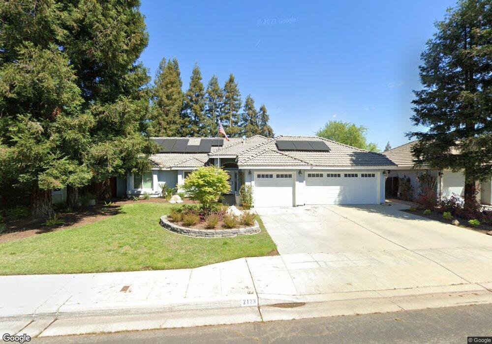
2123 Cromwell Ave Clovis, CA 93611
Estimated Value: $496,819 - $557,000
3
Beds
3
Baths
1,730
Sq Ft
$301/Sq Ft
Est. Value
About This Home
This home is located at 2123 Cromwell Ave, Clovis, CA 93611 and is currently estimated at $520,955, approximately $301 per square foot. 2123 Cromwell Ave is a home located in Fresno County with nearby schools including Dry Creek Elementary School, Alta Sierra Intermediate School, and Buchanan High School.
Ownership History
Date
Name
Owned For
Owner Type
Purchase Details
Closed on
Jan 17, 2024
Sold by
Morehead Scott and Morehead Brittany
Bought by
Morehead Family Trust and Morehead
Current Estimated Value
Purchase Details
Closed on
Jun 7, 2021
Sold by
Morehead Scott A
Bought by
Morehead Brittany L and Morehead Scott A
Home Financials for this Owner
Home Financials are based on the most recent Mortgage that was taken out on this home.
Original Mortgage
$213,000
Interest Rate
2.99%
Purchase Details
Closed on
May 28, 2021
Sold by
Morehead Scott Adam and Morehead Scott
Bought by
Morehead Scott Adam and Morehead Brittany Leanne
Home Financials for this Owner
Home Financials are based on the most recent Mortgage that was taken out on this home.
Original Mortgage
$213,000
Interest Rate
2.99%
Purchase Details
Closed on
Apr 18, 2016
Sold by
Morehead Brittany
Bought by
Morehead Scott
Home Financials for this Owner
Home Financials are based on the most recent Mortgage that was taken out on this home.
Original Mortgage
$228,000
Interest Rate
3.68%
Mortgage Type
New Conventional
Purchase Details
Closed on
Mar 25, 2016
Sold by
Surviving Jackie E
Bought by
Morehead Scott
Home Financials for this Owner
Home Financials are based on the most recent Mortgage that was taken out on this home.
Original Mortgage
$228,000
Interest Rate
3.68%
Mortgage Type
New Conventional
Purchase Details
Closed on
Nov 28, 2005
Sold by
Hullum Jackie E and Hullum Jo Ann
Bought by
Hullum Jackie E and Hullum Jo Ann
Home Financials for this Owner
Home Financials are based on the most recent Mortgage that was taken out on this home.
Original Mortgage
$89,325
Interest Rate
6.07%
Mortgage Type
New Conventional
Purchase Details
Closed on
Feb 7, 1994
Sold by
N T Hill Inc Co
Bought by
Hullum Jack E and Hullum Jo Ann
Home Financials for this Owner
Home Financials are based on the most recent Mortgage that was taken out on this home.
Original Mortgage
$58,900
Interest Rate
7.24%
Create a Home Valuation Report for This Property
The Home Valuation Report is an in-depth analysis detailing your home's value as well as a comparison with similar homes in the area
Home Values in the Area
Average Home Value in this Area
Purchase History
| Date | Buyer | Sale Price | Title Company |
|---|---|---|---|
| Morehead Family Trust | -- | None Listed On Document | |
| Morehead Brittany L | -- | -- | |
| Morehead Scott Adam | -- | Placer Title Company | |
| Morehead Scott | -- | Old Republic Title Company | |
| Morehead Scott | $285,000 | Old Republic Title Company | |
| Hullum Jackie E | -- | Chicago Title Company | |
| Hullum Jack E | $145,500 | Central Title Company |
Source: Public Records
Mortgage History
| Date | Status | Borrower | Loan Amount |
|---|---|---|---|
| Previous Owner | Morehead Brittany L | $213,000 | |
| Previous Owner | Morehead Brittany L | -- | |
| Previous Owner | Morehead Scott Adam | $213,000 | |
| Previous Owner | Morehead Scott | $228,000 | |
| Previous Owner | Hullum Jackie E | $89,325 | |
| Previous Owner | Hullum Jack E | $58,900 |
Source: Public Records
Tax History
| Year | Tax Paid | Tax Assessment Tax Assessment Total Assessment is a certain percentage of the fair market value that is determined by local assessors to be the total taxable value of land and additions on the property. | Land | Improvement |
|---|---|---|---|---|
| 2025 | $4,150 | $337,376 | $118,377 | $218,999 |
| 2023 | $3,984 | $324,277 | $113,781 | $210,496 |
| 2022 | $3,933 | $317,919 | $111,550 | $206,369 |
| 2021 | $3,806 | $311,686 | $109,363 | $202,323 |
| 2020 | $3,792 | $308,491 | $108,242 | $200,249 |
| 2019 | $3,721 | $302,443 | $106,120 | $196,323 |
| 2018 | $3,643 | $296,514 | $104,040 | $192,474 |
| 2017 | $3,583 | $290,700 | $102,000 | $188,700 |
| 2016 | $2,494 | $208,456 | $64,599 | $143,857 |
| 2015 | $2,443 | $205,326 | $63,629 | $141,697 |
| 2014 | $2,398 | $201,305 | $62,383 | $138,922 |
Source: Public Records
Map
Nearby Homes
- 878 N Ash Ave
- 971 N Filbert Ave
- 2117 Goshen Ave
- 1977 Goshen Ave
- 2361 Cromwell Ave
- 8220 N Fowler Ave
- 2089 Boccioni Ln
- 367 N Raphael Ln Unit 367
- 338 N Filbert Ave
- 2670 Muncie Ave
- 1490 Fir Ave
- 2770 Muncie Ave
- 2643 Quincy Ave
- 2051 Los Altos Ave
- 1323 Oak Ave
- 1736 N Holly Ave
- 1303 Jordan Ave
- 2047 Menlo Ave
- 1124 Oak Ave
- 1 Ave
- 2133 Cromwell Ave
- 2113 Cromwell Ave
- 2122 Decatur Ave
- 2132 Decatur Ave
- 2112 Decatur Ave
- 2143 Cromwell Ave
- 2093 Cromwell Ave
- 2124 Cromwell Ave
- 2114 Cromwell Ave
- 2142 Decatur Ave
- 2092 Decatur Ave
- 2134 Cromwell Ave
- 2094 Cromwell Ave
- 2163 Cromwell Ave
- 2083 Cromwell Ave
- 2144 Cromwell Ave
- 2082 Decatur Ave
- 2084 Cromwell Ave
- 2121 Decatur Ave
- 2125 Bedford Ave
Your Personal Tour Guide
Ask me questions while you tour the home.