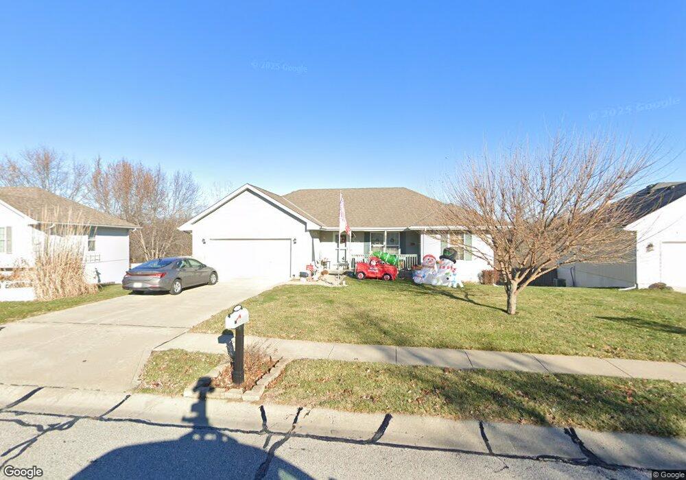
2123 Glenside Rd Kearney, MO 64060
Estimated Value: $295,000 - $318,000
3
Beds
2
Baths
1,212
Sq Ft
$252/Sq Ft
Est. Value
About This Home
This home is located at 2123 Glenside Rd, Kearney, MO 64060 and is currently estimated at $305,005, approximately $251 per square foot. 2123 Glenside Rd is a home located in Clay County with nearby schools including Kearney Junior High School and Kearney High School.
Ownership History
Date
Name
Owned For
Owner Type
Purchase Details
Closed on
Oct 31, 2003
Sold by
Barr Gerald D and Hardesty Medford
Bought by
Barr Julianne K and Pogue Verl Lee
Current Estimated Value
Home Financials for this Owner
Home Financials are based on the most recent Mortgage that was taken out on this home.
Original Mortgage
$136,675
Outstanding Balance
$63,363
Interest Rate
6%
Mortgage Type
Seller Take Back
Estimated Equity
$241,642
Purchase Details
Closed on
Oct 23, 2000
Sold by
Aartech Investments Inc
Bought by
Barr Gerald D and Hardesty Medford
Create a Home Valuation Report for This Property
The Home Valuation Report is an in-depth analysis detailing your home's value as well as a comparison with similar homes in the area
Home Values in the Area
Average Home Value in this Area
Purchase History
| Date | Buyer | Sale Price | Title Company |
|---|---|---|---|
| Barr Julianne K | -- | Thomson Title Corporation | |
| Barr Gerald D | -- | Thomson Title Corporation |
Source: Public Records
Mortgage History
| Date | Status | Borrower | Loan Amount |
|---|---|---|---|
| Open | Barr Julianne K | $136,675 |
Source: Public Records
Tax History
| Year | Tax Paid | Tax Assessment Tax Assessment Total Assessment is a certain percentage of the fair market value that is determined by local assessors to be the total taxable value of land and additions on the property. | Land | Improvement |
|---|---|---|---|---|
| 2025 | $2,490 | $41,530 | -- | -- |
| 2024 | $2,490 | $36,330 | -- | -- |
| 2023 | $2,481 | $36,330 | $0 | $0 |
| 2022 | $2,256 | $31,940 | $0 | $0 |
| 2021 | $2,211 | $31,939 | $5,130 | $26,809 |
| 2020 | $2,242 | $29,450 | $0 | $0 |
| 2019 | $2,230 | $29,450 | $0 | $0 |
| 2018 | $2,085 | $26,600 | $0 | $0 |
| 2017 | $2,087 | $26,600 | $3,800 | $22,800 |
| 2016 | $1,953 | $25,180 | $4,180 | $21,000 |
| 2015 | $1,953 | $25,180 | $4,180 | $21,000 |
| 2014 | $1,963 | $25,180 | $4,180 | $21,000 |
Source: Public Records
Map
Nearby Homes
- 2118 Glenside Rd
- 204 E 22nd St
- 200 E 20th Terrace
- 2371 Prairie Creek Dr
- 2367 Prairie Creek Dr
- 1933 Meadowlane
- 111 Dogwood Ln
- 2211 Prairie Creek Dr
- 107 Dogwood Ln
- 2119 Greenfield Point
- 2123 Greenfield Point
- 2121 Greenfield Point
- 2357 Prairie Creek Dr
- 1505 Emerald Cir
- 2001 Foxtail Point
- 217 Old Trail Run
- 2341 Fishing Ln
- 2002 Foxtail Point
- 1845 Falcon Ct
- 318 Old Trail Run N A
- 2121 Glenside Rd
- 2201 Glenside Rd
- 2119 Glenside Rd
- 2203 Glenside Rd
- 2122 Glenside Rd
- 2205 Glenside Rd
- 2117 Glenside Rd
- 2120 Glenside Rd
- 2200 Glenside Rd
- 2207 Glenside Rd
- 2115 Glenside Rd
- 2202 Glenside Rd
- 408 E 22nd St
- 2116 Glenside Rd
- 413 Brookside Cir
- 411 Brookside Cir
- 409 E 22nd St
- 2209 Glenside Rd
- 2113 Glenside Rd
- 2204 Glenside Rd
Your Personal Tour Guide
Ask me questions while you tour the home.