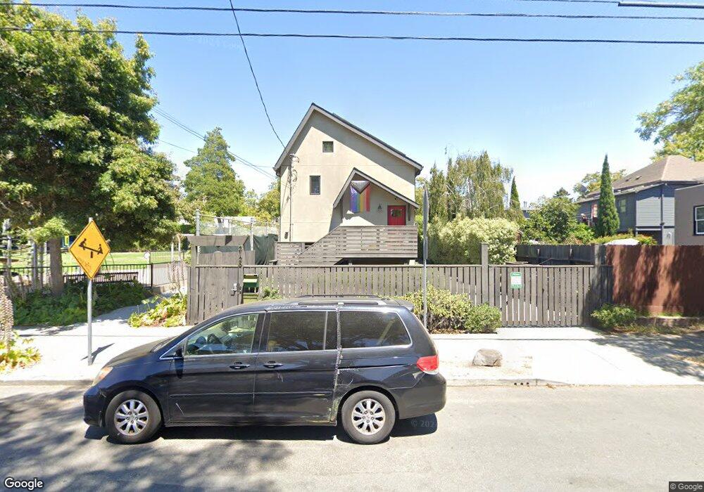
2125 10th St Berkeley, CA 94710
West Berkeley NeighborhoodEstimated Value: $1,138,000 - $1,540,000
3
Beds
2
Baths
1,251
Sq Ft
$1,044/Sq Ft
Est. Value
About This Home
This home is located at 2125 10th St, Berkeley, CA 94710 and is currently estimated at $1,306,329, approximately $1,044 per square foot. 2125 10th St is a home located in Alameda County with nearby schools including Rosa Parks Elementary School, Ruth Acty Elementary, and Berkeley Arts Magnet at Whittier School.
Ownership History
Date
Name
Owned For
Owner Type
Purchase Details
Closed on
Jul 27, 2018
Sold by
Rivero Jose Ramon
Bought by
Whyte Adam C and Clearfield Maureen
Current Estimated Value
Home Financials for this Owner
Home Financials are based on the most recent Mortgage that was taken out on this home.
Original Mortgage
$743,000
Outstanding Balance
$653,248
Interest Rate
4.6%
Mortgage Type
New Conventional
Estimated Equity
$585,643
Purchase Details
Closed on
Oct 31, 2008
Sold by
Benjamin Kathy June and Benjamin Karen Joanne
Bought by
Rivero Jose Ramon
Home Financials for this Owner
Home Financials are based on the most recent Mortgage that was taken out on this home.
Original Mortgage
$210,000
Interest Rate
6.1%
Mortgage Type
Unknown
Create a Home Valuation Report for This Property
The Home Valuation Report is an in-depth analysis detailing your home's value as well as a comparison with similar homes in the area
Home Values in the Area
Average Home Value in this Area
Purchase History
| Date | Buyer | Sale Price | Title Company |
|---|---|---|---|
| Whyte Adam C | $955,000 | First American Title Company | |
| Rivero Jose Ramon | $215,000 | Cornerstone Title Company |
Source: Public Records
Mortgage History
| Date | Status | Borrower | Loan Amount |
|---|---|---|---|
| Open | Whyte Adam C | $743,000 | |
| Previous Owner | Rivero Jose Ramon | $210,000 |
Source: Public Records
Tax History Compared to Growth
Tax History
| Year | Tax Paid | Tax Assessment Tax Assessment Total Assessment is a certain percentage of the fair market value that is determined by local assessors to be the total taxable value of land and additions on the property. | Land | Improvement |
|---|---|---|---|---|
| 2025 | -- | -- | -- | -- |
| 2024 | -- | -- | -- | -- |
| 2022 | $0 | $0 | $0 | $0 |
| 2021 | $0 | $0 | $0 | $0 |
| 2020 | $0 | $0 | $0 | $0 |
| 2019 | $0 | $0 | $0 | $0 |
| 2018 | $0 | $0 | $0 | $0 |
| 2017 | $0 | $0 | $0 | $0 |
| 2016 | $0 | $0 | $0 | $0 |
| 2015 | -- | $0 | $0 | $0 |
| 2014 | -- | $0 | $0 | $0 |
Source: Public Records
Map
Nearby Homes
- 2138 Byron St
- 2035 Ninth St
- 2018 9th St Unit B
- 2223 Byron St
- 1018 Bancroft Way
- 1050 Allston Way
- 2331 San Pablo Ave
- 2326 10th St
- 2351 San Pablo Ave
- 2327 10th St Unit 4
- 2220 7th St
- 2238 7th St
- 2120 6th St Unit 11
- 2406 10th St
- 917 Channing Way
- 1283 University Ave
- 1092 Dwight Way
- 1738 7th St
- 1201 Dwight Way
- 915 Dwight Way
- 1027 Allston Way
- 1033 Allston Way
- 1023 Allston Way
- 1035 Allston Way
- 2154 San Pablo Ave
- 1019 Allston Way
- 2126 10th St
- 2128 10th St
- 1017 Allston Way
- 2124 10th St
- 2124 10th St Unit 2126
- 2122 10th St
- 2113 10th St
- 1015 Allston Way
- 2120 10th St
- 1034 Allston Way
- 1036 Allston Way
- 1030 Allston Way
- 1013 Allston Way
- 2116 10th St