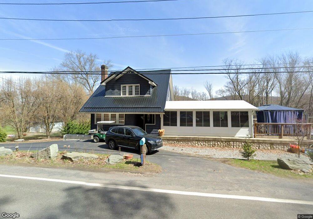
2125 State Route 92 Hwy Harding, PA 18643
Estimated Value: $197,000 - $247,000
--
Bed
--
Bath
--
Sq Ft
0.28
Acres
About This Home
This home is located at 2125 State Route 92 Hwy, Harding, PA 18643 and is currently estimated at $222,000. 2125 State Route 92 Hwy is a home with nearby schools including Wyoming Area Secondary Center.
Ownership History
Date
Name
Owned For
Owner Type
Purchase Details
Closed on
Jul 30, 2025
Sold by
Cicierski Joseph J and Woods Lori Anne
Bought by
Russell Juliet Amber and Richardson Mason Safford
Current Estimated Value
Home Financials for this Owner
Home Financials are based on the most recent Mortgage that was taken out on this home.
Original Mortgage
$190,000
Outstanding Balance
$190,000
Interest Rate
6.81%
Mortgage Type
New Conventional
Estimated Equity
$32,000
Purchase Details
Closed on
Jun 9, 1998
Bought by
Woods Lori Anne
Create a Home Valuation Report for This Property
The Home Valuation Report is an in-depth analysis detailing your home's value as well as a comparison with similar homes in the area
Home Values in the Area
Average Home Value in this Area
Purchase History
| Date | Buyer | Sale Price | Title Company |
|---|---|---|---|
| Russell Juliet Amber | $330,000 | United One Resources | |
| Woods Lori Anne | $47,000 | -- |
Source: Public Records
Mortgage History
| Date | Status | Borrower | Loan Amount |
|---|---|---|---|
| Open | Russell Juliet Amber | $190,000 | |
| Previous Owner | Woods Lori Anne | $177,600 |
Source: Public Records
Tax History Compared to Growth
Tax History
| Year | Tax Paid | Tax Assessment Tax Assessment Total Assessment is a certain percentage of the fair market value that is determined by local assessors to be the total taxable value of land and additions on the property. | Land | Improvement |
|---|---|---|---|---|
| 2025 | $3,755 | $129,400 | $17,200 | $112,200 |
| 2024 | $3,589 | $129,400 | $17,200 | $112,200 |
| 2023 | $3,349 | $129,400 | $17,200 | $112,200 |
| 2022 | $3,325 | $129,400 | $17,200 | $112,200 |
| 2021 | $2,984 | $117,800 | $17,200 | $100,600 |
| 2020 | $2,914 | $117,800 | $17,200 | $100,600 |
| 2019 | $2,831 | $117,800 | $17,200 | $100,600 |
| 2018 | $2,736 | $117,800 | $17,200 | $100,600 |
| 2017 | $2,674 | $117,800 | $17,200 | $100,600 |
| 2016 | -- | $17,600 | $17,200 | $400 |
| 2015 | -- | $17,600 | $17,200 | $400 |
| 2014 | -- | $17,600 | $17,200 | $400 |
Source: Public Records
Map
Nearby Homes
- 3061 Main St
- 675 Apple Tree Rd
- 3018 Main St
- 522 Sutton Creek Rd
- 2304 Pennsylvania 92
- 2356 Newton Ransom Blvd
- 2352 Newton Ransom Blvd
- 314 Terrace Ave
- 9 Circle Dr
- 750 Slocum Ave
- 2694 Ransom Rd
- 242 Pauline St
- 0 Lockville Rd Church Rd Unit 25-1114
- 0 Campbell Ledge Reservoir Unit 18-190
- 0 Spring & Red Oak Dr Unit GSBSC1753
- 41 Gashi Rd
- 456 Village Rd
- 798 Coxton Rd
- 633 Campground Rd
- 215 Bennett St
- 166 Rte 92
- 168 Rt 92
- 2137 State Route 92 Hwy
- 169 Rt 92
- 2149 State Route 92 Hwy
- 2158 State Route 92 Hwy
- 2092 State Route 92 Hwy
- LOT 5 Noah Lane Applewood Estates Ln
- 437 Sutton Creek Rd
- LOT 6 Noah Lane Applewood Estates Ln
- 605 Apple Tree Rd
- 1 Main St
- 1 Main St
- 2 Railroad St
- 405 Sutton Creek Rd
- 2064 State Route 92 Hwy
- 2060 State Route 92 Hwy
- 2058 State Route 92 Hwy
- rear Main St
- 2056 State Route 92 Hwy