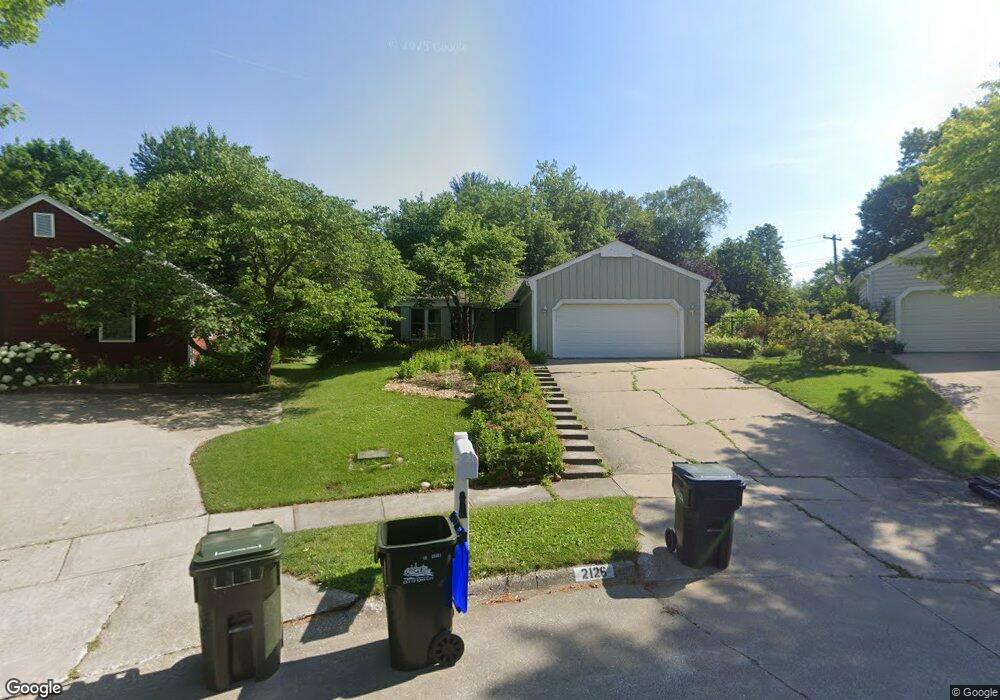
2126 Leonard Cir Iowa City, IA 52246
Estimated Value: $335,000 - $426,000
4
Beds
1
Bath
1,618
Sq Ft
$229/Sq Ft
Est. Value
About This Home
This home is located at 2126 Leonard Cir, Iowa City, IA 52246 and is currently estimated at $371,311, approximately $229 per square foot. 2126 Leonard Cir is a home located in Johnson County with nearby schools including Ernest Horn Elementary School, Northwest Junior High School, and West High School.
Ownership History
Date
Name
Owned For
Owner Type
Purchase Details
Closed on
Jul 31, 2006
Sold by
Zhou Li and Ma Lijie
Bought by
Jung Anita E and Christison Thomas A
Current Estimated Value
Home Financials for this Owner
Home Financials are based on the most recent Mortgage that was taken out on this home.
Original Mortgage
$158,000
Interest Rate
6.82%
Mortgage Type
New Conventional
Create a Home Valuation Report for This Property
The Home Valuation Report is an in-depth analysis detailing your home's value as well as a comparison with similar homes in the area
Home Values in the Area
Average Home Value in this Area
Purchase History
| Date | Buyer | Sale Price | Title Company |
|---|---|---|---|
| Jung Anita E | $218,000 | None Available |
Source: Public Records
Mortgage History
| Date | Status | Borrower | Loan Amount |
|---|---|---|---|
| Closed | Jung Anita E | $158,000 |
Source: Public Records
Tax History Compared to Growth
Tax History
| Year | Tax Paid | Tax Assessment Tax Assessment Total Assessment is a certain percentage of the fair market value that is determined by local assessors to be the total taxable value of land and additions on the property. | Land | Improvement |
|---|---|---|---|---|
| 2025 | $6,238 | $357,690 | $74,000 | $283,690 |
| 2024 | $6,160 | $327,510 | $62,900 | $264,610 |
| 2023 | $5,842 | $327,510 | $62,900 | $264,610 |
| 2022 | $5,582 | $269,520 | $59,200 | $210,320 |
| 2021 | $5,646 | $269,520 | $59,200 | $210,320 |
| 2020 | $5,646 | $261,120 | $51,800 | $209,320 |
| 2019 | $5,270 | $261,120 | $51,800 | $209,320 |
| 2018 | $5,270 | $239,830 | $44,400 | $195,430 |
| 2017 | $5,214 | $239,830 | $44,400 | $195,430 |
| 2016 | $5,058 | $234,650 | $40,700 | $193,950 |
| 2015 | $5,058 | $234,650 | $40,700 | $193,950 |
| 2014 | $5,034 | $232,720 | $40,700 | $192,020 |
Source: Public Records
Map
Nearby Homes
- 7 Westgate Cir
- 1848 W Benton St Unit 101
- 2314 Macbride Dr
- 1950 Calvin Ave
- 2525 Sylvan Glen Ct
- 1507 Oakcrest Ave
- 1153 Cambria Ct
- 1207 Cambria Ct
- 1060 Jensen St
- 808 Westwinds Dr Unit 5
- 740 Westwinds Dr Unit 2
- 2283 Cae Dr
- 2365 Cae Dr
- 2271 Cae Dr
- 468 Samoa Dr Unit J4
- 2259 Cae Dr
- 2423 Walden Ct
- 463 Samoa Dr
- 556 Mahaska Ct
- 813 Westwinds Dr Unit 1-4
- 2120 Leonard Cir
- 2132 Leonard Cir
- 2107 Slagle Cir
- 2119 Slagle Cir
- 811 Keswick Dr
- 805 Keswick Dr
- 817 Keswick Dr
- 2138 Leonard Cir
- 789 Keswick Dr
- 2119 Leonard Cir
- 823 Keswick Dr
- 783 Keswick Dr
- 2129 Slagle Cir
- 2137 Leonard Cir
- 2110 Slagle Cir
- 829 Keswick Dr
- 814 Spencer Dr
- 2125 Leonard Cir
- 777 Keswick Dr
- 2131 Leonard Cir