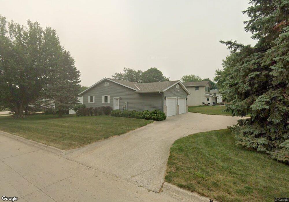
2126 N West St Carroll, IA 51401
Estimated Value: $283,000 - $426,000
2
Beds
3
Baths
1,608
Sq Ft
$211/Sq Ft
Est. Value
About This Home
This home is located at 2126 N West St, Carroll, IA 51401 and is currently estimated at $339,720, approximately $211 per square foot. 2126 N West St is a home with nearby schools including Fairview Elementary School, Adams Elementary School, and Carroll Middle School.
Ownership History
Date
Name
Owned For
Owner Type
Purchase Details
Closed on
Jan 5, 2022
Sold by
Klocke Gerald A and Klocke Elizabeth A
Bought by
Ferneding Land Trust
Current Estimated Value
Home Financials for this Owner
Home Financials are based on the most recent Mortgage that was taken out on this home.
Original Mortgage
$240,000
Outstanding Balance
$221,219
Interest Rate
3.12%
Mortgage Type
Construction
Estimated Equity
$118,501
Create a Home Valuation Report for This Property
The Home Valuation Report is an in-depth analysis detailing your home's value as well as a comparison with similar homes in the area
Home Values in the Area
Average Home Value in this Area
Purchase History
| Date | Buyer | Sale Price | Title Company |
|---|---|---|---|
| Ferneding Land Trust | $300,000 | None Listed On Document |
Source: Public Records
Mortgage History
| Date | Status | Borrower | Loan Amount |
|---|---|---|---|
| Open | Ferneding Land Trust | $240,000 |
Source: Public Records
Tax History Compared to Growth
Tax History
| Year | Tax Paid | Tax Assessment Tax Assessment Total Assessment is a certain percentage of the fair market value that is determined by local assessors to be the total taxable value of land and additions on the property. | Land | Improvement |
|---|---|---|---|---|
| 2025 | $3,470 | $325,480 | $28,040 | $297,440 |
| 2024 | $3,484 | $288,550 | $28,040 | $260,510 |
| 2023 | $3,589 | $288,550 | $28,040 | $260,510 |
| 2022 | $3,406 | $243,850 | $28,040 | $215,810 |
| 2021 | $3,406 | $243,850 | $28,040 | $215,810 |
| 2020 | $3,484 | $243,850 | $28,040 | $215,810 |
| 2019 | $3,450 | $243,850 | $28,040 | $215,810 |
| 2018 | $3,246 | $243,850 | $28,040 | $215,810 |
| 2017 | $3,246 | $235,389 | $24,856 | $210,533 |
| 2016 | $3,024 | $219,990 | $0 | $0 |
| 2015 | $3,024 | $211,750 | $0 | $0 |
| 2014 | $2,872 | $211,750 | $0 | $0 |
Source: Public Records
Map
Nearby Homes
- 219 Windwood Dr
- 611 W 21st St
- 711 W 21st St
- 1852 Quint Ave
- 1810 Crestview Dr
- 631 W 17th St
- 1509 Birch St
- 1608 Salinger Ave
- 1601 N Main St
- 1515 N Main St
- 265 Perch St
- 1320 N Adams St
- 260 Bass St
- 1546 Olive St
- 2340 Skyline Dr
- 746 Granada Rd
- 1015 N Adams St
- 1108 N Main St
- 907 Salinger Ave
- 1102 N Main St
- 305 W Randall Rd
- 2118 N West St
- 302 W Randall Rd
- 2112 N West St
- 304 W Randall Rd
- 303 W Randall Rd
- 2125 N West St
- 2115 N West St
- 2102 N West St
- 2205 N West St
- 318 W 21st St
- 310 W 21st St
- 402 W 21st St
- 2225 Fairway Heights
- 302 W 21st St
- 258 W Randall Rd
- 414 W 21st St
- 2020 N West St
- 246 W 21st St
- 319 Kevin Ave