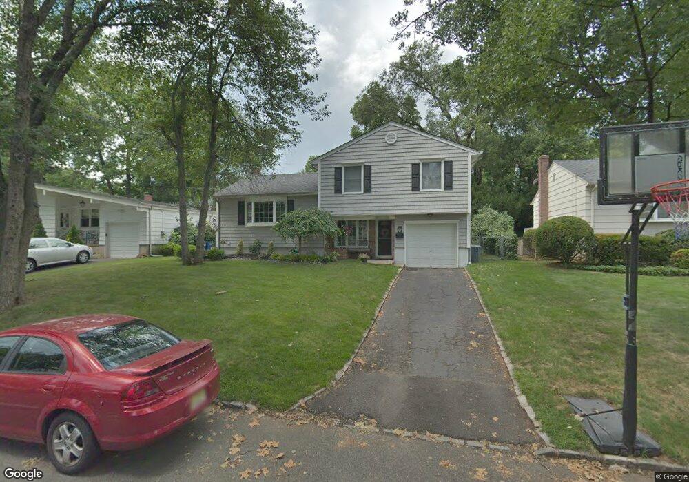
2127 Algonquin Dr Scotch Plains, NJ 07076
Estimated Value: $565,264 - $845,000
--
Bed
--
Bath
1,468
Sq Ft
$496/Sq Ft
Est. Value
About This Home
This home is located at 2127 Algonquin Dr, Scotch Plains, NJ 07076 and is currently estimated at $728,566, approximately $496 per square foot. 2127 Algonquin Dr is a home located in Union County with nearby schools including William J. McGinn Elementary School, Terrill Middle School, and Scotch Plains-Fanwood High School.
Ownership History
Date
Name
Owned For
Owner Type
Purchase Details
Closed on
Aug 8, 2001
Sold by
Driscoll Michael M and Driscoll Carole M
Bought by
Oslislo Jeffrey and Oslislo Maria
Current Estimated Value
Home Financials for this Owner
Home Financials are based on the most recent Mortgage that was taken out on this home.
Original Mortgage
$165,000
Outstanding Balance
$64,410
Interest Rate
7.16%
Mortgage Type
Stand Alone First
Estimated Equity
$664,156
Create a Home Valuation Report for This Property
The Home Valuation Report is an in-depth analysis detailing your home's value as well as a comparison with similar homes in the area
Home Values in the Area
Average Home Value in this Area
Purchase History
| Date | Buyer | Sale Price | Title Company |
|---|---|---|---|
| Oslislo Jeffrey | $315,000 | Lawyers Title Insurance Corp |
Source: Public Records
Mortgage History
| Date | Status | Borrower | Loan Amount |
|---|---|---|---|
| Open | Oslislo Jeffrey | $165,000 |
Source: Public Records
Tax History Compared to Growth
Tax History
| Year | Tax Paid | Tax Assessment Tax Assessment Total Assessment is a certain percentage of the fair market value that is determined by local assessors to be the total taxable value of land and additions on the property. | Land | Improvement |
|---|---|---|---|---|
| 2025 | $11,003 | $93,500 | $28,100 | $65,400 |
| 2024 | $10,679 | $93,500 | $28,100 | $65,400 |
| 2023 | $10,679 | $93,500 | $28,100 | $65,400 |
| 2022 | $10,551 | $93,500 | $28,100 | $65,400 |
| 2021 | $10,534 | $93,500 | $28,100 | $65,400 |
| 2020 | $10,483 | $93,500 | $28,100 | $65,400 |
| 2019 | $10,406 | $93,500 | $28,100 | $65,400 |
| 2018 | $10,231 | $93,500 | $28,100 | $65,400 |
| 2017 | $10,004 | $93,500 | $28,100 | $65,400 |
| 2016 | $9,811 | $93,500 | $28,100 | $65,400 |
| 2015 | $9,650 | $93,500 | $28,100 | $65,400 |
| 2014 | $9,332 | $93,500 | $28,100 | $65,400 |
Source: Public Records
Map
Nearby Homes
- 2212 Shady Ln
- 2116 Newark Ave
- 2219 North Ave Unit 6
- 2314 Longfellow Ave
- 345 La Grande Ave
- 2286 Stocker Ln
- 21 Old South Ave
- 9 Timberline Dr
- 40 1st St
- 120 S Martine Ave
- 1933 Mary Ellen Ln
- 869 Ternay Ave
- 2154 W Broad St
- 350 W Dudley Ave
- 1933 W Broad St
- 119 Lamberts Mill Rd
- 4 Lois Place
- 2406 Park Place
- 187 King St
- 5 Robin Rd
- 2123 Algonquin Dr
- 2135 Algonquin Dr
- 2128 Princeton Ave
- 2122 Princeton Ave
- 2117 Algonquin Dr
- 2132 Princeton Ave
- 1072 Hetfield Ave
- 1068 Hetfield Ave
- 2128 Algonquin Dr
- 2118 Princeton Ave
- 2122 Algonquin Dr
- 2132 Algonquin Dr
- 2115 Algonquin Dr
- 2134 Princeton Ave
- 2116 Algonquin Dr
- 2114 Princeton Ave
- 1080 Hetfield Ave
- 2112 Algonquin Dr
- 2111 Algonquin Dr
- 2125 Princeton Ave