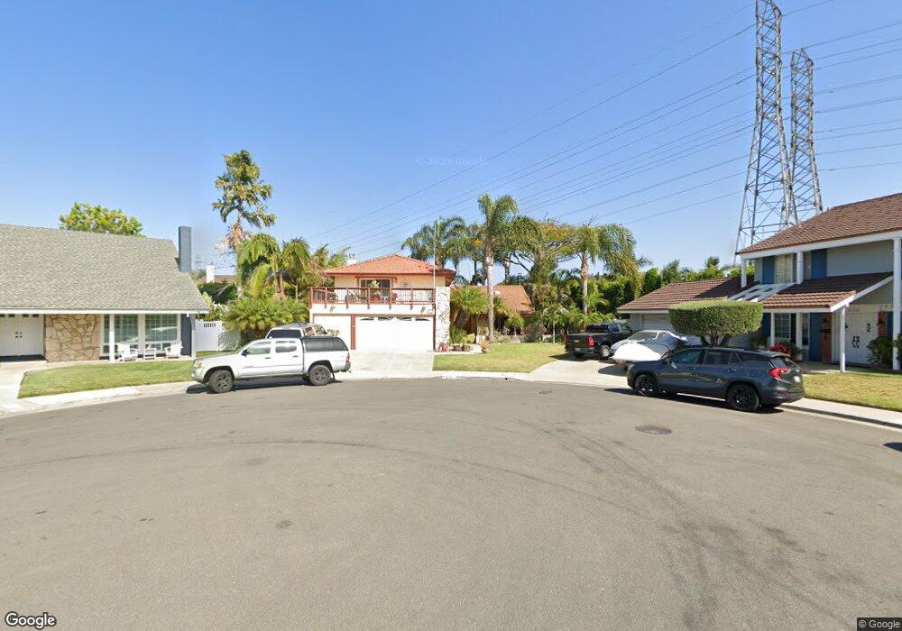
21271 Bulkhead Cir Huntington Beach, CA 92646
Southeast NeighborhoodEstimated Value: $1,546,000 - $1,856,000
3
Beds
3
Baths
2,307
Sq Ft
$717/Sq Ft
Est. Value
About This Home
This home is located at 21271 Bulkhead Cir, Huntington Beach, CA 92646 and is currently estimated at $1,654,649, approximately $717 per square foot. 21271 Bulkhead Cir is a home located in Orange County with nearby schools including John H. Eader Elementary School, Isaac L. Sowers Middle School, and Edison High School.
Ownership History
Date
Name
Owned For
Owner Type
Purchase Details
Closed on
Apr 25, 1994
Sold by
Schneider Paul Bruce and Schneider Arla Irene
Bought by
Thompson Ronald E and Thompson Kristin P
Current Estimated Value
Home Financials for this Owner
Home Financials are based on the most recent Mortgage that was taken out on this home.
Original Mortgage
$231,300
Interest Rate
3.95%
Create a Home Valuation Report for This Property
The Home Valuation Report is an in-depth analysis detailing your home's value as well as a comparison with similar homes in the area
Home Values in the Area
Average Home Value in this Area
Purchase History
| Date | Buyer | Sale Price | Title Company |
|---|---|---|---|
| Thompson Ronald E | $257,000 | Fidelity National Title Ins |
Source: Public Records
Mortgage History
| Date | Status | Borrower | Loan Amount |
|---|---|---|---|
| Closed | Thompson Ronald E | $231,300 |
Source: Public Records
Tax History Compared to Growth
Tax History
| Year | Tax Paid | Tax Assessment Tax Assessment Total Assessment is a certain percentage of the fair market value that is determined by local assessors to be the total taxable value of land and additions on the property. | Land | Improvement |
|---|---|---|---|---|
| 2025 | $5,554 | $484,702 | $302,963 | $181,739 |
| 2024 | $5,554 | $475,199 | $297,023 | $178,176 |
| 2023 | $5,427 | $465,882 | $291,199 | $174,683 |
| 2022 | $5,283 | $456,748 | $285,490 | $171,258 |
| 2021 | $5,185 | $447,793 | $279,893 | $167,900 |
| 2020 | $5,150 | $443,202 | $277,023 | $166,179 |
| 2019 | $5,089 | $434,512 | $271,591 | $162,921 |
| 2018 | $5,009 | $425,993 | $266,266 | $159,727 |
| 2017 | $4,942 | $417,641 | $261,045 | $156,596 |
| 2016 | $4,725 | $409,452 | $255,926 | $153,526 |
| 2015 | $4,678 | $403,302 | $252,082 | $151,220 |
| 2014 | $4,579 | $395,402 | $247,144 | $148,258 |
Source: Public Records
Map
Nearby Homes
- 21292 Bulkhead Cir
- 9452 Waterfront Dr
- 21221 Hillsdale Ln
- 9461 Pier Dr
- 21361 Lemontree Ln
- 21382 Lemontree Ln
- 9221 Belcaro Dr
- 9695 Brookbay Cir
- 21335 Bay Crest Cir
- 9802 Effingham Dr
- 9171 Regatta Dr
- 20862 Lancelot Ln
- 20791 Hunter Ln
- 21682 Impala Ln
- 9882 Cornerbrook Dr
- 9562 Rockpoint Dr
- 9001 Oceanwood Dr
- 21372 Brookhurst St Unit 625
- 20971 Surge Ln
- 21861 Vacation Ln
- 21291 Bulkhead Cir
- 21261 Bulkhead Cir
- 21272 Compass Ln
- 21292 Compass Ln
- 21301 Bulkhead Cir
- 21272 Bulkhead Cir
- 9401 Southshore Dr
- 21302 Compass Ln
- 21302 Bulkhead Cir
- 21311 Bulkhead Cir
- 9391 Southshore Dr
- 21251 Bushard St
- 21312 Compass Ln
- 21312 Bulkhead Cir
- 21321 Bulkhead Cir
- 21252 Spurney Ln
- 21301 Compass Ln
- 21241 Spurney Ln
- 9381 Southshore Dr
- 21322 Compass Ln