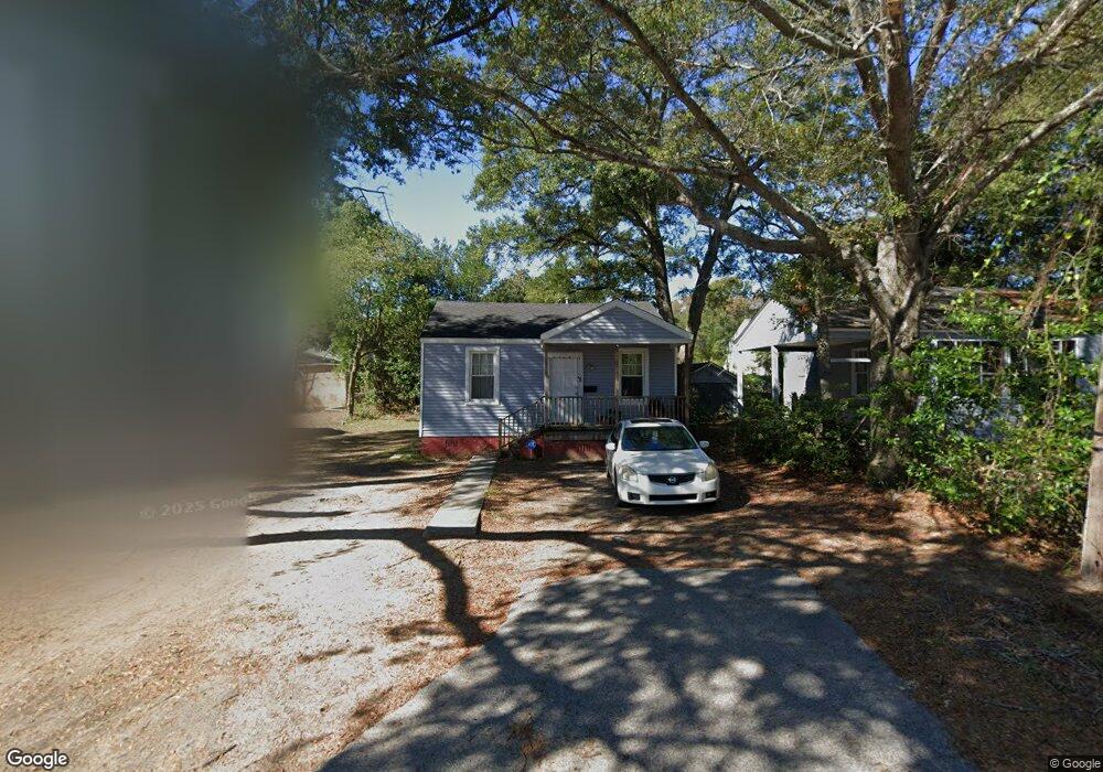
2128 Commander Rd North Charleston, SC 29405
Charleston Heights NeighborhoodEstimated Value: $125,000 - $328,000
2
Beds
1
Bath
650
Sq Ft
$313/Sq Ft
Est. Value
About This Home
This home is located at 2128 Commander Rd, North Charleston, SC 29405 and is currently estimated at $203,767, approximately $313 per square foot. 2128 Commander Rd is a home located in Charleston County with nearby schools including Mary Ford Elementary School, Chicora Elementary School, and Morningside Middle.
Ownership History
Date
Name
Owned For
Owner Type
Purchase Details
Closed on
Aug 25, 2011
Sold by
Lamb Brett Thomas
Bought by
Realty Holding Group Llc
Current Estimated Value
Purchase Details
Closed on
Jul 26, 2011
Sold by
Federal National Mortgage Association
Bought by
Lamb Brett
Purchase Details
Closed on
Mar 15, 2011
Sold by
Rose Broadus S
Bought by
Federal National Mortgage Association
Create a Home Valuation Report for This Property
The Home Valuation Report is an in-depth analysis detailing your home's value as well as a comparison with similar homes in the area
Home Values in the Area
Average Home Value in this Area
Purchase History
| Date | Buyer | Sale Price | Title Company |
|---|---|---|---|
| Realty Holding Group Llc | -- | -- | |
| Lamb Brett | $12,000 | -- | |
| Federal National Mortgage Association | $19,500 | -- |
Source: Public Records
Tax History
| Year | Tax Paid | Tax Assessment Tax Assessment Total Assessment is a certain percentage of the fair market value that is determined by local assessors to be the total taxable value of land and additions on the property. | Land | Improvement |
|---|---|---|---|---|
| 2024 | $504 | $870 | $0 | $0 |
| 2023 | $475 | $870 | $0 | $0 |
| 2022 | $412 | $870 | $0 | $0 |
| 2021 | $410 | $870 | $0 | $0 |
| 2020 | $408 | $870 | $0 | $0 |
| 2019 | $383 | $750 | $0 | $0 |
| 2017 | $338 | $750 | $0 | $0 |
| 2016 | $331 | $750 | $0 | $0 |
| 2015 | $325 | $750 | $0 | $0 |
| 2014 | $314 | $0 | $0 | $0 |
| 2011 | -- | $0 | $0 | $0 |
Source: Public Records
Map
Nearby Homes
- 2136 Commander Rd
- 2135 Dorchester Rd
- 2116 Commander Rd
- 2125 Cosgrove Ave
- 2121 Cosgrove Ave
- 2208 Bailey Dr
- 2213 Crosby Ave
- 3436 Osceola St Unit A-D
- 2224 Suffolk St
- 2257 Mott Ave
- 2601 S Allen Dr
- 2217 Cambridge Ave
- 2635 S Allen Dr
- 2343 Cambridge Ave
- 2211 Garfield St
- 2655 S Allen Dr
- 3311 Proctor St
- 2654 Harvey Ave
- 2372 Sorentrue Ave
- 3722 Tim St
- 2130 Commander Rd
- 2126 Commander Rd
- 2132 Commander Rd
- 2147 Dorchester Rd
- 2145 Dorchester Rd
- 2124 Commander Rd
- 2143 Dorchester Rd
- 2127 Commander Rd
- 2134 Commander Rd
- 2125 Commander Rd
- 2141 Dorchester Rd
- 2129 Commander Rd
- 2151 Dorchester Rd
- 2123 Commander Rd
- 2139 Dorchester Rd
- 2153 Dorchester Rd
- 2131 Commander Rd
- 2126 Captain Ave
- 2128 Captain Ave
- 2120 Commander Rd
Your Personal Tour Guide
Ask me questions while you tour the home.