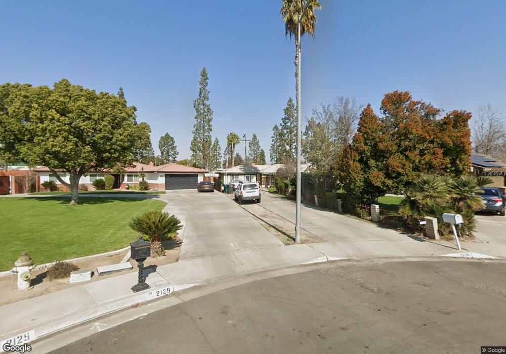
2128 Jason St Bakersfield, CA 93312
Greenacres NeighborhoodEstimated Value: $492,169 - $557,000
4
Beds
2
Baths
1,522
Sq Ft
$346/Sq Ft
Est. Value
About This Home
This home is located at 2128 Jason St, Bakersfield, CA 93312 and is currently estimated at $527,292, approximately $346 per square foot. 2128 Jason St is a home located in Kern County with nearby schools including American Elementary School, Rosedale Middle School, and Liberty High School.
Ownership History
Date
Name
Owned For
Owner Type
Purchase Details
Closed on
Nov 29, 2007
Sold by
Murrell Walker C and Murrell Alecia Marie
Bought by
Murrell Walker C
Current Estimated Value
Home Financials for this Owner
Home Financials are based on the most recent Mortgage that was taken out on this home.
Original Mortgage
$348,500
Interest Rate
7.5%
Mortgage Type
New Conventional
Purchase Details
Closed on
Jun 23, 2006
Sold by
Murrell Walker C and Murrell Alecia Marie
Bought by
Murrell Walker C and Murrell Alecia Marie
Home Financials for this Owner
Home Financials are based on the most recent Mortgage that was taken out on this home.
Original Mortgage
$273,000
Interest Rate
7.4%
Mortgage Type
New Conventional
Purchase Details
Closed on
Aug 3, 2005
Sold by
Mayes Kennith Larry and Mayes Susan Eileen
Bought by
Murrell Walter C and Murrell Alecia Marie
Home Financials for this Owner
Home Financials are based on the most recent Mortgage that was taken out on this home.
Original Mortgage
$130,000
Interest Rate
5.56%
Mortgage Type
New Conventional
Create a Home Valuation Report for This Property
The Home Valuation Report is an in-depth analysis detailing your home's value as well as a comparison with similar homes in the area
Home Values in the Area
Average Home Value in this Area
Purchase History
| Date | Buyer | Sale Price | Title Company |
|---|---|---|---|
| Murrell Walker C | -- | Alliance Title Company | |
| Murrell Walker C | -- | Stewart Title Of California | |
| Murrell Walter C | -- | -- |
Source: Public Records
Mortgage History
| Date | Status | Borrower | Loan Amount |
|---|---|---|---|
| Closed | Murrell Walker C | $348,500 | |
| Closed | Murrell Walker C | $273,000 | |
| Closed | Murrell Walter C | $130,000 |
Source: Public Records
Tax History Compared to Growth
Tax History
| Year | Tax Paid | Tax Assessment Tax Assessment Total Assessment is a certain percentage of the fair market value that is determined by local assessors to be the total taxable value of land and additions on the property. | Land | Improvement |
|---|---|---|---|---|
| 2025 | $2,608 | $181,345 | $23,997 | $157,348 |
| 2024 | $2,531 | $177,791 | $23,527 | $154,264 |
| 2023 | $2,531 | $174,306 | $23,066 | $151,240 |
| 2022 | $2,451 | $170,889 | $22,614 | $148,275 |
| 2021 | $2,337 | $167,540 | $22,171 | $145,369 |
| 2020 | $2,264 | $165,824 | $21,944 | $143,880 |
| 2019 | $2,209 | $165,824 | $21,944 | $143,880 |
| 2018 | $2,145 | $159,388 | $21,093 | $138,295 |
| 2017 | $2,095 | $156,264 | $20,680 | $135,584 |
| 2016 | $1,975 | $153,201 | $20,275 | $132,926 |
Source: Public Records
Map
Nearby Homes
- 10729 Lindalee Ln
- 2008 Torrey Dr
- 2125 Verdugo Ln
- 11407 Palm Ave
- 10429 Enger St
- 11520 Pinehaven Ave
- 10920 Cilantro Ave
- 3108 Holbrook St
- 11201 Paddock Ave
- 11617 Cactus Dr
- 10307 Glenn St
- 1850 Verdugo Ln
- 11705 Cactus Dr
- 10931 Shellabarger Rd
- 3122 Campfire Dr Unit 2
- 11510 Finsbury Ct
- 3435 Moss St
- 11717 Old Town Rd
- 10701 Meacham Rd
- 10514 Brimhall Rd
- 2129 Jason St
- 2124 Jason St
- 2125 Jason St
- 2120 Jason St
- 2116 Jason St
- 2117 Jason St
- 2113 Jason St
- 2108 Jason St
- 2500 Jewetta Ave Unit 21
- 2500 Jewetta Ave Unit 80
- 2500 Jewetta Ave Unit 84
- 2500 Jewetta Ave Unit 59
- 2500 Jewetta Ave Unit 47
- 2500 Jewetta Ave Unit 83
- 2500 Jewetta Ave Unit 46
- 2500 Jewetta Ave Unit 20
- 2500 Jewetta Ave Unit 48
- 2500 Jewetta Ave Unit 11
- 2500 Jewetta Ave Unit 7
- 2500 Jewetta Ave Unit 30