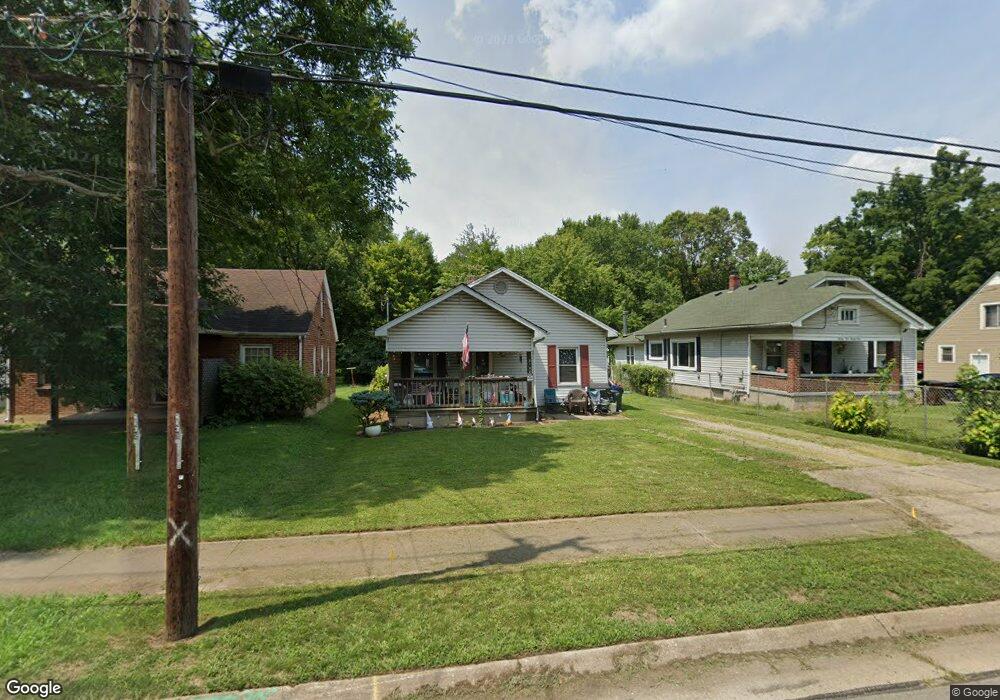
2128 Winton St Middletown, OH 45044
Mayfield NeighborhoodEstimated Value: $152,000 - $173,000
3
Beds
2
Baths
1,078
Sq Ft
$155/Sq Ft
Est. Value
About This Home
This home is located at 2128 Winton St, Middletown, OH 45044 and is currently estimated at $166,668, approximately $154 per square foot. 2128 Winton St is a home located in Butler County with nearby schools including Mayfield Elementary School, Highview 6th Grade Center, and Middletown Middle School.
Ownership History
Date
Name
Owned For
Owner Type
Purchase Details
Closed on
May 30, 2006
Sold by
Hud
Bought by
Haass Craig A
Current Estimated Value
Home Financials for this Owner
Home Financials are based on the most recent Mortgage that was taken out on this home.
Original Mortgage
$45,200
Outstanding Balance
$3,350
Interest Rate
8.25%
Mortgage Type
Fannie Mae Freddie Mac
Estimated Equity
$163,318
Purchase Details
Closed on
Jul 8, 2005
Sold by
Collins Frank D
Bought by
Hud
Purchase Details
Closed on
Jan 12, 2001
Sold by
Caudell Steve C and Caudell Donna
Bought by
Collins Frank D
Home Financials for this Owner
Home Financials are based on the most recent Mortgage that was taken out on this home.
Original Mortgage
$84,671
Interest Rate
7.58%
Mortgage Type
FHA
Create a Home Valuation Report for This Property
The Home Valuation Report is an in-depth analysis detailing your home's value as well as a comparison with similar homes in the area
Home Values in the Area
Average Home Value in this Area
Purchase History
| Date | Buyer | Sale Price | Title Company |
|---|---|---|---|
| Haass Craig A | $56,500 | Lakeside Title & Escrow Agen | |
| Hud | $52,000 | -- | |
| Collins Frank D | $86,000 | Midland Title Security Inc |
Source: Public Records
Mortgage History
| Date | Status | Borrower | Loan Amount |
|---|---|---|---|
| Open | Haass Craig A | $45,200 | |
| Previous Owner | Collins Frank D | $84,671 |
Source: Public Records
Tax History Compared to Growth
Tax History
| Year | Tax Paid | Tax Assessment Tax Assessment Total Assessment is a certain percentage of the fair market value that is determined by local assessors to be the total taxable value of land and additions on the property. | Land | Improvement |
|---|---|---|---|---|
| 2024 | $2,031 | $38,320 | $6,610 | $31,710 |
| 2023 | $2,019 | $38,450 | $6,610 | $31,840 |
| 2022 | $1,649 | $27,660 | $6,610 | $21,050 |
| 2021 | $1,587 | $27,660 | $6,610 | $21,050 |
| 2020 | $1,653 | $27,660 | $6,610 | $21,050 |
| 2019 | $1,166 | $16,090 | $6,140 | $9,950 |
| 2018 | $1,042 | $16,090 | $6,140 | $9,950 |
| 2017 | $1,044 | $16,090 | $6,140 | $9,950 |
| 2016 | $975 | $14,390 | $6,140 | $8,250 |
| 2015 | $961 | $14,390 | $6,140 | $8,250 |
| 2014 | $1,318 | $14,390 | $6,140 | $8,250 |
| 2013 | $1,318 | $21,450 | $6,140 | $15,310 |
Source: Public Records
Map
Nearby Homes
- 2120 Fernwood St
- 1932 Winton St
- 1913 Brentwood St
- 2225 Sheffield St
- 3105 August Ave
- 2216 Carolina St
- 2128 Lamberton St
- 1728 Fernwood St
- 3218 Keays Ave
- 2033 Jackson Ln
- 2010 Waynedale Ct
- 1926 Circle Kelly Jo
- 3717 Ellis Way
- 1305 Highland St
- 3708 Greenwood Dr
- 1030 Jackson Ln
- 1012 Jackson Ln
- 800 Orchard St
- 3006 Grand Ave
- 808 The Alameda