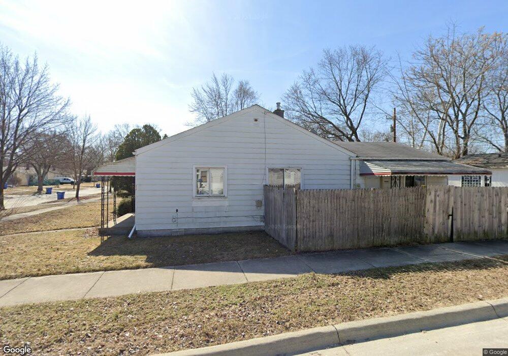
21281 Atlantic Ave Warren, MI 48091
Southwest Warren NeighborhoodEstimated Value: $126,000 - $141,000
3
Beds
1
Bath
1,080
Sq Ft
$124/Sq Ft
Est. Value
About This Home
This home is located at 21281 Atlantic Ave, Warren, MI 48091 and is currently estimated at $134,044, approximately $124 per square foot. 21281 Atlantic Ave is a home located in Macomb County with nearby schools including Mound Park Elementary School, Schofield Elementary School, and Westview Elementary School.
Ownership History
Date
Name
Owned For
Owner Type
Purchase Details
Closed on
Apr 16, 2010
Sold by
Donovan Shaun
Bought by
Stocki Marcin
Current Estimated Value
Purchase Details
Closed on
Nov 2, 2009
Sold by
Everbank
Bought by
The Secretary Of Housing & Urban Develop
Purchase Details
Closed on
Apr 10, 2009
Sold by
Dingess Allen G and Dingess Veronica K
Bought by
Everbank
Purchase Details
Closed on
Sep 1, 1998
Sold by
Carolyn St Germain
Bought by
Dingess Allen G
Create a Home Valuation Report for This Property
The Home Valuation Report is an in-depth analysis detailing your home's value as well as a comparison with similar homes in the area
Home Values in the Area
Average Home Value in this Area
Purchase History
| Date | Buyer | Sale Price | Title Company |
|---|---|---|---|
| Stocki Marcin | $10,100 | None Available | |
| The Secretary Of Housing & Urban Develop | -- | None Available | |
| Everbank | $65,840 | None Available | |
| Dingess Allen G | $62,100 | -- |
Source: Public Records
Tax History Compared to Growth
Tax History
| Year | Tax Paid | Tax Assessment Tax Assessment Total Assessment is a certain percentage of the fair market value that is determined by local assessors to be the total taxable value of land and additions on the property. | Land | Improvement |
|---|---|---|---|---|
| 2025 | $1,870 | $59,310 | $0 | $0 |
| 2024 | $1,839 | $53,000 | $0 | $0 |
| 2023 | $1,802 | $37,230 | $0 | $0 |
| 2022 | $1,361 | $32,200 | $0 | $0 |
| 2021 | $1,745 | $30,300 | $0 | $0 |
| 2020 | $1,332 | $26,830 | $0 | $0 |
| 2019 | $1,253 | $26,070 | $0 | $0 |
| 2018 | $26 | $20,370 | $0 | $0 |
| 2017 | $1,193 | $19,910 | $1,980 | $17,930 |
| 2016 | $1,171 | $19,910 | $0 | $0 |
| 2015 | -- | $18,400 | $0 | $0 |
| 2012 | -- | $18,990 | $0 | $0 |
Source: Public Records
Map
Nearby Homes
- 21222 Audrey Ave
- 21137 Curie Ave
- 21034 Audrey Ave
- 21034 Atlantic Ave
- 21441 Atlantic Ave
- 20870 Curie Ave
- 20817 Atlantic Ave
- 20818 Atlantic Ave
- 21116 Cyman Ave
- 21234 Cyman Ave
- 20760 Atlantic Ave
- 21410 Panama St
- 21029 Blackmar Ave
- 21067 Albany Ave
- 21820 Cunningham Ave
- 20511 Caldwell St
- 21299 Sunset Ave
- 22355 Curie Ave
- 20200 Caldwell St
- 22595 Curie Ave
- 21273 Atlantic Ave
- 21263 Atlantic Ave
- 21405 Atlantic Ave
- 21245 Atlantic Ave
- 21409 Atlantic Ave
- 21282 Audrey Ave
- 21274 Audrey Ave
- 21264 Audrey Ave
- 21221 Atlantic Ave
- 21406 Audrey Ave
- 21246 Audrey Ave
- 21415 Atlantic Ave
- 21410 Audrey Ave
- 21195 Atlantic Ave
- 21282 Atlantic Ave
- 21274 Atlantic Ave Unit Bldg-Unit
- 21274 Atlantic Ave
- 21264 Atlantic Ave
- 21416 Audrey Ave
- 21406 Atlantic Ave