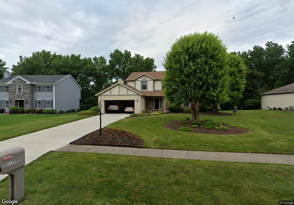
21284 Montclare Blvd Strongsville, OH 44149
Estimated Value: $378,511 - $424,000
4
Beds
3
Baths
2,130
Sq Ft
$190/Sq Ft
Est. Value
About This Home
This home is located at 21284 Montclare Blvd, Strongsville, OH 44149 and is currently estimated at $403,878, approximately $189 per square foot. 21284 Montclare Blvd is a home located in Cuyahoga County with nearby schools including Strongsville High School, St Mary School, and Sts Joseph & John Interparochial School.
Ownership History
Date
Name
Owned For
Owner Type
Purchase Details
Closed on
Aug 10, 1993
Sold by
Radin Jeffrey S
Bought by
Hvizd George M
Current Estimated Value
Purchase Details
Closed on
Jul 28, 1989
Sold by
Radin Jeffrey S
Bought by
Radin Jeffrey S
Purchase Details
Closed on
Dec 23, 1986
Bought by
Radin Jeffrey S
Purchase Details
Closed on
Sep 18, 1986
Bought by
Stonecrest Homes Inc
Purchase Details
Closed on
Jan 1, 1985
Bought by
Fair Farms Co
Create a Home Valuation Report for This Property
The Home Valuation Report is an in-depth analysis detailing your home's value as well as a comparison with similar homes in the area
Home Values in the Area
Average Home Value in this Area
Purchase History
| Date | Buyer | Sale Price | Title Company |
|---|---|---|---|
| Hvizd George M | $170,000 | -- | |
| Radin Jeffrey S | -- | -- | |
| Radin Jeffrey S | $126,800 | -- | |
| Stonecrest Homes Inc | $27,400 | -- | |
| Fair Farms Co | -- | -- |
Source: Public Records
Tax History Compared to Growth
Tax History
| Year | Tax Paid | Tax Assessment Tax Assessment Total Assessment is a certain percentage of the fair market value that is determined by local assessors to be the total taxable value of land and additions on the property. | Land | Improvement |
|---|---|---|---|---|
| 2024 | $5,635 | $120,015 | $23,240 | $96,775 |
| 2023 | $5,886 | $94,010 | $22,960 | $71,050 |
| 2022 | $5,844 | $94,010 | $22,960 | $71,050 |
| 2021 | $5,798 | $94,010 | $22,960 | $71,050 |
| 2020 | $5,749 | $82,460 | $20,130 | $62,340 |
| 2019 | $5,580 | $235,600 | $57,500 | $178,100 |
| 2018 | $5,064 | $82,460 | $20,130 | $62,340 |
| 2017 | $5,039 | $75,960 | $18,170 | $57,790 |
| 2016 | $4,998 | $75,960 | $18,170 | $57,790 |
| 2015 | $4,921 | $75,960 | $18,170 | $57,790 |
| 2014 | $4,921 | $73,750 | $17,640 | $56,110 |
Source: Public Records
Map
Nearby Homes
- 8627 Courtland Dr
- 84 Sprague Rd
- 8036 Fair Rd
- 8902 Lincolnshire Blvd
- 104 Whitehall Dr
- 740 Fair St
- 9829 Plum Brook Ln
- 243 Jananna Dr
- 9401 Pheasant Run Place
- 9598 Pebble Brook Ln
- 10353 Oak Branch Trail
- 8746 Barton Dr
- 22300 Rock Creek Cir
- 0 Priem Rd
- 148 Meadow Cir
- 21355 Hickory Branch Trail
- 21176 Hickory Branch Trail
- 458 Sprague Rd
- 9384 N Marks Rd
- 10839 Prospect Rd
- 21332 Montclare Blvd
- 21236 Montclare Blvd
- 21481 Montclare Blvd
- 21188 Montclare Blvd
- 21380 Montclare Blvd
- 21059 Montclare Blvd
- 21529 Montclare Blvd
- 21140 Montclare Blvd
- 20987 Montclare Blvd
- 21476 Montclare Blvd
- 8584 Fair Rd
- 21573 Montclare Blvd
- 8586 Fair Rd
- 8576 Fair Rd
- 21092 Montclare Blvd
- 8568 Fair Rd
- 20935 Montclare Blvd
- 21044 Montclare Blvd
- 8536 Fair Rd
- 8619 Courtland Dr