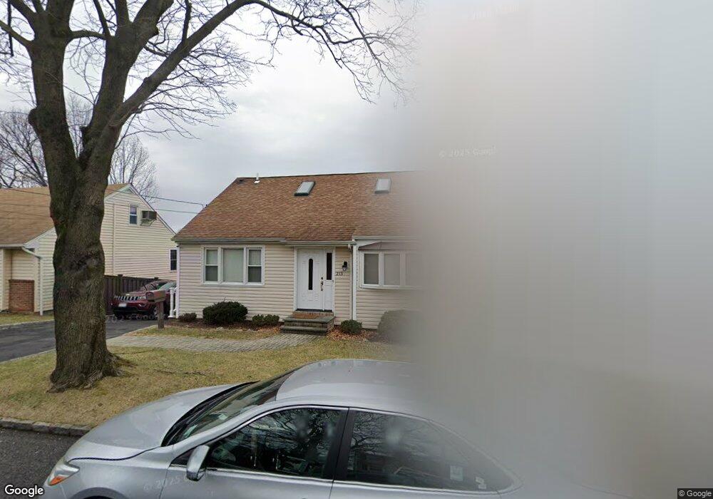
213 Bennett Ave Yonkers, NY 10701
Dunwoodie NeighborhoodEstimated Value: $673,366 - $721,000
3
Beds
2
Baths
1,470
Sq Ft
$471/Sq Ft
Est. Value
About This Home
This home is located at 213 Bennett Ave, Yonkers, NY 10701 and is currently estimated at $692,092, approximately $470 per square foot. 213 Bennett Ave is a home located in Westchester County with nearby schools including St. John the Baptist Catholic Church and Andalusia School.
Ownership History
Date
Name
Owned For
Owner Type
Purchase Details
Closed on
Nov 29, 2007
Sold by
Morrisette Gordon W and Morrisette Russell
Bought by
Murphy Charles
Current Estimated Value
Home Financials for this Owner
Home Financials are based on the most recent Mortgage that was taken out on this home.
Original Mortgage
$320,000
Outstanding Balance
$202,232
Interest Rate
6.27%
Mortgage Type
Purchase Money Mortgage
Estimated Equity
$489,860
Create a Home Valuation Report for This Property
The Home Valuation Report is an in-depth analysis detailing your home's value as well as a comparison with similar homes in the area
Home Values in the Area
Average Home Value in this Area
Purchase History
| Date | Buyer | Sale Price | Title Company |
|---|---|---|---|
| Murphy Charles | $400,000 | New York Title Research Corp |
Source: Public Records
Mortgage History
| Date | Status | Borrower | Loan Amount |
|---|---|---|---|
| Open | Murphy Charles | $320,000 |
Source: Public Records
Tax History
| Year | Tax Paid | Tax Assessment Tax Assessment Total Assessment is a certain percentage of the fair market value that is determined by local assessors to be the total taxable value of land and additions on the property. | Land | Improvement |
|---|---|---|---|---|
| 2024 | $1,550 | $8,700 | $3,000 | $5,700 |
| 2023 | $1,542 | $8,700 | $3,000 | $5,700 |
| 2022 | $1,532 | $8,700 | $3,000 | $5,700 |
| 2021 | $6,510 | $8,700 | $3,000 | $5,700 |
| 2020 | $6,417 | $8,700 | $3,000 | $5,700 |
| 2019 | $7,846 | $8,700 | $3,000 | $5,700 |
| 2018 | $5,876 | $8,700 | $3,000 | $5,700 |
| 2017 | -- | $8,700 | $3,000 | $5,700 |
| 2016 | $6,808 | $8,700 | $3,000 | $5,700 |
| 2015 | -- | $8,700 | $3,000 | $5,700 |
| 2014 | -- | $8,700 | $3,000 | $5,700 |
| 2013 | -- | $8,700 | $3,000 | $5,700 |
Source: Public Records
Map
Nearby Homes
- 20 Ashford Place
- 116 Homewood Ave
- 30 College Place
- 900 Midland Ave Unit 2G
- 900 Midland Ave Unit 1D
- 900 Midland Ave Unit 2E
- 419 Palmer Rd
- 58 Kingston Ave
- 466 Palmer Rd
- 98 University Ave
- 90 University Ave
- 46 Bryn Mawr Place
- 219 Mile Square Rd
- 194 Valentine St
- 60 Gramercy Ave
- 5 Victor Ln
- 38 Gramercy Ave
- 2 Victoria Ln
- 1078 Midland Ave
- 1101 Midland Ave Unit 223
- 207 Bennett Ave
- 215 Bennett Ave
- 214 Cook Ave
- 218 Cook Ave
- 203 Bennett Ave
- 1 Ashford Place
- 222 Cook Ave Unit 1
- 222 Cook Ave Unit 2
- 222 Cook Ave Unit 2nd Floor
- 222 Cook Ave
- 221 Bennett Ave
- 214 Bennett Ave
- 226 Cook Ave
- 201 Bennett Ave Unit 1
- 218 aka 220 Cook Ave
- 218 Bennett Ave
- 206 Cook Ave
- 208 Cook Ave
- 206 AKA 208 Cook Ave
- 199 Bennett Ave
Your Personal Tour Guide
Ask me questions while you tour the home.