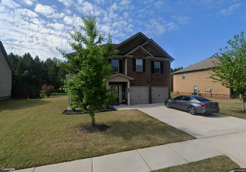
213 Christopher Michael Ln Unit 31 Hampton, GA 30228
Estimated Value: $317,670 - $347,000
4
Beds
3
Baths
2,370
Sq Ft
$142/Sq Ft
Est. Value
About This Home
This home is located at 213 Christopher Michael Ln Unit 31, Hampton, GA 30228 and is currently estimated at $337,418, approximately $142 per square foot. 213 Christopher Michael Ln Unit 31 is a home located in Henry County with nearby schools including Mount Carmel Elementary School, Hampton Middle School, and Hampton High School.
Ownership History
Date
Name
Owned For
Owner Type
Purchase Details
Closed on
Dec 31, 2015
Sold by
Century Communities Of Georgia Llc
Bought by
Rutledge John G
Current Estimated Value
Home Financials for this Owner
Home Financials are based on the most recent Mortgage that was taken out on this home.
Original Mortgage
$179,233
Outstanding Balance
$143,449
Interest Rate
3.87%
Mortgage Type
FHA
Estimated Equity
$193,969
Create a Home Valuation Report for This Property
The Home Valuation Report is an in-depth analysis detailing your home's value as well as a comparison with similar homes in the area
Home Values in the Area
Average Home Value in this Area
Purchase History
| Date | Buyer | Sale Price | Title Company |
|---|---|---|---|
| Rutledge John G | $182,540 | -- |
Source: Public Records
Mortgage History
| Date | Status | Borrower | Loan Amount |
|---|---|---|---|
| Open | Rutledge John G | $179,233 |
Source: Public Records
Tax History
| Year | Tax Paid | Tax Assessment Tax Assessment Total Assessment is a certain percentage of the fair market value that is determined by local assessors to be the total taxable value of land and additions on the property. | Land | Improvement |
|---|---|---|---|---|
| 2025 | $3,898 | $133,880 | $16,000 | $117,880 |
| 2024 | $3,898 | $137,360 | $16,000 | $121,360 |
| 2023 | $3,459 | $133,200 | $14,000 | $119,200 |
| 2022 | $3,516 | $114,240 | $14,000 | $100,240 |
| 2021 | $2,922 | $89,120 | $14,000 | $75,120 |
| 2020 | $2,668 | $78,360 | $10,000 | $68,360 |
| 2019 | $2,590 | $75,040 | $10,000 | $65,040 |
| 2018 | $2,506 | $71,520 | $10,000 | $61,520 |
| 2016 | $2,444 | $68,880 | $12,000 | $56,880 |
| 2015 | -- | $10,000 | $10,000 | $0 |
| 2014 | $353 | $8,000 | $8,000 | $0 |
Source: Public Records
Map
Nearby Homes
- 108 Christopher Michael Ln
- 424 Browning Field Way
- 105 David Rd
- 11140 Cornerstone Ln
- 907 Brisley Cir
- 50 David Rd
- 105 Kentwood Springs Dr
- 1554 Gunstock Ct
- 423 Pearson Cir
- 1549 Gunstock Ct
- 327 Steele Dr
- 269 Makenna Dr
- 101 River View Ct
- 20 North Ave
- 230 Dodgen Rd
- 280 Dodgen Rd
- 0 Dodgen Rd Unit 10630730
- 1775 Goodwin Dr
- 244 Dodgen Rd
- 1209 Pendley Point
- 213 Christopher Michael Ln
- 209 Christopher Michael Ln Unit 32
- 209 Christopher Michael Ln
- 217 Christopher Michael Ln Unit 30
- 217 Christopher Michael Ln
- 221 Christopher Michael Ln
- 221 Christopher Michael Ln Unit 29
- 221 Christopher Michael Ln
- 210 Christopher Michael Ln
- 205 Christopher Michael Ln
- 362 M J McCarthy Way Unit 21
- 362 M J McCarthy Way
- 225 Christopher Michael Ln Unit 28
- 225 Christopher Michael Ln
- 361 M J McCarthy Way Unit 70
- 361 M J McCarthy Way
- 201 Christopher Michael Ln
- 196 Christopher Micheal Ln Unit 72
- 196 Christopher Micheal Ln
- 358 M J McCarthy Way