Estimated Value: $292,945 - $360,000
5
Beds
2
Baths
3,433
Sq Ft
$96/Sq Ft
Est. Value
About This Home
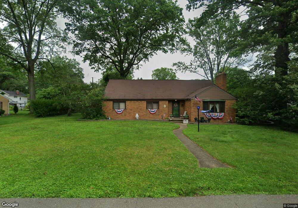
This home is located at 213 E 27th St, Dover, OH 44622 and is currently estimated at $328,236, approximately $95 per square foot. 213 E 27th St is a home located in Tuscarawas County with nearby schools including Dover High School and Tuscarawas Central Catholic Elementary School.
Ownership History
Date
Name
Owned For
Owner Type
Purchase Details
Closed on
Oct 2, 1997
Sold by
Range Thomas W
Bought by
Biancamano Donald P and Biancamano Peggy S
Current Estimated Value
Home Financials for this Owner
Home Financials are based on the most recent Mortgage that was taken out on this home.
Original Mortgage
$80,000
Outstanding Balance
$12,954
Interest Rate
7.54%
Mortgage Type
New Conventional
Estimated Equity
$315,282
Create a Home Valuation Report for This Property
The Home Valuation Report is an in-depth analysis detailing your home's value as well as a comparison with similar homes in the area
Home Values in the Area
Average Home Value in this Area
Purchase History
| Date | Buyer | Sale Price | Title Company |
|---|---|---|---|
| Biancamano Donald P | $141,000 | -- |
Source: Public Records
Mortgage History
| Date | Status | Borrower | Loan Amount |
|---|---|---|---|
| Open | Biancamano Donald P | $80,000 |
Source: Public Records
Tax History Compared to Growth
Tax History
| Year | Tax Paid | Tax Assessment Tax Assessment Total Assessment is a certain percentage of the fair market value that is determined by local assessors to be the total taxable value of land and additions on the property. | Land | Improvement |
|---|---|---|---|---|
| 2024 | $2,694 | $189,770 | $50,450 | $139,320 |
| 2023 | $2,694 | $189,770 | $50,450 | $139,320 |
| 2022 | $2,723 | $66,420 | $17,658 | $48,762 |
| 2021 | $2,636 | $60,662 | $16,737 | $43,925 |
| 2020 | $2,637 | $60,662 | $16,737 | $43,925 |
| 2019 | $2,657 | $60,662 | $16,737 | $43,925 |
| 2018 | $2,360 | $51,200 | $14,130 | $37,070 |
| 2017 | $2,360 | $51,200 | $14,130 | $37,070 |
| 2016 | $2,364 | $51,200 | $14,130 | $37,070 |
| 2014 | $2,184 | $48,340 | $11,150 | $37,190 |
| 2013 | $2,185 | $48,340 | $11,150 | $37,190 |
Source: Public Records
Map
Nearby Homes
- 520 Oakdale Dr
- 312 E 21st St
- 3030 N Wooster Ave
- 1608 N Wooster Ave
- 1512 N Walnut St
- 1326 N Wooster Ave
- 314 W 14th St
- 1221 Dover Ave
- 221 W 10th St
- 819 Race St
- 1132 Jennifer Dr
- 0 Jennifer Dr
- 3222 Circleview Dr NW
- 0 Swonger Rd Unit 5161457
- 0 Swonger Rd Unit 5161456
- 210 W 4th St
- 4295 Blacksnake Hill Rd NE
- 6650 Saint Peters Church Rd NW
- 6531 Columbia Rd NW
- 4029 Minard Rd NW