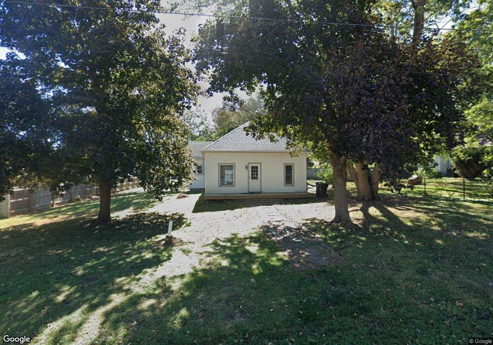
213 E F St Elmwood, NE 68349
Estimated Value: $88,000 - $160,000
3
Beds
1
Bath
1,258
Sq Ft
$97/Sq Ft
Est. Value
About This Home
This home is located at 213 E F St, Elmwood, NE 68349 and is currently estimated at $121,891, approximately $96 per square foot. 213 E F St is a home located in Cass County with nearby schools including Elmwood-Murdock Elementary School and Elmwood-Murdock Junior/Senior High School.
Ownership History
Date
Name
Owned For
Owner Type
Purchase Details
Closed on
May 22, 2018
Sold by
Scattergood Tony R
Bought by
Guy Tara R and Guy Matthew J
Current Estimated Value
Home Financials for this Owner
Home Financials are based on the most recent Mortgage that was taken out on this home.
Original Mortgage
$28,560
Outstanding Balance
$24,648
Interest Rate
4.5%
Mortgage Type
New Conventional
Estimated Equity
$97,243
Purchase Details
Closed on
Jul 19, 2002
Sold by
Scattergood Tony R and Scattergood Shara L
Bought by
Scattergood Tony R and Scattergood Shara L
Create a Home Valuation Report for This Property
The Home Valuation Report is an in-depth analysis detailing your home's value as well as a comparison with similar homes in the area
Home Values in the Area
Average Home Value in this Area
Purchase History
| Date | Buyer | Sale Price | Title Company |
|---|---|---|---|
| Guy Tara R | $36,000 | None Available | |
| Scattergood Tony R | -- | -- |
Source: Public Records
Mortgage History
| Date | Status | Borrower | Loan Amount |
|---|---|---|---|
| Open | Guy Tara R | $28,560 |
Source: Public Records
Tax History Compared to Growth
Tax History
| Year | Tax Paid | Tax Assessment Tax Assessment Total Assessment is a certain percentage of the fair market value that is determined by local assessors to be the total taxable value of land and additions on the property. | Land | Improvement |
|---|---|---|---|---|
| 2024 | $769 | $57,985 | $30,170 | $27,815 |
| 2023 | $953 | $53,770 | $26,235 | $27,535 |
| 2022 | $931 | $51,566 | $27,547 | $24,019 |
| 2021 | $743 | $40,649 | $17,119 | $23,530 |
| 2020 | $992 | $48,707 | $18,831 | $29,876 |
| 2019 | $909 | $44,279 | $17,119 | $27,160 |
| 2018 | $932 | $44,279 | $17,119 | $27,160 |
| 2017 | $935 | $44,279 | $17,119 | $27,160 |
| 2016 | $891 | $44,279 | $17,119 | $27,160 |
| 2015 | $964 | $48,782 | $18,256 | $30,526 |
| 2014 | $1,032 | $48,782 | $18,256 | $30,526 |
Source: Public Records
Map
Nearby Homes
- 301 E H St
- 1.13 Acres, E H St
- 209 E D St
- 204 S 2nd St
- 5103 322nd St
- 8206 310th St
- 35408 34 Hwy
- 501 E 1st St
- 105 Washington St
- TBD Tbd
- 815 S 358th St
- 116 Kansas St
- 125 S 1st St Unit 30
- 125 S 1st St Unit 6
- 1287 D Rd
- 0000 County Road D
- 14902 Adams St
- Lot 18 Eagles Landing
- Lot 20 Eagles Landing
- Lot 26 Eagles Landing