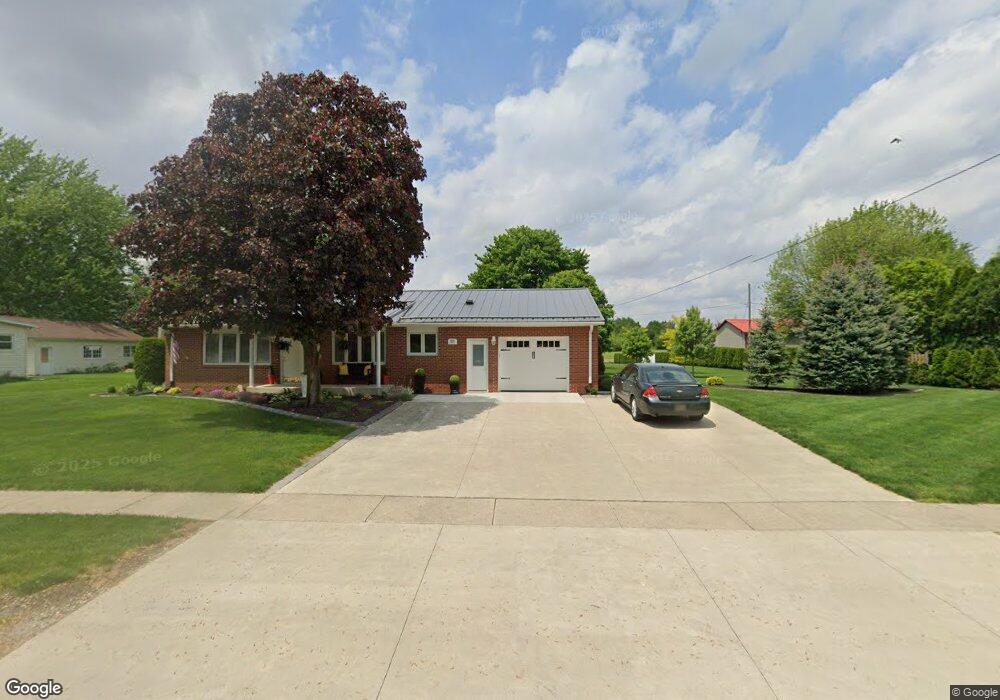
213 E High St Napoleon, OH 43545
Estimated Value: $158,000 - $166,467
3
Beds
1
Bath
1,360
Sq Ft
$119/Sq Ft
Est. Value
About This Home
This home is located at 213 E High St, Napoleon, OH 43545 and is currently estimated at $162,367, approximately $119 per square foot. 213 E High St is a home located in Henry County with nearby schools including Napoleon Elementary School and Napoleon Junior/Senior High School.
Ownership History
Date
Name
Owned For
Owner Type
Purchase Details
Closed on
Jul 5, 2024
Sold by
Sharp James E and Sharp Debra L
Bought by
James E Sharp And Debra L Sharp Family Irrevo and Thorpe
Current Estimated Value
Purchase Details
Closed on
Nov 2, 2021
Sold by
Sharp James E and Sharp Debra L
Bought by
Sharp James E and Sharp Debra L
Create a Home Valuation Report for This Property
The Home Valuation Report is an in-depth analysis detailing your home's value as well as a comparison with similar homes in the area
Purchase History
| Date | Buyer | Sale Price | Title Company |
|---|---|---|---|
| James E Sharp And Debra L Sharp Family Irrevo | -- | None Listed On Document | |
| Sharp James E | -- | None Available |
Source: Public Records
Tax History
| Year | Tax Paid | Tax Assessment Tax Assessment Total Assessment is a certain percentage of the fair market value that is determined by local assessors to be the total taxable value of land and additions on the property. | Land | Improvement |
|---|---|---|---|---|
| 2024 | $1,903 | $44,290 | $5,930 | $38,360 |
| 2023 | $1,904 | $44,290 | $5,930 | $38,360 |
| 2022 | $2,171 | $88,420 | $6,740 | $81,680 |
| 2021 | $2,169 | $44,210 | $3,370 | $40,840 |
| 2020 | $2,137 | $44,210 | $3,370 | $40,840 |
| 2019 | $2,059 | $38,640 | $3,210 | $35,430 |
| 2018 | $2,085 | $38,640 | $3,210 | $35,430 |
| 2017 | $2,018 | $38,640 | $3,210 | $35,430 |
| 2016 | $2,099 | $38,640 | $3,210 | $35,430 |
| 2015 | $2,200 | $38,640 | $3,210 | $35,430 |
| 2014 | $2,200 | $38,640 | $3,210 | $35,430 |
| 2013 | $2,200 | $38,640 | $3,210 | $35,430 |
Source: Public Records
Map
Nearby Homes
- 104 W High St
- O-083 County Road 17
- H011 County Road 17
- 150 Wayne Park Dr
- 140 Wayne Park Dr
- 8205 Independence Rd
- 907 Huddle Rd
- 0 Westmoreland Ave
- 00 Westmoreland Ave
- 29232 Coressel Rd
- 814 Park St
- 1384 Clairmont Ave
- 538 Huddle Rd
- 1123 Clairmont Ave
- 1113 Clairmont Ave
- Integrity 2280 Plan at Lynnefield Estates
- 1314 Clairmont Ave
- 1324 Clairmont Ave
- 1304 Clairmont Ave
- 1354 Clairmont Ave
Your Personal Tour Guide
Ask me questions while you tour the home.