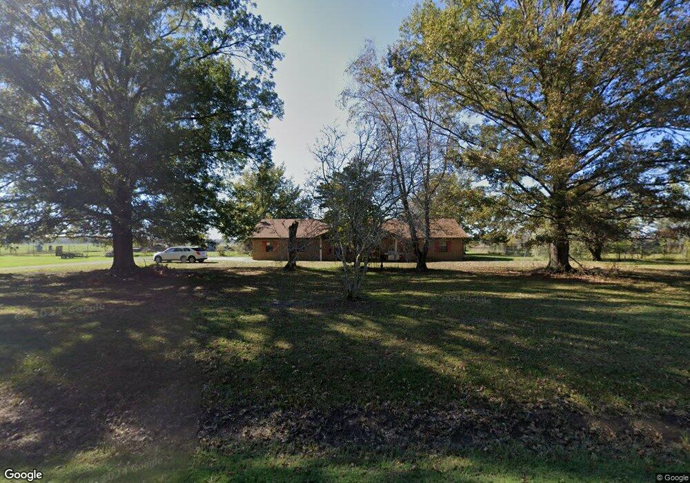
213 Highway 152 Humphrey, AR 72073
Estimated Value: $132,000 - $263,000
--
Bed
2
Baths
2,144
Sq Ft
$94/Sq Ft
Est. Value
About This Home
This home is located at 213 Highway 152, Humphrey, AR 72073 and is currently estimated at $201,188, approximately $93 per square foot. 213 Highway 152 is a home located in Arkansas County with nearby schools including Dewitt Elementary School, Dewitt Middle School, and Dewitt High School.
Ownership History
Date
Name
Owned For
Owner Type
Purchase Details
Closed on
Aug 29, 2024
Sold by
Bunyard Louis and Bunyard Delores Ann
Bought by
Caan Brothers Properties Llc
Current Estimated Value
Purchase Details
Closed on
Jul 17, 2002
Bought by
Bunyard
Purchase Details
Closed on
Jan 18, 2000
Bought by
Word
Purchase Details
Closed on
Oct 14, 1998
Bought by
Nelson
Create a Home Valuation Report for This Property
The Home Valuation Report is an in-depth analysis detailing your home's value as well as a comparison with similar homes in the area
Home Values in the Area
Average Home Value in this Area
Purchase History
| Date | Buyer | Sale Price | Title Company |
|---|---|---|---|
| Caan Brothers Properties Llc | $28,000 | Advantage Title & Escrow | |
| Bunyard | $115,000 | -- | |
| Word | $100,000 | -- | |
| Nelson | -- | -- | |
| Morgan | -- | -- |
Source: Public Records
Tax History Compared to Growth
Tax History
| Year | Tax Paid | Tax Assessment Tax Assessment Total Assessment is a certain percentage of the fair market value that is determined by local assessors to be the total taxable value of land and additions on the property. | Land | Improvement |
|---|---|---|---|---|
| 2025 | $888 | $38,872 | $6,040 | $32,832 |
| 2024 | $888 | $38,872 | $6,040 | $32,832 |
| 2023 | $963 | $38,872 | $6,040 | $32,832 |
| 2022 | $1,013 | $33,370 | $3,400 | $29,970 |
| 2021 | $1,013 | $33,370 | $3,400 | $29,970 |
| 2020 | $1,013 | $33,370 | $3,400 | $29,970 |
| 2019 | $1,013 | $33,370 | $3,400 | $29,970 |
| 2018 | $1,038 | $33,370 | $3,400 | $29,970 |
| 2017 | $1,388 | $34,650 | $2,200 | $32,450 |
| 2016 | $1,038 | $34,650 | $2,200 | $32,450 |
| 2015 | -- | $29,540 | $2,200 | $27,340 |
| 2014 | -- | $29,540 | $2,200 | $27,340 |
| 2013 | -- | $29,540 | $2,200 | $27,340 |
Source: Public Records
Map
Nearby Homes
- 3061 Highway 79 S
- 516 S Hickory St
- 106 S Main St
- 000 Senning Loop
- 000 Burlison Ln
- 000 Hwy 79 Hwy
- 1307 W 22nd St
- 2106 Beumer St
- 2109 Strait Place
- 1820 Beumer St
- 2020 S Prairie St
- 2006 S Prairie St
- 1618 S Prairie St
- 1605 Coker Hampton Dr
- 1410 Granvue Dr
- 0 Buerkle St Unit 23033391
- 1905 S Spring St
- 1912 S Lowe St
- 602 Circle Ln
- 0 Townsend Dr
- 197 Highway 152
- 229 Highway 152
- 191 Highway 152
- 179 Highway 152
- 167 Highway 152
- 267 Highway 152
- 152 Highway 152
- 139 Highway 152
- 301 Highway 152
- 113 Highway 152
- 342 Highway 152
- 56 Crum Ln
- 98 Newton Rd
- 852 Alcorn Gill Rd
- 440 Roberts Ln
- 392 Highway 152
- 409 Roberts Ln
- 411 Highway 152
- 327 Theresa Ave
- 131 Swl Rd