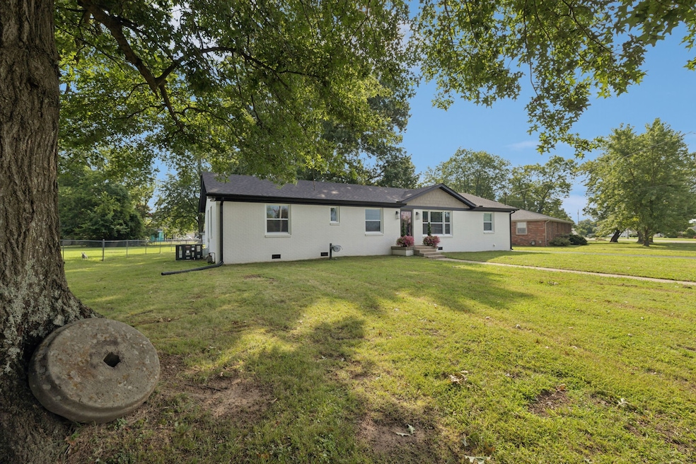
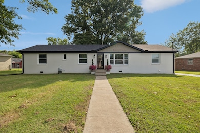
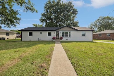
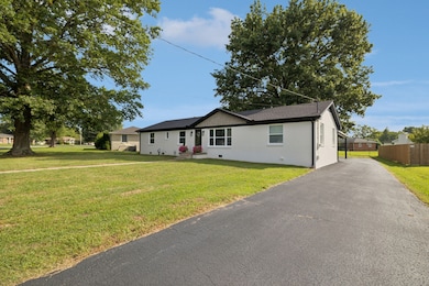
213 Knob Rd Lebanon, TN 37087
Estimated payment $2,539/month
Highlights
- Open Floorplan
- No HOA
- Smart Appliances
- High Ceiling
- Eat-In Kitchen
- Central Heating and Cooling System
About This Home
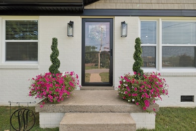
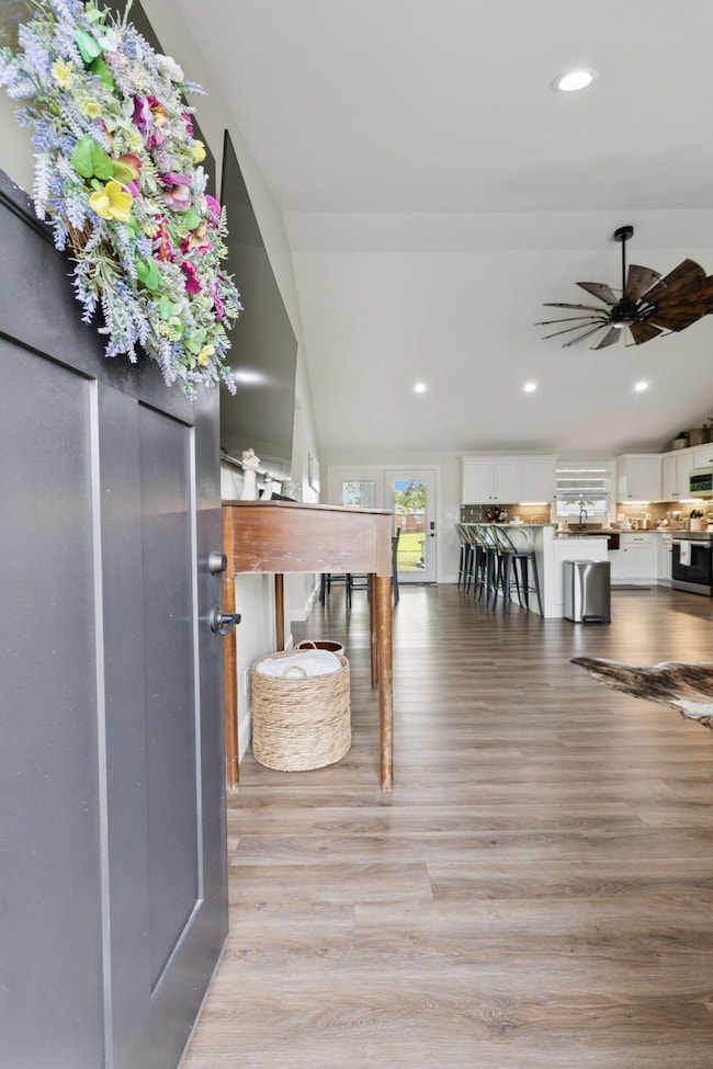
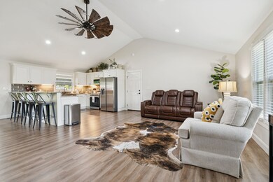
Welcome home to this charming brick ranch in Lebanon, TN, offering an incredibly convenient location. This home was taken down to the studs in 2022 and beautifully remodeled from top to bottom. Every major system is new, including the roof, HVAC, and flooring. The modern kitchen and brand-new master bath create a perfect blend of style and comfort. With a fresh, cozy feel, this home is the ideal find for a first-time homeowner or those ready to downsize. OWNER IS THE AGENT.
Listing Agent
Agee & Johnson Realty & Auction, Inc Brokerage Phone: 6155871152 License # 339220 Listed on: 10/28/2025
Home Details
Home Type
- Single Family
Est. Annual Taxes
- $1,522
Year Built
- Built in 1968
Home Design
- Brick Exterior Construction
Interior Spaces
- 1,614 Sq Ft Home
- Property has 1 Level
- Open Floorplan
- High Ceiling
- Ceiling Fan
- Combination Dining and Living Room
- Crawl Space
Kitchen
- Eat-In Kitchen
- Microwave
- Dishwasher
- Smart Appliances
Flooring
- Laminate
- Vinyl
Bedrooms and Bathrooms
- 3 Main Level Bedrooms
Parking
- 2 Parking Spaces
- 2 Carport Spaces
Schools
- Byars Dowdy Elementary School
- Winfree Bryant Middle School
- Lebanon High School
Additional Features
- 0.34 Acre Lot
- Central Heating and Cooling System
Community Details
- No Home Owners Association
- West Hill 1 Subdivision
Listing and Financial Details
- Assessor Parcel Number 068A D 00900 000
Map
Home Values in the Area
Average Home Value in this Area
Tax History
| Year | Tax Paid | Tax Assessment Tax Assessment Total Assessment is a certain percentage of the fair market value that is determined by local assessors to be the total taxable value of land and additions on the property. | Land | Improvement |
|---|---|---|---|---|
| 2024 | $1,161 | $52,625 | $13,750 | $38,875 |
| 2022 | $1,522 | $52,625 | $13,750 | $38,875 |
| 2021 | $1,522 | $52,625 | $13,750 | $38,875 |
| 2020 | $1,513 | $52,625 | $13,750 | $38,875 |
| 2019 | $345 | $40,275 | $11,000 | $29,275 |
| 2018 | $1,413 | $40,275 | $11,000 | $29,275 |
| 2017 | $1,413 | $40,275 | $11,000 | $29,275 |
| 2016 | $1,413 | $40,275 | $11,000 | $29,275 |
| 2015 | $1,461 | $40,275 | $11,000 | $29,275 |
| 2014 | $1,136 | $31,304 | $0 | $0 |
Property History
| Date | Event | Price | List to Sale | Price per Sq Ft |
|---|---|---|---|---|
| 12/03/2025 12/03/25 | Price Changed | $459,900 | -2.1% | $285 / Sq Ft |
| 10/28/2025 10/28/25 | For Sale | $469,900 | -- | $291 / Sq Ft |
Purchase History
| Date | Type | Sale Price | Title Company |
|---|---|---|---|
| Warranty Deed | $316,000 | Rochelle Mcculloch & Aulds Pll | |
| Deed | -- | -- | |
| Deed | -- | -- | |
| Deed | -- | -- |
Mortgage History
| Date | Status | Loan Amount | Loan Type |
|---|---|---|---|
| Open | $150,000 | No Value Available | |
| Closed | $166,000 | New Conventional |
Source: Realtracs
MLS Number: 3034625
APN: 068A-D-009.00
Disclaimer: Certain information contained herein is derived from information provided by parties other than Homes.com. All information provided is deemed reliable, but is not guaranteed to be accurate and should be independently verified.
![]() Based on information submitted to the MLS GRID. All data is obtained from various sources and may not have been verified by broker or MLS GRID. Supplied Open House Information is subject to change without notice. All information should be independently reviewed and verified for accuracy. Properties may or may not be listed by the office/agent presenting the information. Some IDX listings have been excluded from this website.
Based on information submitted to the MLS GRID. All data is obtained from various sources and may not have been verified by broker or MLS GRID. Supplied Open House Information is subject to change without notice. All information should be independently reviewed and verified for accuracy. Properties may or may not be listed by the office/agent presenting the information. Some IDX listings have been excluded from this website.
The Digital Millennium Copyright Act of 1998, 17 U.S.C. § 512 (the “DMCA”) provides recourse for copyright owners who believe that material appearing on the Internet infringes their rights under U.S. copyright law. If you believe in good faith that any content or material made available in connection with our website or services infringes your copyright, you (or your agent) may send us a notice requesting that the content or material be removed, or access to it blocked.
Notices must be sent in writing by email to DMCAnotice@MLSGrid.com.
The DMCA requires that your notice of alleged copyright infringement include the following information:
(1) description of the copyrighted work that is the subject of claimed infringement;
(2) description of the alleged infringing content and information sufficient to permit us to locate the content;
(3) contact information for you, including your address, telephone number and email address;
(4) a statement by you that you have a good faith belief that the content in the manner complained of is not authorized by the copyright owner, or its agent, or by the operation of any law;
(5) a statement by you, signed under penalty of perjury, that the information in the notification is accurate and that you have the authority to enforce the copyrights that are claimed to be infringed; and
(6) a physical or electronic signature of the copyright owner or a person authorized to act on the copyright owner’s behalf. Failure to include all of the above information may result in the delay of the processing of your complaint.
- 8 Hartmann Dr
- 1045 Alexandria Way
- 1465 Woodside Dr
- 151 Speedwell Ln
- 145 Plymouth Dr
- 253 Signature Place
- 108 Hartmann Crossing Dr
- 4 Hidden Acres Dr
- 408 Dawson Ln
- 118 Hartmann Crossing Dr
- 508 Ryan Boyd Ct
- 231 W End Heights
- 414 Winwood Dr
- 113 Gordon Dr
- 126 Oak Hill Dr
- 217 Dogwood Dr
- 116 Hartmann Crossing Dr
- 1619 Edgewood Dr
- 1618 Woodside Dr
- 123 High Park Cir
- 120 W End Heights
- 100 Rollingwood Dr
- 2000 Bennett Dr
- 408 Brigade Ct
- 505 Ryan Boyd Ct
- 136 Maybrook Dr
- 221 River Rock Dr
- 180 Maybrook Dr
- 806 Meadowlane Dr
- 204 Ansley Way
- 219 Ansley Way
- 127 High Park Cir
- 125 High Park Cir
- 115 High Park Cir
- 601 Mason Ward Place
- 1640 W Main St
- 108 Ethelyne Way
- 203 Jeffries Way
- 2180 Leeville Pike
- 2000 Hartmann Plantation Ct
