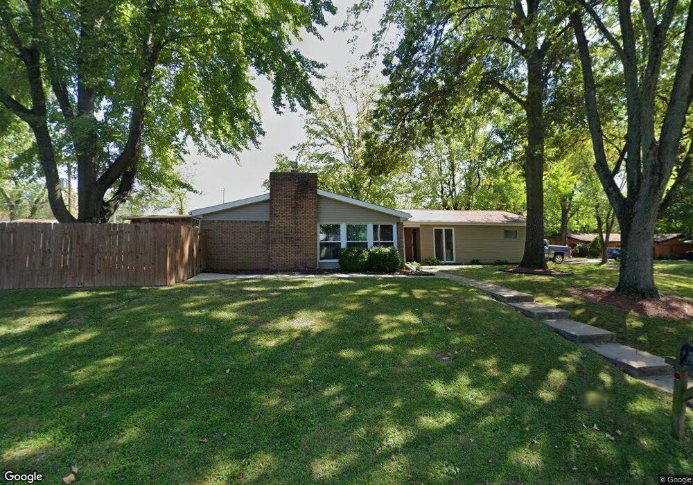
213 Laurel Dr Fairview Heights, IL 62208
Estimated Value: $193,000 - $209,615
--
Bed
--
Bath
1,826
Sq Ft
$110/Sq Ft
Est. Value
About This Home
This home is located at 213 Laurel Dr, Fairview Heights, IL 62208 and is currently estimated at $201,654, approximately $110 per square foot. 213 Laurel Dr is a home located in St. Clair County with nearby schools including Illini Elementary School, Grant Middle School, and Holy Trinity Catholic School.
Ownership History
Date
Name
Owned For
Owner Type
Purchase Details
Closed on
Jun 18, 2018
Sold by
Callahan Janet E
Bought by
Callahamn James W
Current Estimated Value
Purchase Details
Closed on
Nov 16, 2004
Sold by
Nagle Bruce and Nagle Chizuko Ina
Bought by
Callahan James W and Callahan Janet E
Home Financials for this Owner
Home Financials are based on the most recent Mortgage that was taken out on this home.
Original Mortgage
$92,400
Interest Rate
5.91%
Mortgage Type
New Conventional
Create a Home Valuation Report for This Property
The Home Valuation Report is an in-depth analysis detailing your home's value as well as a comparison with similar homes in the area
Home Values in the Area
Average Home Value in this Area
Purchase History
| Date | Buyer | Sale Price | Title Company |
|---|---|---|---|
| Callahamn James W | -- | Attorney | |
| Callahan James W | $115,500 | Town & Country Title Co |
Source: Public Records
Mortgage History
| Date | Status | Borrower | Loan Amount |
|---|---|---|---|
| Previous Owner | Callahan James W | $92,400 |
Source: Public Records
Tax History Compared to Growth
Tax History
| Year | Tax Paid | Tax Assessment Tax Assessment Total Assessment is a certain percentage of the fair market value that is determined by local assessors to be the total taxable value of land and additions on the property. | Land | Improvement |
|---|---|---|---|---|
| 2024 | $3,516 | $55,550 | $5,774 | $49,776 |
| 2023 | $3,235 | $49,151 | $5,109 | $44,042 |
| 2022 | $2,554 | $40,484 | $5,008 | $35,476 |
| 2021 | $2,389 | $38,424 | $4,753 | $33,671 |
| 2020 | $2,332 | $36,397 | $4,502 | $31,895 |
| 2019 | $2,220 | $36,397 | $4,502 | $31,895 |
| 2018 | $2,346 | $37,841 | $4,813 | $33,028 |
| 2017 | $2,262 | $36,306 | $4,618 | $31,688 |
| 2016 | $2,271 | $35,487 | $4,514 | $30,973 |
| 2014 | $2,317 | $37,118 | $7,361 | $29,757 |
| 2013 | $2,700 | $37,803 | $7,497 | $30,306 |
Source: Public Records
Map
Nearby Homes
- 110 Primrose Ln
- 216 Laurel Dr
- 117 Primrose Ln
- 212 Mcknight Rd
- 4 Primrose Ln
- 225 Merriweather Ln
- 214 Union Hill Rd
- 318 Union Hill Rd
- 201 Oxford Ave
- 10010 S Road Ln
- 10009 Club Rd
- 23 Pleasant Ln
- 9915 North Rd
- 7 Leo Dr
- 41 Fairview Dr
- 500 Liberty Rd
- 9723 Greenridge Heights Rd
- 10 E Beacon Hill Rd
- 112 Lake Stratford Ct
- 11 Weslake Dr
- 103 Gale Dr
- 211 Laurel Dr
- 300 Laurel Dr
- 209 Laurel Dr
- 212 North Point Rd
- 214 North Point Rd
- 214 N Point Rd
- 214 Laurel Dr
- 100 Gale Dr
- 210 N Point Rd
- 210 North Point Rd
- 212 Laurel Dr
- 104 Gale Dr
- 207 Laurel Dr
- 208 North Point Rd
- 206 North Point Rd
- 200 Liberty Rd
- 205 Laurel Dr
- 304 Laurel Dr
- 215 N Point Rd